Oniba Castle: Difference between revisions
No edit summary |
No edit summary |
||
| Line 3: | Line 3: | ||
|Japanese Name=鬼場城 | |Japanese Name=鬼場城 | ||
|Romaji Name=Onibajō | |Romaji Name=Onibajō | ||
|Founder= | |Founder=Yagasaki Clan | ||
|Year Founded=Sengoku Period | |Year Founded=Sengoku Period | ||
|Castle Type=Mountaintop | |Castle Type=Mountaintop | ||
| Line 15: | Line 15: | ||
|Prefecture=Nagano Prefecture | |Prefecture=Nagano Prefecture | ||
|Notes=There is a nature trail leading all the way from Ueharajō to Onibajō, making for a pleasant stroll between the two sites. Onibajō is a small site consisting of trenches, embankments and bailey ruins. One can enter from either the main road up a long stairway, or from the top of a residential area called Jōyama. Dorui (embankments) surround the shukuruwa (main bailey), and reach across the mountain ridge where one might otherwise expect to see more trenches. A large trench splits the castle roughly in two. The ninokuruwa (second bailey) is now the site of a pylon. Obi-kuruwa (ring baileys) wrap around the first and second enclosures. A third bailey sits between ramparts of piled earth, and has terraced sub-baileys below on either side. | |Notes=There is a nature trail leading all the way from Ueharajō to Onibajō, making for a pleasant stroll between the two sites. Onibajō is a small site consisting of trenches, embankments and bailey ruins. One can enter from either the main road up a long stairway, or from the top of a residential area called Jōyama. Dorui (embankments) surround the shukuruwa (main bailey), and reach across the mountain ridge where one might otherwise expect to see more trenches. A large trench splits the castle roughly in two. The ninokuruwa (second bailey) is now the site of a pylon. Obi-kuruwa (ring baileys) wrap around the first and second enclosures. A third bailey sits between ramparts of piled earth, and has terraced sub-baileys below on either side. | ||
|History=The origins of Onibajō are not clear, which is a shame because it has a cool name ( | |History=The origins of Onibajō are not clear, which is a shame because it has a cool name ('Demon Place'), but it was controlled by a branch of the Suwa Clan called the Yagasaki in the Sengoku period. In the middle 16th century Onibajō was subjugated by Takeda Shingen. | ||
|Year Visited=Viewer Contributed | |Year Visited=Viewer Contributed | ||
|AddedJcastle=2020 | |AddedJcastle=2020 | ||
Revision as of 12:47, 22 July 2023
There is a nature trail leading all the way from Ueharajō to Onibajō, making for a pleasant stroll between the two sites. Onibajō is a small site consisting of trenches, embankments and bailey ruins. One can enter from either the main road up a long stairway, or from the top of a residential area ca
History
The origins of Onibajō are not clear, which is a shame because it has a cool name ('Demon Place'), but it was controlled by a branch of the Suwa Clan called the Yagasaki in the Sengoku period. In the middle 16th century Onibajō was subjugated by Takeda Shingen.
Field Notes
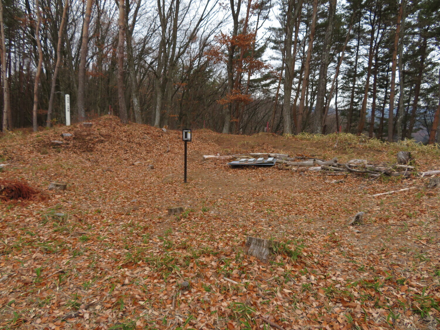
There is a nature trail leading all the way from Ueharajō to Onibajō, making for a pleasant stroll between the two sites. Onibajō is a small site consisting of trenches, embankments and bailey ruins. One can enter from either the main road up a long stairway, or from the top of a residential area called Jōyama. Dorui (embankments) surround the shukuruwa (main bailey), and reach across the mountain ridge where one might otherwise expect to see more trenches. A large trench splits the castle roughly in two. The ninokuruwa (second bailey) is now the site of a pylon. Obi-kuruwa (ring baileys) wrap around the first and second enclosures. A third bailey sits between ramparts of piled earth, and has terraced sub-baileys below on either side.
| Castle Profile | |
|---|---|
| English Name | Oniba Castle |
| Japanese Name | 鬼場城 |
| Founder | Yagasaki Clan |
| Year Founded | Sengoku Period |
| Castle Type | Mountaintop |
| Castle Condition | Ruins only |
| Historical Period | Pre Edo Period |
| Features | trenches |
| Visitor Information | |
| Access | Chino Station on the Chuo East Line; walk 35 minutes |
| Hours | 24/7 free |
| Time Required | 45 minutes |
| Location | Chino, Nagano Prefecture |
| Coordinates | 36.00481, 138.17323 |
|
|
|
| Admin | |
| Added to Jcastle | 2020 |
| Contributor | ART |
| Admin Year Visited | Viewer Contributed |


