Sarugajou Noroshidai: Difference between revisions
(Created page with "{{Castle |English Name=Sarugajou Noroshidai |Japanese Name=猿ヶ城烽火台 |Romaji Name=Saruǵajō-noroshidai |Founder=Nishina Clan |Year Founded=Sengoku Period |Castle Typ...") |
No edit summary |
||
| Line 19: | Line 19: | ||
|Year Visited=Viewer Contributed | |Year Visited=Viewer Contributed | ||
|AddedJcastle=2023 | |AddedJcastle=2023 | ||
|GPSLocation=36. | |GPSLocation=36.58462, 137.8274 | ||
|Contributor=ART | |Contributor=ART | ||
}} | }} | ||
Latest revision as of 08:32, 18 October 2023
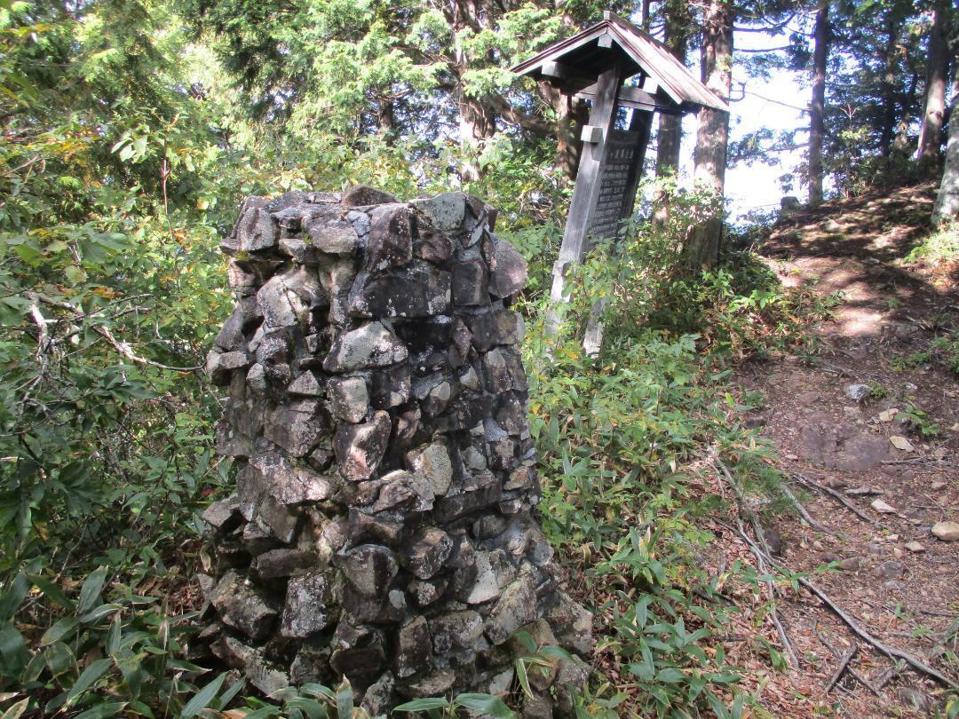
Saruǵajō-noroshidai is a noroshidai (beacon tower) site above and west of the ruins of Saruǵajō in Ômachi Municipality. A 2.5m tall conicular stone tower used to funnel smoke signals has been restored, which is the first time I've seen such a thing! There is also an explanatory board about the site
History
See Aźumi-Saruǵajō
Field Notes
Saruǵajō-noroshidai is a noroshidai (beacon tower) site above and west of the ruins of Saruǵajō in Ômachi Municipality. A 2.5m tall conicular stone tower used to funnel smoke signals has been restored, which is the first time I've seen such a thing! There is also an explanatory board about the site besides. There is a rocky peak to the east with a hokora (mini-shrine), whereas the signboard and furnace are in a somewhat depressed area. There was likely a look-out on the peak. In addition to using smoke signals, defenders likely also banged drums and rung bells to warn the people below of danger. Saruǵajō can be reached by hiking down the ridge from this site.
| Castle Profile | |
|---|---|
| English Name | Sarugajou Noroshidai |
| Japanese Name | 猿ヶ城烽火台 |
| Founder | Nishina Clan |
| Year Founded | Sengoku Period |
| Castle Type | Mountaintop |
| Castle Condition | Ruins only |
| Historical Period | Pre Edo Period |
| Artifacts | Noroshidai (reconstructed) |
| Features | stone walls |
| Visitor Information | |
| Access | Shinano-Ômachi Station on the Ôito Line; rental e-bike; or, hike from Lake Kizaki |
| Hours | 24/7 free; mountain |
| Time Required | 30 minutes |
| Location | Ômachi, Nagano Prefecture |
| Coordinates | 36.58462, 137.8274 |
|
|
|
| Admin | |
| Added to Jcastle | 2023 |
| Contributor | ART |
| Admin Year Visited | Viewer Contributed |


