Yamabukiyama Noroshidai: Difference between revisions
(Created page with "{{Castle |English Name=Yamabukiyama Noroshidai |Japanese Name=山吹山烽火台 |Romaji Name=Yamabukiyama-noroshidai |Alternate Names= |Founder=Kiso Clan |Year Founded=Mediev...") |
No edit summary |
||
| (One intermediate revision by the same user not shown) | |||
| Line 3: | Line 3: | ||
|Japanese Name=山吹山烽火台 | |Japanese Name=山吹山烽火台 | ||
|Romaji Name=Yamabukiyama-noroshidai | |Romaji Name=Yamabukiyama-noroshidai | ||
|Founder=Kiso Clan | |Founder=Kiso Clan | ||
|Year Founded=Medieval Times | |Year Founded=Medieval Times | ||
| Line 9: | Line 8: | ||
|Castle Condition=No main keep but other buildings | |Castle Condition=No main keep but other buildings | ||
|Historical Period=Pre Edo Period | |Historical Period=Pre Edo Period | ||
|Artifacts=Karabori, Dorui, Kuruwa, Miyagura | |Artifacts=Karabori, Dorui, Kuruwa, Miyagura | ||
|Features=trenches | |Features=trenches | ||
| Line 16: | Line 13: | ||
|Visitor Information=Free; 24/7; mountain | |Visitor Information=Free; 24/7; mountain | ||
|Time Required=90 minutes | |Time Required=90 minutes | ||
|City=Kiso | |City=Kiso | ||
|Prefecture=Nagano Prefecture | |Prefecture=Nagano Prefecture | ||
|Notes=Every August 14th the Rapposho Festival in commemoration of Kiso Yoshinaka takes place in Miyanokoshi. | |Notes=Yamabukiyama-noroshidai is a noroshidai (fortified beacon tower) site in the Hiyoshi area of Kiso Township, Kiso County. | ||
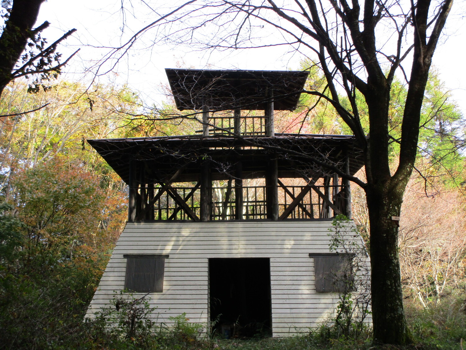
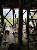
Every August 14th the Rapposho Festival in commemoration of Kiso Yoshinaka takes place in Miyanokoshi. Villagers gather and children lead a torch-lit procession from Tokuon Temple to the top of Mount Yamabuki where there is a cleared space high up on the mountainside. Here the torches are arranged in a 「木」 shape, lighting up the mountain with the ideograph. The trail to this site is well maintained for this purpose, though the climb itself is not trivial. Beyond the festival site is the ruin of Yamabukiyama-noroshidai, a signal fort. I was surprised to find here a three-storey mock reconstruction of a watch tower. The tower is falling to pieces, however, making ascending it a risky prospect. I did, of course, and there are views of the valley below to be had from there. | |||
The fort's ruins consists of earthworks, such as dry moats, trenches and baileys. The main part of the fort is bounded by two trenches, which can still be seen clearly today; one is spanned by a short bridge and the one in the rear requires a short hop down into. These are each approached by sloped areas, redolent of former terracing. These trenches would've been much deeper originally, of course. Although now hard to see except from below the bailey, the main bailey is divided by a pair of dorui (earthen ramparts) with a trench between them that cuts into the main enclosure, creating a barrier which requires a diverted approach, though these earthworks are very deformed now and easy to miss. Short dorui can also be found toward the rear of the central enclosure. | The fort's ruins consists of earthworks, such as dry moats, trenches and baileys. The main part of the fort is bounded by two trenches, which can still be seen clearly today; one is spanned by a short bridge and the one in the rear requires a short hop down into. These are each approached by sloped areas, redolent of former terracing. These trenches would've been much deeper originally, of course. Although now hard to see except from below the bailey, the main bailey is divided by a pair of dorui (earthen ramparts) with a trench between them that cuts into the main enclosure, creating a barrier which requires a diverted approach, though these earthworks are very deformed now and easy to miss. Short dorui can also be found toward the rear of the central enclosure. | ||
| Line 25: | Line 23: | ||
|Year Visited=Viewer Contributed | |Year Visited=Viewer Contributed | ||
|AddedJcastle=2020 | |AddedJcastle=2020 | ||
|GPSLocation=35.90203, 137.76987 | |GPSLocation=35.90203, 137.76987 | ||
|Contributor=ART | |Contributor=ART | ||
|FriendsLinks= | |FriendsLinks={{FriendsLinks | ||
|FriendWebsiteName=Ranmaru | |||
|FriendWebsiteURL=https://ranmaru99.blog.fc2.com/blog-entry-699.html | |||
}} | |||
}} | }} | ||
Latest revision as of 15:51, 27 March 2025
Yamabukiyama-noroshidai is a noroshidai (fortified beacon tower) site in the Hiyoshi area of Kiso Township, Kiso County. Every August 14th the Rapposho Festival in commemoration of Kiso Yoshinaka takes place in Miyanokoshi. Villagers gather and children lead a torch-lit procession from Tokuon Temp
History
The Yamabukiyama-noroshidai was used as a fortified signal tower by the Kiso Clan during medieval times. Yamabukiyama-noroshidai was one in a network of these signal forts used to relay warnings of enemy attack speedily throughout the valley to Kiso-Fukushima, the site of the Kiso Clan's main base. According to folklore, in 1389 Kiso Nobumichi, a descedant of Kiso Yoshinaka, originated the Rapposho Festival in which a torchlit procession of village children travels to the top of Yamabukiyama whilst singing the Rapposho song to venerate Kiso Yoshinaka.
Field Notes
Yamabukiyama-noroshidai is a noroshidai (fortified beacon tower) site in the Hiyoshi area of Kiso Township, Kiso County.
Every August 14th the Rapposho Festival in commemoration of Kiso Yoshinaka takes place in Miyanokoshi. Villagers gather and children lead a torch-lit procession from Tokuon Temple to the top of Mount Yamabuki where there is a cleared space high up on the mountainside. Here the torches are arranged in a 「木」 shape, lighting up the mountain with the ideograph. The trail to this site is well maintained for this purpose, though the climb itself is not trivial. Beyond the festival site is the ruin of Yamabukiyama-noroshidai, a signal fort. I was surprised to find here a three-storey mock reconstruction of a watch tower. The tower is falling to pieces, however, making ascending it a risky prospect. I did, of course, and there are views of the valley below to be had from there.
The fort's ruins consists of earthworks, such as dry moats, trenches and baileys. The main part of the fort is bounded by two trenches, which can still be seen clearly today; one is spanned by a short bridge and the one in the rear requires a short hop down into. These are each approached by sloped areas, redolent of former terracing. These trenches would've been much deeper originally, of course. Although now hard to see except from below the bailey, the main bailey is divided by a pair of dorui (earthen ramparts) with a trench between them that cuts into the main enclosure, creating a barrier which requires a diverted approach, though these earthworks are very deformed now and easy to miss. Short dorui can also be found toward the rear of the central enclosure.
| Castle Profile | |
|---|---|
| English Name | Yamabukiyama Noroshidai |
| Japanese Name | 山吹山烽火台 |
| Founder | Kiso Clan |
| Year Founded | Medieval Times |
| Castle Type | Mountaintop |
| Castle Condition | No main keep but other buildings |
| Historical Period | Pre Edo Period |
| Artifacts | Karabori, Dorui, Kuruwa, Miyagura |
| Features | trenches |
| Visitor Information | |
| Access | Miyanokoshi Station on the Chūō West Line; 25 minute walk to trail head; 20-30 minute climb |
| Hours | Free; 24/7; mountain |
| Time Required | 90 minutes |
| Location | Kiso, Nagano Prefecture |
| Coordinates | 35.90203, 137.76987 |
|
|
|
| Admin | |
| Added to Jcastle | 2020 |
| Contributor | ART |
| Admin Year Visited | Viewer Contributed |
| Friends of JCastle | |
| Ranmaru | |


