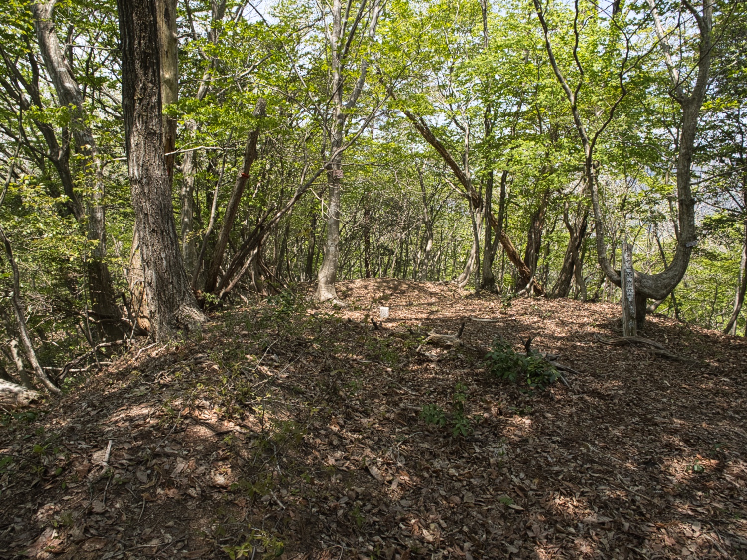
(Created page with "{{Castle |English Name=Tochidaniyama Fort |Japanese Name=橡谷山砦 |Romaji Name=Tochidaniyama Toride |Founder=Shibata Katsuie |Year Founded=1583 |Castle Type=Mountaintop |Castle Condition=Ruins only |Historical Period=Pre Edo Period |Access=JR Yogo Sta., 4.5km to trailhead |Visitor Information=Mountain trails, limited signage, lightly marked trail |Time Required=30 mins |Yamaptrail=https://yamap.com/activities/40767096 |City=Nagahama |Prefecture=Shiga Prefecture |Note...") |
No edit summary |
||
| Line 14: | Line 14: | ||
|City=Nagahama | |City=Nagahama | ||
|Prefecture=Shiga Prefecture | |Prefecture=Shiga Prefecture | ||
|History=Tochidaniyama Fort was one of several mountaintop forts constructed by Shibata Katsuie's general along the Mt. Gyoichi mountain range leading up to the Battle of Shizugatake in 1583. It was commanded by Fuwa Naomitsu. | |History=Tochidaniyama Fort was one of several mountaintop forts constructed by Shibata Katsuie's general along the Mt. Gyoichi mountain range leading up to the Battle of Shizugatake in 1583. It was commanded by Fuwa Naomitsu. | ||
| Line 21: | Line 20: | ||
|AddedJcastle=2025 | |AddedJcastle=2025 | ||
|Visits=April 27, 2025 | |Visits=April 27, 2025 | ||
|GPSLocation=35. | |GPSLocation=35.56754, 136.18421 | ||
|Contributor=Eric | |Contributor=Eric | ||
|FriendsLinks={{FriendsLinks | |FriendsLinks={{FriendsLinks | ||
Revision as of 19:15, 20 June 2025
History
Tochidaniyama Fort was one of several mountaintop forts constructed by Shibata Katsuie's general along the Mt. Gyoichi mountain range leading up to the Battle of Shizugatake in 1583. It was commanded by Fuwa Naomitsu.
See Battle of Shizugatake for more details.
Loading map...
{"format":"leaflet","minzoom":false,"maxzoom":false,"limit":500,"offset":0,"link":"all","sort":["order"],"order":[],"headers":"show","mainlabel":"","intro":"","outro":"","searchlabel":"... further results","default":"","import-annotation":false,"width":"auto","height":"350px","centre":false,"title":"","label":"","icon":"Darkred18.png","lines":[],"polygons":[],"circles":[],"rectangles":[],"copycoords":false,"static":false,"zoom":false,"defzoom":14,"layers":["Esri.WorldTopoMap"],"image layers":[],"overlays":[],"resizable":false,"fullscreen":false,"scrollwheelzoom":true,"cluster":false,"clustermaxzoom":20,"clusterzoomonclick":true,"clustermaxradius":80,"clusterspiderfy":true,"geojson":"","clicktarget":"","showtitle":false,"hidenamespace":true,"template":"InfoWindowProfile","userparam":"","activeicon":"","pagelabel":false,"ajaxcoordproperty":"","ajaxquery":"","locations":[{"text":"\u003Cdiv style=\"width:150px\"\u003E\n\u003Cp\u003E\u003Ca href=\"/view/File:Tochidaniyama20.jpg\" class=\"image\"\u003E\u003Cimg alt=\"Tochidaniyama20.jpg\" src=\"../images/thumb/1/12/Tochidaniyama20.jpg/125px-Tochidaniyama20.jpg\" decoding=\"async\" width=\"125\" height=\"94\" srcset=\"../images/thumb/1/12/Tochidaniyama20.jpg/188px-Tochidaniyama20.jpg 1.5x, ../images/thumb/1/12/Tochidaniyama20.jpg/250px-Tochidaniyama20.jpg 2x\" data-file-width=\"1500\" data-file-height=\"1125\" /\u003E\u003C/a\u003E\u003C!--MW-PAGEIMAGES-CANDIDATE-0--\u003E\n\u003C/p\u003E\n\u003C/div\u003E","title":"","link":"","lat":35.56748,"lon":136.18402,"icon":"../images/0/06/Darkred18.png"},{"text":"\u003Cdiv style=\"width:150px\"\u003E\n\u003Cp\u003E\u003Ca href=\"/view/File:Tochidaniyama1.jpg\" class=\"image\"\u003E\u003Cimg alt=\"Tochidaniyama1.jpg\" src=\"../images/thumb/9/9b/Tochidaniyama1.jpg/125px-Tochidaniyama1.jpg\" decoding=\"async\" width=\"125\" height=\"94\" srcset=\"../images/thumb/9/9b/Tochidaniyama1.jpg/188px-Tochidaniyama1.jpg 1.5x, ../images/thumb/9/9b/Tochidaniyama1.jpg/250px-Tochidaniyama1.jpg 2x\" data-file-width=\"1500\" data-file-height=\"1125\" /\u003E\u003C/a\u003E\u003C!--MW-PAGEIMAGES-CANDIDATE-1--\u003E\n\u003C/p\u003E\n\u003C/div\u003E","title":"","link":"","lat":35.56728,"lon":136.184743,"icon":"../images/0/06/Darkred18.png"},{"text":"\u003Cdiv style=\"width:150px\"\u003E\n\u003Cp\u003E\u003Ca href=\"/view/File:Tochidaniyama2.jpg\" class=\"image\"\u003E\u003Cimg alt=\"Tochidaniyama2.jpg\" src=\"../images/thumb/7/77/Tochidaniyama2.jpg/125px-Tochidaniyama2.jpg\" decoding=\"async\" width=\"125\" height=\"94\" srcset=\"../images/thumb/7/77/Tochidaniyama2.jpg/188px-Tochidaniyama2.jpg 1.5x, ../images/thumb/7/77/Tochidaniyama2.jpg/250px-Tochidaniyama2.jpg 2x\" data-file-width=\"1500\" data-file-height=\"1125\" /\u003E\u003C/a\u003E\u003C!--MW-PAGEIMAGES-CANDIDATE-2--\u003E\n\u003C/p\u003E\n\u003C/div\u003E","title":"","link":"","lat":35.5673,"lon":136.184737,"icon":"../images/0/06/Darkred18.png"},{"text":"\u003Cdiv style=\"width:150px\"\u003E\n\u003Cp\u003E\u003Ca href=\"/view/File:Tochidaniyama3.jpg\" class=\"image\"\u003E\u003Cimg alt=\"Tochidaniyama3.jpg\" src=\"../images/thumb/6/68/Tochidaniyama3.jpg/125px-Tochidaniyama3.jpg\" decoding=\"async\" width=\"125\" height=\"94\" srcset=\"../images/thumb/6/68/Tochidaniyama3.jpg/188px-Tochidaniyama3.jpg 1.5x, ../images/thumb/6/68/Tochidaniyama3.jpg/250px-Tochidaniyama3.jpg 2x\" data-file-width=\"1500\" data-file-height=\"1125\" /\u003E\u003C/a\u003E\u003C!--MW-PAGEIMAGES-CANDIDATE-3--\u003E\n\u003C/p\u003E\n\u003C/div\u003E","title":"","link":"","lat":35.567307,"lon":136.184738,"icon":"../images/0/06/Darkred18.png"},{"text":"\u003Cdiv style=\"width:150px\"\u003E\n\u003Cp\u003E\u003Ca href=\"/view/File:Tochidaniyama4.jpg\" class=\"image\"\u003E\u003Cimg alt=\"Tochidaniyama4.jpg\" src=\"../images/thumb/1/12/Tochidaniyama4.jpg/125px-Tochidaniyama4.jpg\" decoding=\"async\" width=\"125\" height=\"94\" srcset=\"../images/thumb/1/12/Tochidaniyama4.jpg/188px-Tochidaniyama4.jpg 1.5x, ../images/thumb/1/12/Tochidaniyama4.jpg/250px-Tochidaniyama4.jpg 2x\" data-file-width=\"1500\" data-file-height=\"1125\" /\u003E\u003C/a\u003E\u003C!--MW-PAGEIMAGES-CANDIDATE-4--\u003E\n\u003C/p\u003E\n\u003C/div\u003E","title":"","link":"","lat":35.567413,"lon":136.184637,"icon":"../images/0/06/Darkred18.png"},{"text":"\u003Cdiv style=\"width:150px\"\u003E\n\u003Cp\u003E\u003Ca href=\"/view/File:Tochidaniyama5.jpg\" class=\"image\"\u003E\u003Cimg alt=\"Tochidaniyama5.jpg\" src=\"../images/thumb/d/d5/Tochidaniyama5.jpg/125px-Tochidaniyama5.jpg\" decoding=\"async\" width=\"125\" height=\"94\" srcset=\"../images/thumb/d/d5/Tochidaniyama5.jpg/188px-Tochidaniyama5.jpg 1.5x, ../images/thumb/d/d5/Tochidaniyama5.jpg/250px-Tochidaniyama5.jpg 2x\" data-file-width=\"1500\" data-file-height=\"1125\" /\u003E\u003C/a\u003E\u003C!--MW-PAGEIMAGES-CANDIDATE-5--\u003E\n\u003C/p\u003E\n\u003C/div\u003E","title":"","link":"","lat":35.567583,"lon":136.184277,"icon":"../images/0/06/Darkred18.png"},{"text":"\u003Cdiv style=\"width:150px\"\u003E\n\u003Cp\u003E\u003Ca href=\"/view/File:Tochidaniyama6.jpg\" class=\"image\"\u003E\u003Cimg alt=\"Tochidaniyama6.jpg\" src=\"../images/thumb/7/76/Tochidaniyama6.jpg/125px-Tochidaniyama6.jpg\" decoding=\"async\" width=\"125\" height=\"94\" srcset=\"../images/thumb/7/76/Tochidaniyama6.jpg/188px-Tochidaniyama6.jpg 1.5x, ../images/thumb/7/76/Tochidaniyama6.jpg/250px-Tochidaniyama6.jpg 2x\" data-file-width=\"1500\" data-file-height=\"1125\" /\u003E\u003C/a\u003E\u003C!--MW-PAGEIMAGES-CANDIDATE-6--\u003E\n\u003C/p\u003E\n\u003C/div\u003E","title":"","link":"","lat":35.567605,"lon":136.184235,"icon":"../images/0/06/Darkred18.png"},{"text":"\u003Cdiv style=\"width:150px\"\u003E\n\u003Cp\u003E\u003Ca href=\"/view/File:Tochidaniyama7.jpg\" class=\"image\"\u003E\u003Cimg alt=\"Tochidaniyama7.jpg\" src=\"../images/thumb/e/ed/Tochidaniyama7.jpg/125px-Tochidaniyama7.jpg\" decoding=\"async\" width=\"125\" height=\"94\" srcset=\"../images/thumb/e/ed/Tochidaniyama7.jpg/188px-Tochidaniyama7.jpg 1.5x, ../images/thumb/e/ed/Tochidaniyama7.jpg/250px-Tochidaniyama7.jpg 2x\" data-file-width=\"1500\" data-file-height=\"1125\" /\u003E\u003C/a\u003E\u003C!--MW-PAGEIMAGES-CANDIDATE-7--\u003E\n\u003C/p\u003E\n\u003C/div\u003E","title":"","link":"","lat":35.567602,"lon":136.184217,"icon":"../images/0/06/Darkred18.png"},{"text":"\u003Cdiv style=\"width:150px\"\u003E\n\u003Cp\u003E\u003Ca href=\"/view/File:Tochidaniyama8.jpg\" class=\"image\"\u003E\u003Cimg alt=\"Tochidaniyama8.jpg\" src=\"../images/thumb/9/94/Tochidaniyama8.jpg/125px-Tochidaniyama8.jpg\" decoding=\"async\" width=\"125\" height=\"94\" srcset=\"../images/thumb/9/94/Tochidaniyama8.jpg/188px-Tochidaniyama8.jpg 1.5x, ../images/thumb/9/94/Tochidaniyama8.jpg/250px-Tochidaniyama8.jpg 2x\" data-file-width=\"1500\" data-file-height=\"1125\" /\u003E\u003C/a\u003E\u003C!--MW-PAGEIMAGES-CANDIDATE-8--\u003E\n\u003C/p\u003E\n\u003C/div\u003E","title":"","link":"","lat":35.5676,"lon":136.184212,"icon":"../images/0/06/Darkred18.png"},{"text":"\u003Cdiv style=\"width:150px\"\u003E\n\u003Cp\u003E\u003Ca href=\"/view/File:Tochidaniyama9.jpg\" class=\"image\"\u003E\u003Cimg alt=\"Tochidaniyama9.jpg\" src=\"../images/thumb/3/34/Tochidaniyama9.jpg/125px-Tochidaniyama9.jpg\" decoding=\"async\" width=\"125\" height=\"94\" srcset=\"../images/thumb/3/34/Tochidaniyama9.jpg/188px-Tochidaniyama9.jpg 1.5x, ../images/thumb/3/34/Tochidaniyama9.jpg/250px-Tochidaniyama9.jpg 2x\" data-file-width=\"1500\" data-file-height=\"1125\" /\u003E\u003C/a\u003E\u003C!--MW-PAGEIMAGES-CANDIDATE-9--\u003E\n\u003C/p\u003E\n\u003C/div\u003E","title":"","link":"","lat":35.567605,"lon":136.184207,"icon":"../images/0/06/Darkred18.png"},{"text":"\u003Cdiv style=\"width:150px\"\u003E\n\u003Cp\u003E\u003Ca href=\"/view/File:Tochidaniyama10.jpg\" class=\"image\"\u003E\u003Cimg alt=\"Tochidaniyama10.jpg\" src=\"../images/thumb/3/30/Tochidaniyama10.jpg/125px-Tochidaniyama10.jpg\" decoding=\"async\" width=\"125\" height=\"94\" srcset=\"../images/thumb/3/30/Tochidaniyama10.jpg/188px-Tochidaniyama10.jpg 1.5x, ../images/thumb/3/30/Tochidaniyama10.jpg/250px-Tochidaniyama10.jpg 2x\" data-file-width=\"1500\" data-file-height=\"1125\" /\u003E\u003C/a\u003E\u003C!--MW-PAGEIMAGES-CANDIDATE-10--\u003E\n\u003C/p\u003E\n\u003C/div\u003E","title":"","link":"","lat":35.567647,"lon":136.184093,"icon":"../images/0/06/Darkred18.png"},{"text":"\u003Cdiv style=\"width:150px\"\u003E\n\u003Cp\u003E\u003Ca href=\"/view/File:Tochidaniyama11.jpg\" class=\"image\"\u003E\u003Cimg alt=\"Tochidaniyama11.jpg\" src=\"../images/thumb/8/86/Tochidaniyama11.jpg/125px-Tochidaniyama11.jpg\" decoding=\"async\" width=\"125\" height=\"94\" srcset=\"../images/thumb/8/86/Tochidaniyama11.jpg/188px-Tochidaniyama11.jpg 1.5x, ../images/thumb/8/86/Tochidaniyama11.jpg/250px-Tochidaniyama11.jpg 2x\" data-file-width=\"1500\" data-file-height=\"1125\" /\u003E\u003C/a\u003E\u003C!--MW-PAGEIMAGES-CANDIDATE-11--\u003E\n\u003C/p\u003E\n\u003C/div\u003E","title":"","link":"","lat":35.567667,"lon":136.184105,"icon":"../images/0/06/Darkred18.png"},{"text":"\u003Cdiv style=\"width:150px\"\u003E\n\u003Cp\u003E\u003Ca href=\"/view/File:Tochidaniyama12.jpg\" class=\"image\"\u003E\u003Cimg alt=\"Tochidaniyama12.jpg\" src=\"../images/thumb/2/2c/Tochidaniyama12.jpg/125px-Tochidaniyama12.jpg\" decoding=\"async\" width=\"125\" height=\"94\" srcset=\"../images/thumb/2/2c/Tochidaniyama12.jpg/188px-Tochidaniyama12.jpg 1.5x, ../images/thumb/2/2c/Tochidaniyama12.jpg/250px-Tochidaniyama12.jpg 2x\" data-file-width=\"1500\" data-file-height=\"1125\" /\u003E\u003C/a\u003E\u003C!--MW-PAGEIMAGES-CANDIDATE-12--\u003E\n\u003C/p\u003E\n\u003C/div\u003E","title":"","link":"","lat":35.567673,"lon":136.184095,"icon":"../images/0/06/Darkred18.png"},{"text":"\u003Cdiv style=\"width:150px\"\u003E\n\u003Cp\u003E\u003Ca href=\"/view/File:Tochidaniyama13.jpg\" class=\"image\"\u003E\u003Cimg alt=\"Tochidaniyama13.jpg\" src=\"../images/thumb/1/1a/Tochidaniyama13.jpg/125px-Tochidaniyama13.jpg\" decoding=\"async\" width=\"125\" height=\"94\" srcset=\"../images/thumb/1/1a/Tochidaniyama13.jpg/188px-Tochidaniyama13.jpg 1.5x, ../images/thumb/1/1a/Tochidaniyama13.jpg/250px-Tochidaniyama13.jpg 2x\" data-file-width=\"1500\" data-file-height=\"1125\" /\u003E\u003C/a\u003E\u003C!--MW-PAGEIMAGES-CANDIDATE-13--\u003E\n\u003C/p\u003E\n\u003C/div\u003E","title":"","link":"","lat":35.567677,"lon":136.18408,"icon":"../images/0/06/Darkred18.png"},{"text":"\u003Cdiv style=\"width:150px\"\u003E\n\u003Cp\u003E\u003Ca href=\"/view/File:Tochidaniyama14.jpg\" class=\"image\"\u003E\u003Cimg alt=\"Tochidaniyama14.jpg\" src=\"../images/thumb/7/7e/Tochidaniyama14.jpg/125px-Tochidaniyama14.jpg\" decoding=\"async\" width=\"125\" height=\"94\" srcset=\"../images/thumb/7/7e/Tochidaniyama14.jpg/188px-Tochidaniyama14.jpg 1.5x, ../images/thumb/7/7e/Tochidaniyama14.jpg/250px-Tochidaniyama14.jpg 2x\" data-file-width=\"1500\" data-file-height=\"1125\" /\u003E\u003C/a\u003E\u003C!--MW-PAGEIMAGES-CANDIDATE-14--\u003E\n\u003C/p\u003E\n\u003C/div\u003E","title":"","link":"","lat":35.567683,"lon":136.184082,"icon":"../images/0/06/Darkred18.png"},{"text":"\u003Cdiv style=\"width:150px\"\u003E\n\u003Cp\u003E\u003Ca href=\"/view/File:Tochidaniyama15.jpg\" class=\"image\"\u003E\u003Cimg alt=\"Tochidaniyama15.jpg\" src=\"../images/thumb/1/1f/Tochidaniyama15.jpg/125px-Tochidaniyama15.jpg\" decoding=\"async\" width=\"125\" height=\"94\" srcset=\"../images/thumb/1/1f/Tochidaniyama15.jpg/188px-Tochidaniyama15.jpg 1.5x, ../images/thumb/1/1f/Tochidaniyama15.jpg/250px-Tochidaniyama15.jpg 2x\" data-file-width=\"1500\" data-file-height=\"1125\" /\u003E\u003C/a\u003E\u003C!--MW-PAGEIMAGES-CANDIDATE-15--\u003E\n\u003C/p\u003E\n\u003C/div\u003E","title":"","link":"","lat":35.567707,"lon":136.184087,"icon":"../images/0/06/Darkred18.png"},{"text":"\u003Cdiv style=\"width:150px\"\u003E\n\u003Cp\u003E\u003Ca href=\"/view/File:Tochidaniyama16.jpg\" class=\"image\"\u003E\u003Cimg alt=\"Tochidaniyama16.jpg\" src=\"../images/thumb/a/aa/Tochidaniyama16.jpg/125px-Tochidaniyama16.jpg\" decoding=\"async\" width=\"125\" height=\"94\" srcset=\"../images/thumb/a/aa/Tochidaniyama16.jpg/188px-Tochidaniyama16.jpg 1.5x, ../images/thumb/a/aa/Tochidaniyama16.jpg/250px-Tochidaniyama16.jpg 2x\" data-file-width=\"1500\" data-file-height=\"1125\" /\u003E\u003C/a\u003E\u003C!--MW-PAGEIMAGES-CANDIDATE-16--\u003E\n\u003C/p\u003E\n\u003C/div\u003E","title":"","link":"","lat":35.567578,"lon":136.184167,"icon":"../images/0/06/Darkred18.png"},{"text":"\u003Cdiv style=\"width:150px\"\u003E\n\u003Cp\u003E\u003Ca href=\"/view/File:Tochidaniyama17.jpg\" class=\"image\"\u003E\u003Cimg alt=\"Tochidaniyama17.jpg\" src=\"../images/thumb/6/66/Tochidaniyama17.jpg/125px-Tochidaniyama17.jpg\" decoding=\"async\" width=\"125\" height=\"94\" srcset=\"../images/thumb/6/66/Tochidaniyama17.jpg/188px-Tochidaniyama17.jpg 1.5x, ../images/thumb/6/66/Tochidaniyama17.jpg/250px-Tochidaniyama17.jpg 2x\" data-file-width=\"1500\" data-file-height=\"1125\" /\u003E\u003C/a\u003E\u003C!--MW-PAGEIMAGES-CANDIDATE-17--\u003E\n\u003C/p\u003E\n\u003C/div\u003E","title":"","link":"","lat":35.567558,"lon":136.184213,"icon":"../images/0/06/Darkred18.png"},{"text":"\u003Cdiv style=\"width:150px\"\u003E\n\u003Cp\u003E\u003Ca href=\"/view/File:Tochidaniyama18.jpg\" class=\"image\"\u003E\u003Cimg alt=\"Tochidaniyama18.jpg\" src=\"../images/thumb/f/f3/Tochidaniyama18.jpg/125px-Tochidaniyama18.jpg\" decoding=\"async\" width=\"125\" height=\"94\" srcset=\"../images/thumb/f/f3/Tochidaniyama18.jpg/188px-Tochidaniyama18.jpg 1.5x, ../images/thumb/f/f3/Tochidaniyama18.jpg/250px-Tochidaniyama18.jpg 2x\" data-file-width=\"1500\" data-file-height=\"1125\" /\u003E\u003C/a\u003E\u003C!--MW-PAGEIMAGES-CANDIDATE-18--\u003E\n\u003C/p\u003E\n\u003C/div\u003E","title":"","link":"","lat":35.567558,"lon":136.184215,"icon":"../images/0/06/Darkred18.png"},{"text":"\u003Cdiv style=\"width:150px\"\u003E\n\u003Cp\u003E\u003Ca href=\"/view/File:Tochidaniyama19.jpg\" class=\"image\"\u003E\u003Cimg alt=\"Tochidaniyama19.jpg\" src=\"../images/thumb/b/b7/Tochidaniyama19.jpg/125px-Tochidaniyama19.jpg\" decoding=\"async\" width=\"125\" height=\"94\" srcset=\"../images/thumb/b/b7/Tochidaniyama19.jpg/188px-Tochidaniyama19.jpg 1.5x, ../images/thumb/b/b7/Tochidaniyama19.jpg/250px-Tochidaniyama19.jpg 2x\" data-file-width=\"1500\" data-file-height=\"1125\" /\u003E\u003C/a\u003E\u003C!--MW-PAGEIMAGES-CANDIDATE-19--\u003E\n\u003C/p\u003E\n\u003C/div\u003E","title":"","link":"","lat":35.567463,"lon":136.18411,"icon":"../images/0/06/Darkred18.png"},{"text":"\u003Cdiv style=\"width:150px\"\u003E\n\u003Cp\u003E\u003Ca href=\"/view/File:Tochidaniyama21.jpg\" class=\"image\"\u003E\u003Cimg alt=\"Tochidaniyama21.jpg\" src=\"../images/thumb/f/f0/Tochidaniyama21.jpg/125px-Tochidaniyama21.jpg\" decoding=\"async\" width=\"125\" height=\"94\" srcset=\"../images/thumb/f/f0/Tochidaniyama21.jpg/188px-Tochidaniyama21.jpg 1.5x, ../images/thumb/f/f0/Tochidaniyama21.jpg/250px-Tochidaniyama21.jpg 2x\" data-file-width=\"1500\" data-file-height=\"1125\" /\u003E\u003C/a\u003E\u003C!--MW-PAGEIMAGES-CANDIDATE-20--\u003E\n\u003C/p\u003E\n\u003C/div\u003E","title":"","link":"","lat":35.56739,"lon":136.184002,"icon":"../images/0/06/Darkred18.png"},{"text":"\u003Cdiv style=\"width:150px\"\u003E\n\u003Cp\u003E\u003Ca href=\"/view/File:Tochidaniyama22.jpg\" class=\"image\"\u003E\u003Cimg alt=\"Tochidaniyama22.jpg\" src=\"../images/thumb/7/79/Tochidaniyama22.jpg/125px-Tochidaniyama22.jpg\" decoding=\"async\" width=\"125\" height=\"94\" srcset=\"../images/thumb/7/79/Tochidaniyama22.jpg/188px-Tochidaniyama22.jpg 1.5x, ../images/thumb/7/79/Tochidaniyama22.jpg/250px-Tochidaniyama22.jpg 2x\" data-file-width=\"1500\" data-file-height=\"1125\" /\u003E\u003C/a\u003E\u003C!--MW-PAGEIMAGES-CANDIDATE-21--\u003E\n\u003C/p\u003E\n\u003C/div\u003E","title":"","link":"","lat":35.56732,"lon":136.183915,"icon":"../images/0/06/Darkred18.png"},{"text":"\u003Cdiv style=\"width:150px\"\u003E\n\u003Cp\u003E\u003Ca href=\"/view/File:Tochidaniyama23.jpg\" class=\"image\"\u003E\u003Cimg alt=\"Tochidaniyama23.jpg\" src=\"../images/thumb/8/8f/Tochidaniyama23.jpg/125px-Tochidaniyama23.jpg\" decoding=\"async\" width=\"125\" height=\"94\" srcset=\"../images/thumb/8/8f/Tochidaniyama23.jpg/188px-Tochidaniyama23.jpg 1.5x, ../images/thumb/8/8f/Tochidaniyama23.jpg/250px-Tochidaniyama23.jpg 2x\" data-file-width=\"1500\" data-file-height=\"1125\" /\u003E\u003C/a\u003E\u003C!--MW-PAGEIMAGES-CANDIDATE-22--\u003E\n\u003C/p\u003E\n\u003C/div\u003E","title":"","link":"","lat":35.567128,"lon":136.183753,"icon":"../images/0/06/Darkred18.png"},{"text":"\u003Cdiv style=\"width:150px\"\u003E\n\u003Cp\u003E\u003Ca href=\"/view/File:Tochidaniyama24.jpg\" class=\"image\"\u003E\u003Cimg alt=\"Tochidaniyama24.jpg\" src=\"../images/thumb/d/d1/Tochidaniyama24.jpg/125px-Tochidaniyama24.jpg\" decoding=\"async\" width=\"125\" height=\"94\" srcset=\"../images/thumb/d/d1/Tochidaniyama24.jpg/188px-Tochidaniyama24.jpg 1.5x, ../images/thumb/d/d1/Tochidaniyama24.jpg/250px-Tochidaniyama24.jpg 2x\" data-file-width=\"1500\" data-file-height=\"1125\" /\u003E\u003C/a\u003E\u003C!--MW-PAGEIMAGES-CANDIDATE-23--\u003E\n\u003C/p\u003E\n\u003C/div\u003E","title":"","link":"","lat":35.566603,"lon":136.183372,"icon":"../images/0/06/Darkred18.png"}],"imageLayers":[]}
| Castle Profile | |
|---|---|
| English Name | Tochidaniyama Fort |
| Japanese Name | 橡谷山砦 |
| Founder | Shibata Katsuie |
| Year Founded | 1583 |
| Castle Type | Mountaintop |
| Castle Condition | Ruins only |
| Historical Period | Pre Edo Period |
| Features | |
| Visitor Information | |
| Access | JR Yogo Sta., 4.5km to trailhead |
| Hours | Mountain trails, limited signage, lightly marked trail |
| Time Required | 30 mins |
| Hiking Trail | View on Yamap |
| Location | Nagahama, Shiga Prefecture |
| Coordinates | 35.56754, 136.18421 |
|
Loading map... {"minzoom":false,"maxzoom":false,"mappingservice":"leaflet","width":"auto","height":"200px","centre":false,"title":"","label":"","icon":"Castlemarker.png","lines":[],"polygons":[],"circles":[],"rectangles":[],"copycoords":false,"static":false,"zoom":6,"defzoom":14,"layers":["CartoDB.Positron"],"image layers":[],"overlays":[],"resizable":false,"fullscreen":false,"scrollwheelzoom":true,"cluster":false,"clustermaxzoom":20,"clusterzoomonclick":true,"clustermaxradius":80,"clusterspiderfy":true,"geojson":"","clicktarget":"","imageLayers":[],"locations":[{"text":"","title":"","link":"","lat":35.56754,"lon":136.18421,"icon":"../images/1/1e/Castlemarker.png"}],"imageoverlays":null} |
|
| Admin | |
| Added to Jcastle | 2025 |
| Contributor | Eric |
| Admin Year Visited | 2025 |
| Admin Visits | April 27, 2025 |
| Friends of JCastle | |
| Jokaku Horoki | |
1.00


 (one vote)
Loading comments...


