Kashiwadaniyama Fort: Difference between revisions
No edit summary |
No edit summary |
||
| Line 15: | Line 15: | ||
|City=Nagahama | |City=Nagahama | ||
|Prefecture=Shiga Prefecture | |Prefecture=Shiga Prefecture | ||
|Notes=From [[Tochidaniyama Fort]], a side ridge leads to Kashiwadaniyama Fort, but there is no trail or signage—not even marked trees to guide the way. The route is fairly overgrown, and I found myself weaving back and forth, dodging thorny brushes and fallen trees as I followed the ridge. | |Notes=From [[Tochidaniyama Fort]], a side ridge leads to Kashiwadaniyama Fort, but there is no trail or signage—not even marked trees to guide the way. The route is fairly overgrown, and I found myself weaving back and forth, dodging thorny brushes, spider webs, and fallen trees as I followed the ridge. | ||
At one point I nearly turned back, but trusted the terrain and eventually reached the ruins. The main bailey is clearly identifiable, as you’ll see in the photos, and the site is a worthwhile visit, if you’re prepared for a bit of off-trail adventuring. | At one point I nearly turned back, but trusted the terrain and eventually reached the ruins. The main bailey is clearly identifiable, as you’ll see in the photos, and the site is a worthwhile visit, if you’re prepared for a bit of off-trail adventuring. | ||
From there, the ridge continues another 300+ meters to Ohtaniyama Fort (大谷山砦). I attempted to push forward, but the path was too choked with fallen bamboo and trees. After advancing only about 15 meters in tough conditions, I decided that climbing back through that mess going uphill wasn’t worth the risk or effort. | From there, the ridge continues another 300+ meters to Ohtaniyama Fort (大谷山砦). I attempted to push forward, but the path was too choked with fallen bamboo and trees. After advancing only about 15 meters in tough conditions, I decided that climbing back through that mess while going uphill wasn’t worth the risk or effort. | ||
While most of the forts on the Mt. Gyōichi ridge are accessible via a clearly marked and maintained trail, Kashiwadaniyama and Ohtaniyama are best left to experienced hikers or those equipped with GPS and a good sense of direction. | While most of the forts on the Mt. Gyōichi ridge are accessible via a clearly marked and maintained trail, Kashiwadaniyama and Ohtaniyama are best left to experienced hikers or those equipped with GPS and a good sense of direction. | ||
|History=Positioned along a side ridge and connected to Ohtaniyama Fort, | |History=Positioned along a side ridge and connected to Ohtaniyama Fort, on the opposite side from the battlefield, it may have functioned as a a retreat or resupply route, especially if the main route through [[Hayashitaniyama Fort]] was blocked or under attack. | ||
See [[Battle of Shizugatake]] for more details. | See [[Battle of Shizugatake]] for more details. | ||
Latest revision as of 11:20, 28 June 2025
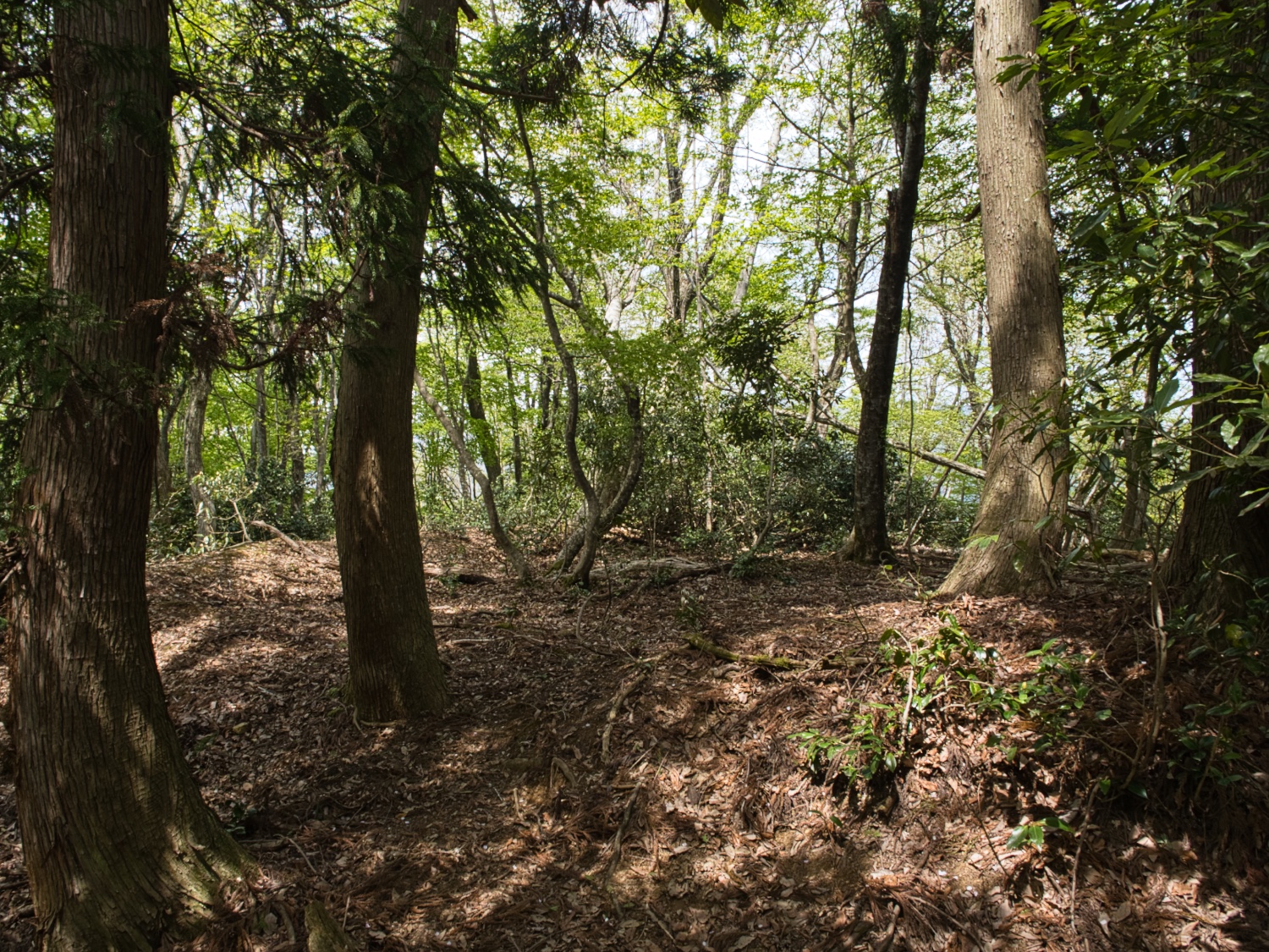
From Tochidaniyama Fort, a side ridge leads to Kashiwadaniyama Fort, but there is no trail or signage—not even marked trees to guide the way. The route is fairly overgrown, and I found myself weaving back and forth, dodging thorny brushes, spider webs, and fallen trees as I followed the ridge.
History
Positioned along a side ridge and connected to Ohtaniyama Fort, on the opposite side from the battlefield, it may have functioned as a a retreat or resupply route, especially if the main route through Hayashitaniyama Fort was blocked or under attack.
See Battle of Shizugatake for more details.
Field Notes
From Tochidaniyama Fort, a side ridge leads to Kashiwadaniyama Fort, but there is no trail or signage—not even marked trees to guide the way. The route is fairly overgrown, and I found myself weaving back and forth, dodging thorny brushes, spider webs, and fallen trees as I followed the ridge.
At one point I nearly turned back, but trusted the terrain and eventually reached the ruins. The main bailey is clearly identifiable, as you’ll see in the photos, and the site is a worthwhile visit, if you’re prepared for a bit of off-trail adventuring.
From there, the ridge continues another 300+ meters to Ohtaniyama Fort (大谷山砦). I attempted to push forward, but the path was too choked with fallen bamboo and trees. After advancing only about 15 meters in tough conditions, I decided that climbing back through that mess while going uphill wasn’t worth the risk or effort.
While most of the forts on the Mt. Gyōichi ridge are accessible via a clearly marked and maintained trail, Kashiwadaniyama and Ohtaniyama are best left to experienced hikers or those equipped with GPS and a good sense of direction.
| Castle Profile | |
|---|---|
| English Name | Kashiwadaniyama Fort |
| Japanese Name | 柏谷山砦 |
| Founder | Shibata Katsuie |
| Year Founded | 1583 |
| Castle Type | Mountaintop |
| Castle Condition | Ruins only |
| Historical Period | Pre Edo Period |
| Features | trenches |
| Visitor Information | |
| Access | JR Yogo Sta., 4.5km to trailhead |
| Hours | Mountain trails, limited signage, lightly marked trail |
| Time Required | 30 mins |
| Hiking Trail | View on Yamap |
| Location | Nagahama, Shiga Prefecture |
| Coordinates | 35.56887, 136.1863 |
|
|
|
| Admin | |
| Added to Jcastle | 2025 |
| Contributor | Eric |
| Admin Year Visited | 2025 |
| Admin Visits | April 27, 2025 |
| Friends of JCastle | |
| Jokaku Horoki | |


