Akiba Fort (Ina): Difference between revisions
(Created page with "{{Castle |English Name=Akiba Fort |Japanese Name=秋葉砦 |Romaji Name=Akiba-toride |Alternate Names= |Founder=Suwa Clan |Year Founded=Medieval Era |Castle Type=Mountaintop |...") |
No edit summary |
||
| Line 3: | Line 3: | ||
|Japanese Name=秋葉砦 | |Japanese Name=秋葉砦 | ||
|Romaji Name=Akiba-toride | |Romaji Name=Akiba-toride | ||
|Founder=Suwa Clan | |Founder=Suwa Clan | ||
|Year Founded=Medieval Era | |Year Founded=Medieval Era | ||
| Line 9: | Line 8: | ||
|Castle Condition=Ruins only | |Castle Condition=Ruins only | ||
|Historical Period=Pre Edo Period | |Historical Period=Pre Edo Period | ||
|Artifacts=Dorui, Kuruwa, Koshikuruwa | |Artifacts=Dorui, Kuruwa, Koshikuruwa | ||
|Access=Tatsuno Station on the Chūō East Line; 15 minute walk | |Access=Tatsuno Station on the Chūō East Line; 15 minute walk | ||
|Visitor Information=24/7; Free; Park | |Visitor Information=24/7; Free; Park | ||
|Time Required=20 minutes | |Time Required=20 minutes | ||
|City=Tatsuno | |City=Tatsuno | ||
|Prefecture=Nagano Prefecture | |Prefecture=Nagano Prefecture | ||
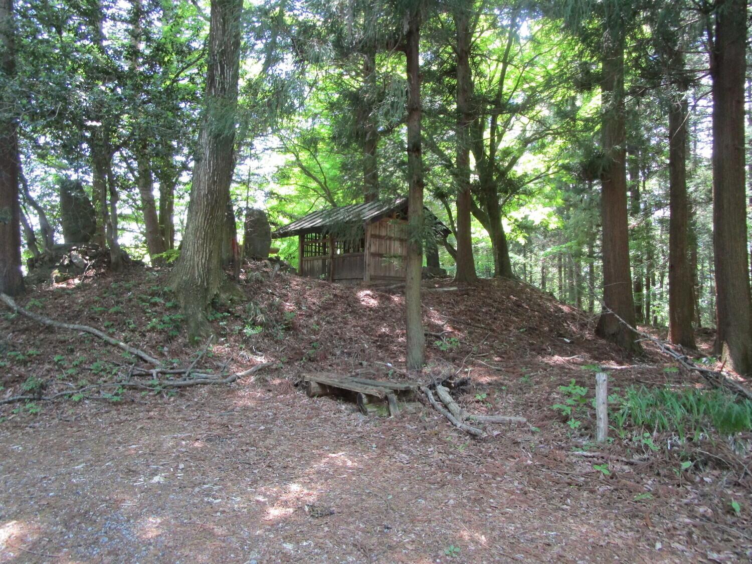
|Notes=The site of this fort is now a shrine and park. The small shrine appears built into the fort's dorui (earthen ramparts). Some more clumps of dorui are located toward the slope, indicating that the fort's bailey was here. After that there are no obvious ruins, though I might guess that some terracing I saw on the climb up may have been part of the fort's extended footprint. The site is, as mentioned, now a park, and during my visit there were many beautiful flowers in blossom, including wisteria (fuji, 藤) thickly coating a pergola. | |Notes=The site of this fort is now a shrine and park. The small shrine appears built into the fort's dorui (earthen ramparts). Some more clumps of dorui are located toward the slope, indicating that the fort's bailey was here. After that there are no obvious ruins, though I might guess that some terracing I saw on the climb up may have been part of the fort's extended footprint. The site is, as mentioned, now a park, and during my visit there were many beautiful flowers in blossom, including wisteria (fuji, 藤) thickly coating a pergola. | ||
|History=Akiba-toride was built as a branch fortification of Ina-Ōjō. It was twinned with Maruyama | |History=Akiba-toride was built as a branch fortification of Ina-Ōjō. It was twinned with [[Ina Maruyama Fort]] nearby. See [[Ina Ou Castle]] for more information. | ||
|Year Visited=Viewer Contributed | |Year Visited=Viewer Contributed | ||
|AddedJcastle=2021 | |AddedJcastle=2021 | ||
|GPSLocation=35.98695, 137.99545 | |GPSLocation=35.98695, 137.99545 | ||
|Contributor=ART | |Contributor=ART | ||
Revision as of 21:31, 21 December 2022
The site of this fort is now a shrine and park. The small shrine appears built into the fort's dorui (earthen ramparts). Some more clumps of dorui are located toward the slope, indicating that the fort's bailey was here. After that there are no obvious ruins, though I might guess that some terracing
History
Akiba-toride was built as a branch fortification of Ina-Ōjō. It was twinned with Ina Maruyama Fort nearby. See Ina Ou Castle for more information.
Field Notes
The site of this fort is now a shrine and park. The small shrine appears built into the fort's dorui (earthen ramparts). Some more clumps of dorui are located toward the slope, indicating that the fort's bailey was here. After that there are no obvious ruins, though I might guess that some terracing I saw on the climb up may have been part of the fort's extended footprint. The site is, as mentioned, now a park, and during my visit there were many beautiful flowers in blossom, including wisteria (fuji, 藤) thickly coating a pergola.
| Castle Profile | |
|---|---|
| English Name | Akiba Fort |
| Japanese Name | 秋葉砦 |
| Founder | Suwa Clan |
| Year Founded | Medieval Era |
| Castle Type | Mountaintop |
| Castle Condition | Ruins only |
| Historical Period | Pre Edo Period |
| Artifacts | Dorui, Kuruwa, Koshikuruwa |
| Features | |
| Visitor Information | |
| Access | Tatsuno Station on the Chūō East Line; 15 minute walk |
| Hours | 24/7; Free; Park |
| Time Required | 20 minutes |
| Location | Tatsuno, Nagano Prefecture |
| Coordinates | 35.98695, 137.99545 |
|
|
|
| Admin | |
| Added to Jcastle | 2021 |
| Contributor | ART |
| Admin Year Visited | Viewer Contributed |
| Friends of JCastle | |
| Yogochan | |


