Iwakura Yakata (Mikawa)
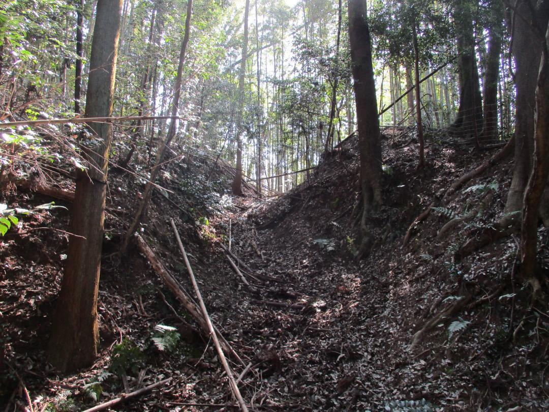
Iwakura-yakata is a yakata (fortified manor hall) ruin in Iwakura Township. It is built on a ridge terminus beneath the Iwakura castle-mount, and consists of a bailey with a large trench complex to the rear. The horikiri (trench) is impressive, and it is spanned by a dobashi (earthen bridge). Dorui
History
For more information see: Mikawa-Iwakurajō.
Field Notes
Iwakura-yakata is a yakata (fortified manor hall) ruin in Iwakura Township. It is built on a ridge terminus beneath the Iwakura castle-mount, and consists of a bailey with a large trench complex to the rear. The horikiri (trench) is impressive, and it is spanned by a dobashi (earthen bridge). Dorui (earthen ramparts) are heaped up on the inside of the trench. The bailey is on private property and a fence has been erected on the dorui. Whilst most dorui in the past would've had stockades and abbattis atop, it's not common to find dorui used to host a modern fence!
I accessed this site by descending from Iwakurajō down a strip of earth which had been left standing between what looked like landslides. It also appears that the mountainside here might've been used as a stone quarry. It seemed like there were some earthworks and flattened spaces just above the yakata, but they did not give a clear impression.
| Castle Profile | |
|---|---|
| English Name | Iwakura Yakata (Mikawa) |
| Japanese Name | 三河岩倉館 |
| Alternate Names | Iwakurashironōra-yakata |
| Founder | Iwakura Hayatonosuke |
| Year Founded | Sengoku Period |
| Castle Type | Fortified Manor |
| Castle Condition | Ruins only |
| Historical Period | Pre Edo Period |
| Artifacts | Horikiri, Dobashi, Dorui, &c. |
| Features | trenches |
| Visitor Information | |
| Access | Descend from Iwakura Castle Ruins. No entry from below. |
| Hours | 24/7 free; mountain |
| Time Required | 30 minutes |
| Location | Toyota, Aichi Prefecture |
| Coordinates | 35.04843, 137.1905 |
|
|
|
| Admin | |
| Added to Jcastle | 2024 |
| Contributor | ART |
| Admin Year Visited | Viewer Contributed |
| Friends of JCastle | |
| Umoreta Kojō | |


