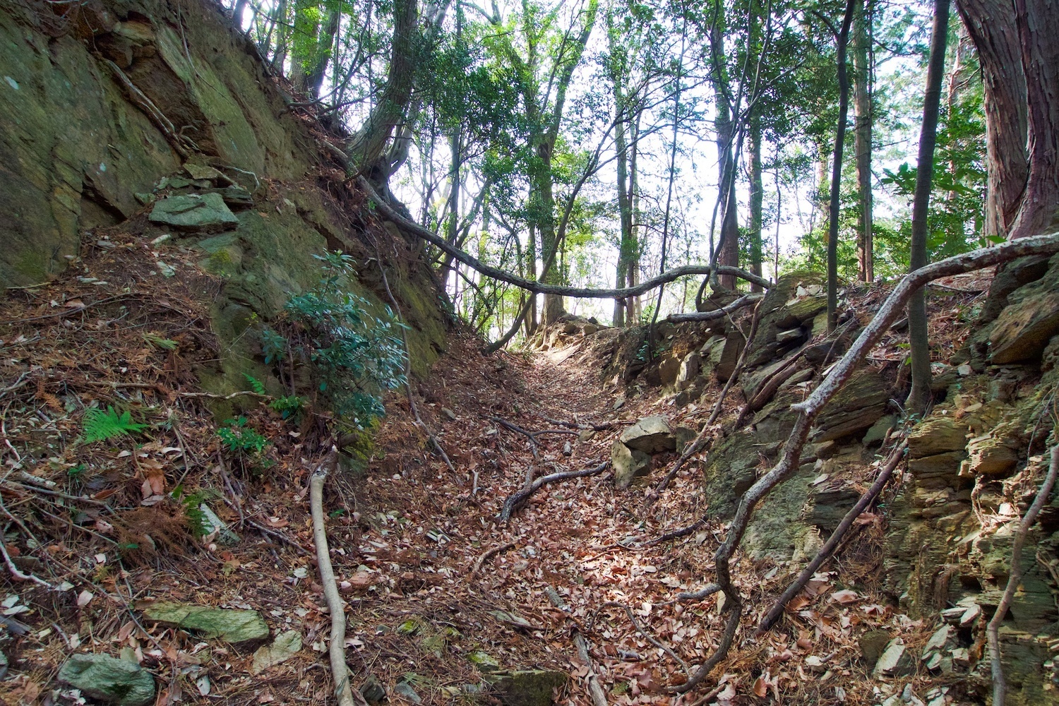
Hanazono Castle
From Jcastle.info
Jump to:navigation, search
Loading map...
{"format":"leaflet","minzoom":false,"maxzoom":false,"limit":500,"offset":0,"link":"all","sort":["order"],"order":[],"headers":"show","mainlabel":"","intro":"","outro":"","searchlabel":"... further results","default":"","import-annotation":false,"width":"auto","height":"350px","centre":false,"title":"","label":"","icon":"Darkred18.png","lines":[],"polygons":[],"circles":[],"rectangles":[],"copycoords":false,"static":false,"zoom":false,"defzoom":14,"layers":["Esri.WorldTopoMap"],"image layers":[],"overlays":[],"resizable":false,"fullscreen":false,"scrollwheelzoom":true,"cluster":false,"clustermaxzoom":20,"clusterzoomonclick":true,"clustermaxradius":80,"clusterspiderfy":true,"geojson":"","clicktarget":"","showtitle":false,"hidenamespace":true,"template":"InfoWindowProfile","userparam":"","activeicon":"","pagelabel":false,"ajaxcoordproperty":"","ajaxquery":"","locations":[{"text":"\u003Cdiv style=\"width:150px\"\u003E\n\u003Cp\u003E\u003Ca href=\"/view/File:Hanazono29.jpg\" class=\"image\"\u003E\u003Cimg alt=\"Hanazono29.jpg\" src=\"../images/thumb/0/0f/Hanazono29.jpg/125px-Hanazono29.jpg\" decoding=\"async\" width=\"125\" height=\"83\" srcset=\"../images/thumb/0/0f/Hanazono29.jpg/188px-Hanazono29.jpg 1.5x, ../images/thumb/0/0f/Hanazono29.jpg/250px-Hanazono29.jpg 2x\" data-file-width=\"1500\" data-file-height=\"1000\" /\u003E\u003C/a\u003E\u003C!--MW-PAGEIMAGES-CANDIDATE-0--\u003E\n\u003C/p\u003E\n\u003C/div\u003E","title":"","link":"","lat":36.1227,"lon":139.17179,"icon":"../images/0/06/Darkred18.png"},{"text":"\u003Cdiv style=\"width:150px\"\u003E\n\u003Cp\u003E\u003Ca href=\"/view/File:Hanazono1.jpg\" class=\"image\"\u003E\u003Cimg alt=\"Hanazono1.jpg\" src=\"../images/thumb/7/74/Hanazono1.jpg/125px-Hanazono1.jpg\" decoding=\"async\" width=\"125\" height=\"83\" srcset=\"../images/thumb/7/74/Hanazono1.jpg/188px-Hanazono1.jpg 1.5x, ../images/thumb/7/74/Hanazono1.jpg/250px-Hanazono1.jpg 2x\" data-file-width=\"1500\" data-file-height=\"999\" /\u003E\u003C/a\u003E\u003C!--MW-PAGEIMAGES-CANDIDATE-1--\u003E\n\u003C/p\u003E\n\u003C/div\u003E","title":"","link":"","lat":36.12059,"lon":139.17389,"icon":"../images/0/06/Darkred18.png"},{"text":"\u003Cdiv style=\"width:150px\"\u003E\n\u003Cp\u003E\u003Ca href=\"/view/File:Hanazono2.jpg\" class=\"image\"\u003E\u003Cimg alt=\"Hanazono2.jpg\" src=\"../images/thumb/2/2a/Hanazono2.jpg/125px-Hanazono2.jpg\" decoding=\"async\" width=\"125\" height=\"83\" srcset=\"../images/thumb/2/2a/Hanazono2.jpg/188px-Hanazono2.jpg 1.5x, ../images/thumb/2/2a/Hanazono2.jpg/250px-Hanazono2.jpg 2x\" data-file-width=\"1500\" data-file-height=\"1000\" /\u003E\u003C/a\u003E\u003C!--MW-PAGEIMAGES-CANDIDATE-2--\u003E\n\u003C/p\u003E\n\u003C/div\u003E","title":"","link":"","lat":36.12085,"lon":139.17398,"icon":"../images/0/06/Darkred18.png"},{"text":"\u003Cdiv style=\"width:150px\"\u003E\n\u003Cp\u003E\u003Ca href=\"/view/File:Hanazono3.jpg\" class=\"image\"\u003E\u003Cimg alt=\"Hanazono3.jpg\" src=\"../images/thumb/9/96/Hanazono3.jpg/125px-Hanazono3.jpg\" decoding=\"async\" width=\"125\" height=\"83\" srcset=\"../images/thumb/9/96/Hanazono3.jpg/188px-Hanazono3.jpg 1.5x, ../images/thumb/9/96/Hanazono3.jpg/250px-Hanazono3.jpg 2x\" data-file-width=\"1500\" data-file-height=\"1000\" /\u003E\u003C/a\u003E\u003C!--MW-PAGEIMAGES-CANDIDATE-3--\u003E\n\u003C/p\u003E\n\u003C/div\u003E","title":"","link":"","lat":36.12162,"lon":139.17262,"icon":"../images/0/06/Darkred18.png"},{"text":"\u003Cdiv style=\"width:150px\"\u003E\n\u003Cp\u003E\u003Ca href=\"/view/File:Hanazono4.jpg\" class=\"image\"\u003E\u003Cimg alt=\"Hanazono4.jpg\" src=\"../images/thumb/f/fc/Hanazono4.jpg/125px-Hanazono4.jpg\" decoding=\"async\" width=\"125\" height=\"83\" srcset=\"../images/thumb/f/fc/Hanazono4.jpg/188px-Hanazono4.jpg 1.5x, ../images/thumb/f/fc/Hanazono4.jpg/250px-Hanazono4.jpg 2x\" data-file-width=\"1500\" data-file-height=\"1000\" /\u003E\u003C/a\u003E\u003C!--MW-PAGEIMAGES-CANDIDATE-4--\u003E\n\u003C/p\u003E\n\u003C/div\u003E","title":"","link":"","lat":36.12178,"lon":139.1728,"icon":"../images/0/06/Darkred18.png"},{"text":"\u003Cdiv style=\"width:150px\"\u003E\n\u003Cp\u003E\u003Ca href=\"/view/File:Hanazono5.jpg\" class=\"image\"\u003E\u003Cimg alt=\"Hanazono5.jpg\" src=\"../images/thumb/1/14/Hanazono5.jpg/125px-Hanazono5.jpg\" decoding=\"async\" width=\"125\" height=\"83\" srcset=\"../images/thumb/1/14/Hanazono5.jpg/188px-Hanazono5.jpg 1.5x, ../images/thumb/1/14/Hanazono5.jpg/250px-Hanazono5.jpg 2x\" data-file-width=\"1500\" data-file-height=\"1000\" /\u003E\u003C/a\u003E\u003C!--MW-PAGEIMAGES-CANDIDATE-5--\u003E\n\u003C/p\u003E\n\u003C/div\u003E","title":"","link":"","lat":36.12178,"lon":139.17281,"icon":"../images/0/06/Darkred18.png"},{"text":"\u003Cdiv style=\"width:150px\"\u003E\n\u003Cp\u003E\u003Ca href=\"/view/File:Hanazono6.jpg\" class=\"image\"\u003E\u003Cimg alt=\"Hanazono6.jpg\" src=\"../images/thumb/9/99/Hanazono6.jpg/125px-Hanazono6.jpg\" decoding=\"async\" width=\"125\" height=\"83\" srcset=\"../images/thumb/9/99/Hanazono6.jpg/188px-Hanazono6.jpg 1.5x, ../images/thumb/9/99/Hanazono6.jpg/250px-Hanazono6.jpg 2x\" data-file-width=\"1500\" data-file-height=\"1000\" /\u003E\u003C/a\u003E\u003C!--MW-PAGEIMAGES-CANDIDATE-6--\u003E\n\u003C/p\u003E\n\u003C/div\u003E","title":"","link":"","lat":36.12178,"lon":139.17283,"icon":"../images/0/06/Darkred18.png"},{"text":"\u003Cdiv style=\"width:150px\"\u003E\n\u003Cp\u003E\u003Ca href=\"/view/File:Hanazono7.jpg\" class=\"image\"\u003E\u003Cimg alt=\"Hanazono7.jpg\" src=\"../images/thumb/2/22/Hanazono7.jpg/125px-Hanazono7.jpg\" decoding=\"async\" width=\"125\" height=\"83\" srcset=\"../images/thumb/2/22/Hanazono7.jpg/188px-Hanazono7.jpg 1.5x, ../images/thumb/2/22/Hanazono7.jpg/250px-Hanazono7.jpg 2x\" data-file-width=\"1500\" data-file-height=\"1000\" /\u003E\u003C/a\u003E\u003C!--MW-PAGEIMAGES-CANDIDATE-7--\u003E\n\u003C/p\u003E\n\u003C/div\u003E","title":"","link":"","lat":36.12176,"lon":139.17289,"icon":"../images/0/06/Darkred18.png"},{"text":"\u003Cdiv style=\"width:150px\"\u003E\n\u003Cp\u003E\u003Ca href=\"/view/File:Hanazono8.jpg\" class=\"image\"\u003E\u003Cimg alt=\"Hanazono8.jpg\" src=\"../images/thumb/c/c9/Hanazono8.jpg/125px-Hanazono8.jpg\" decoding=\"async\" width=\"125\" height=\"83\" srcset=\"../images/thumb/c/c9/Hanazono8.jpg/188px-Hanazono8.jpg 1.5x, ../images/thumb/c/c9/Hanazono8.jpg/250px-Hanazono8.jpg 2x\" data-file-width=\"1500\" data-file-height=\"1000\" /\u003E\u003C/a\u003E\u003C!--MW-PAGEIMAGES-CANDIDATE-8--\u003E\n\u003C/p\u003E\n\u003C/div\u003E","title":"","link":"","lat":36.1217,"lon":139.17301,"icon":"../images/0/06/Darkred18.png"},{"text":"\u003Cdiv style=\"width:150px\"\u003E\n\u003Cp\u003E\u003Ca href=\"/view/File:Hanazono9.jpg\" class=\"image\"\u003E\u003Cimg alt=\"Hanazono9.jpg\" src=\"../images/thumb/b/bb/Hanazono9.jpg/125px-Hanazono9.jpg\" decoding=\"async\" width=\"125\" height=\"83\" srcset=\"../images/thumb/b/bb/Hanazono9.jpg/188px-Hanazono9.jpg 1.5x, ../images/thumb/b/bb/Hanazono9.jpg/250px-Hanazono9.jpg 2x\" data-file-width=\"1500\" data-file-height=\"1000\" /\u003E\u003C/a\u003E\u003C!--MW-PAGEIMAGES-CANDIDATE-9--\u003E\n\u003C/p\u003E\n\u003C/div\u003E","title":"","link":"","lat":36.12174,"lon":139.17329,"icon":"../images/0/06/Darkred18.png"},{"text":"\u003Cdiv style=\"width:150px\"\u003E\n\u003Cp\u003E\u003Ca href=\"/view/File:Hanazono10.jpg\" class=\"image\"\u003E\u003Cimg alt=\"Hanazono10.jpg\" src=\"../images/thumb/9/9f/Hanazono10.jpg/125px-Hanazono10.jpg\" decoding=\"async\" width=\"125\" height=\"83\" srcset=\"../images/thumb/9/9f/Hanazono10.jpg/188px-Hanazono10.jpg 1.5x, ../images/thumb/9/9f/Hanazono10.jpg/250px-Hanazono10.jpg 2x\" data-file-width=\"1500\" data-file-height=\"1000\" /\u003E\u003C/a\u003E\u003C!--MW-PAGEIMAGES-CANDIDATE-10--\u003E\n\u003C/p\u003E\n\u003C/div\u003E","title":"","link":"","lat":36.12165,"lon":139.17298,"icon":"../images/0/06/Darkred18.png"},{"text":"\u003Cdiv style=\"width:150px\"\u003E\n\u003Cp\u003E\u003Ca href=\"/view/File:Hanazono11.jpg\" class=\"image\"\u003E\u003Cimg alt=\"Hanazono11.jpg\" src=\"../images/thumb/1/1e/Hanazono11.jpg/125px-Hanazono11.jpg\" decoding=\"async\" width=\"125\" height=\"83\" srcset=\"../images/thumb/1/1e/Hanazono11.jpg/188px-Hanazono11.jpg 1.5x, ../images/thumb/1/1e/Hanazono11.jpg/250px-Hanazono11.jpg 2x\" data-file-width=\"1500\" data-file-height=\"1000\" /\u003E\u003C/a\u003E\u003C!--MW-PAGEIMAGES-CANDIDATE-11--\u003E\n\u003C/p\u003E\n\u003C/div\u003E","title":"","link":"","lat":36.12165,"lon":139.17296,"icon":"../images/0/06/Darkred18.png"},{"text":"\u003Cdiv style=\"width:150px\"\u003E\n\u003Cp\u003E\u003Ca href=\"/view/File:Hanazono12.jpg\" class=\"image\"\u003E\u003Cimg alt=\"Hanazono12.jpg\" src=\"../images/thumb/d/d1/Hanazono12.jpg/125px-Hanazono12.jpg\" decoding=\"async\" width=\"125\" height=\"83\" srcset=\"../images/thumb/d/d1/Hanazono12.jpg/188px-Hanazono12.jpg 1.5x, ../images/thumb/d/d1/Hanazono12.jpg/250px-Hanazono12.jpg 2x\" data-file-width=\"1500\" data-file-height=\"1000\" /\u003E\u003C/a\u003E\u003C!--MW-PAGEIMAGES-CANDIDATE-12--\u003E\n\u003C/p\u003E\n\u003C/div\u003E","title":"","link":"","lat":36.1218,"lon":139.17265,"icon":"../images/0/06/Darkred18.png"},{"text":"\u003Cdiv style=\"width:150px\"\u003E\n\u003Cp\u003E\u003Ca href=\"/view/File:Hanazono13.jpg\" class=\"image\"\u003E\u003Cimg alt=\"Hanazono13.jpg\" src=\"../images/thumb/6/6b/Hanazono13.jpg/125px-Hanazono13.jpg\" decoding=\"async\" width=\"125\" height=\"83\" srcset=\"../images/thumb/6/6b/Hanazono13.jpg/188px-Hanazono13.jpg 1.5x, ../images/thumb/6/6b/Hanazono13.jpg/250px-Hanazono13.jpg 2x\" data-file-width=\"1500\" data-file-height=\"1000\" /\u003E\u003C/a\u003E\u003C!--MW-PAGEIMAGES-CANDIDATE-13--\u003E\n\u003C/p\u003E\n\u003C/div\u003E","title":"","link":"","lat":36.12194,"lon":139.17253,"icon":"../images/0/06/Darkred18.png"},{"text":"\u003Cdiv style=\"width:150px\"\u003E\n\u003Cp\u003E\u003Ca href=\"/view/File:Hanazono14.jpg\" class=\"image\"\u003E\u003Cimg alt=\"Hanazono14.jpg\" src=\"../images/thumb/9/9d/Hanazono14.jpg/125px-Hanazono14.jpg\" decoding=\"async\" width=\"125\" height=\"83\" srcset=\"../images/thumb/9/9d/Hanazono14.jpg/188px-Hanazono14.jpg 1.5x, ../images/thumb/9/9d/Hanazono14.jpg/250px-Hanazono14.jpg 2x\" data-file-width=\"1500\" data-file-height=\"1000\" /\u003E\u003C/a\u003E\u003C!--MW-PAGEIMAGES-CANDIDATE-14--\u003E\n\u003C/p\u003E\n\u003C/div\u003E","title":"","link":"","lat":36.12196,"lon":139.17245,"icon":"../images/0/06/Darkred18.png"},{"text":"\u003Cdiv style=\"width:150px\"\u003E\n\u003Cp\u003E\u003Ca href=\"/view/File:Hanazono15.jpg\" class=\"image\"\u003E\u003Cimg alt=\"Hanazono15.jpg\" src=\"../images/thumb/e/ee/Hanazono15.jpg/125px-Hanazono15.jpg\" decoding=\"async\" width=\"125\" height=\"83\" srcset=\"../images/thumb/e/ee/Hanazono15.jpg/188px-Hanazono15.jpg 1.5x, ../images/thumb/e/ee/Hanazono15.jpg/250px-Hanazono15.jpg 2x\" data-file-width=\"1500\" data-file-height=\"1000\" /\u003E\u003C/a\u003E\u003C!--MW-PAGEIMAGES-CANDIDATE-15--\u003E\n\u003C/p\u003E\n\u003C/div\u003E","title":"","link":"","lat":36.12194,"lon":139.17223,"icon":"../images/0/06/Darkred18.png"},{"text":"\u003Cdiv style=\"width:150px\"\u003E\n\u003Cp\u003E\u003Ca href=\"/view/File:Hanazono16.jpg\" class=\"image\"\u003E\u003Cimg alt=\"Hanazono16.jpg\" src=\"../images/thumb/8/8f/Hanazono16.jpg/125px-Hanazono16.jpg\" decoding=\"async\" width=\"125\" height=\"83\" srcset=\"../images/thumb/8/8f/Hanazono16.jpg/188px-Hanazono16.jpg 1.5x, ../images/thumb/8/8f/Hanazono16.jpg/250px-Hanazono16.jpg 2x\" data-file-width=\"1500\" data-file-height=\"1000\" /\u003E\u003C/a\u003E\u003C!--MW-PAGEIMAGES-CANDIDATE-16--\u003E\n\u003C/p\u003E\n\u003C/div\u003E","title":"","link":"","lat":36.12198,"lon":139.17224,"icon":"../images/0/06/Darkred18.png"},{"text":"\u003Cdiv style=\"width:150px\"\u003E\n\u003Cp\u003E\u003Ca href=\"/view/File:Hanazono17.jpg\" class=\"image\"\u003E\u003Cimg alt=\"Hanazono17.jpg\" src=\"../images/thumb/9/95/Hanazono17.jpg/125px-Hanazono17.jpg\" decoding=\"async\" width=\"125\" height=\"83\" srcset=\"../images/thumb/9/95/Hanazono17.jpg/188px-Hanazono17.jpg 1.5x, ../images/thumb/9/95/Hanazono17.jpg/250px-Hanazono17.jpg 2x\" data-file-width=\"1500\" data-file-height=\"1000\" /\u003E\u003C/a\u003E\u003C!--MW-PAGEIMAGES-CANDIDATE-17--\u003E\n\u003C/p\u003E\n\u003C/div\u003E","title":"","link":"","lat":36.12197,"lon":139.17226,"icon":"../images/0/06/Darkred18.png"},{"text":"\u003Cdiv style=\"width:150px\"\u003E\n\u003Cp\u003E\u003Ca href=\"/view/File:Hanazono18.jpg\" class=\"image\"\u003E\u003Cimg alt=\"Hanazono18.jpg\" src=\"../images/thumb/a/ab/Hanazono18.jpg/125px-Hanazono18.jpg\" decoding=\"async\" width=\"125\" height=\"83\" srcset=\"../images/thumb/a/ab/Hanazono18.jpg/188px-Hanazono18.jpg 1.5x, ../images/thumb/a/ab/Hanazono18.jpg/250px-Hanazono18.jpg 2x\" data-file-width=\"1500\" data-file-height=\"1000\" /\u003E\u003C/a\u003E\u003C!--MW-PAGEIMAGES-CANDIDATE-18--\u003E\n\u003C/p\u003E\n\u003C/div\u003E","title":"","link":"","lat":36.12198,"lon":139.17224,"icon":"../images/0/06/Darkred18.png"},{"text":"\u003Cdiv style=\"width:150px\"\u003E\n\u003Cp\u003E\u003Ca href=\"/view/File:Hanazono19.jpg\" class=\"image\"\u003E\u003Cimg alt=\"Hanazono19.jpg\" src=\"../images/thumb/e/e1/Hanazono19.jpg/125px-Hanazono19.jpg\" decoding=\"async\" width=\"125\" height=\"83\" srcset=\"../images/thumb/e/e1/Hanazono19.jpg/188px-Hanazono19.jpg 1.5x, ../images/thumb/e/e1/Hanazono19.jpg/250px-Hanazono19.jpg 2x\" data-file-width=\"1500\" data-file-height=\"1000\" /\u003E\u003C/a\u003E\u003C!--MW-PAGEIMAGES-CANDIDATE-19--\u003E\n\u003C/p\u003E\n\u003C/div\u003E","title":"","link":"","lat":36.12216,"lon":139.17192,"icon":"../images/0/06/Darkred18.png"},{"text":"\u003Cdiv style=\"width:150px\"\u003E\n\u003Cp\u003E\u003Ca href=\"/view/File:Hanazono20.jpg\" class=\"image\"\u003E\u003Cimg alt=\"Hanazono20.jpg\" src=\"../images/thumb/7/7f/Hanazono20.jpg/125px-Hanazono20.jpg\" decoding=\"async\" width=\"125\" height=\"83\" srcset=\"../images/thumb/7/7f/Hanazono20.jpg/188px-Hanazono20.jpg 1.5x, ../images/thumb/7/7f/Hanazono20.jpg/250px-Hanazono20.jpg 2x\" data-file-width=\"1500\" data-file-height=\"1000\" /\u003E\u003C/a\u003E\u003C!--MW-PAGEIMAGES-CANDIDATE-20--\u003E\n\u003C/p\u003E\n\u003C/div\u003E","title":"","link":"","lat":36.12215,"lon":139.17178,"icon":"../images/0/06/Darkred18.png"},{"text":"\u003Cdiv style=\"width:150px\"\u003E\n\u003Cp\u003E\u003Ca href=\"/view/File:Hanazono21.jpg\" class=\"image\"\u003E\u003Cimg alt=\"Hanazono21.jpg\" src=\"../images/thumb/a/ac/Hanazono21.jpg/125px-Hanazono21.jpg\" decoding=\"async\" width=\"125\" height=\"83\" srcset=\"../images/thumb/a/ac/Hanazono21.jpg/188px-Hanazono21.jpg 1.5x, ../images/thumb/a/ac/Hanazono21.jpg/250px-Hanazono21.jpg 2x\" data-file-width=\"1500\" data-file-height=\"1000\" /\u003E\u003C/a\u003E\u003C!--MW-PAGEIMAGES-CANDIDATE-21--\u003E\n\u003C/p\u003E\n\u003C/div\u003E","title":"","link":"","lat":36.12234,"lon":139.1719,"icon":"../images/0/06/Darkred18.png"},{"text":"\u003Cdiv style=\"width:150px\"\u003E\n\u003Cp\u003E\u003Ca href=\"/view/File:Hanazono22.jpg\" class=\"image\"\u003E\u003Cimg alt=\"Hanazono22.jpg\" src=\"../images/thumb/a/a7/Hanazono22.jpg/125px-Hanazono22.jpg\" decoding=\"async\" width=\"125\" height=\"83\" srcset=\"../images/thumb/a/a7/Hanazono22.jpg/188px-Hanazono22.jpg 1.5x, ../images/thumb/a/a7/Hanazono22.jpg/250px-Hanazono22.jpg 2x\" data-file-width=\"1500\" data-file-height=\"1000\" /\u003E\u003C/a\u003E\u003C!--MW-PAGEIMAGES-CANDIDATE-22--\u003E\n\u003C/p\u003E\n\u003C/div\u003E","title":"","link":"","lat":36.12247,"lon":139.17199,"icon":"../images/0/06/Darkred18.png"},{"text":"\u003Cdiv style=\"width:150px\"\u003E\n\u003Cp\u003E\u003Ca href=\"/view/File:Hanazono23.jpg\" class=\"image\"\u003E\u003Cimg alt=\"Hanazono23.jpg\" src=\"../images/thumb/2/2a/Hanazono23.jpg/125px-Hanazono23.jpg\" decoding=\"async\" width=\"125\" height=\"83\" srcset=\"../images/thumb/2/2a/Hanazono23.jpg/188px-Hanazono23.jpg 1.5x, ../images/thumb/2/2a/Hanazono23.jpg/250px-Hanazono23.jpg 2x\" data-file-width=\"1500\" data-file-height=\"1000\" /\u003E\u003C/a\u003E\u003C!--MW-PAGEIMAGES-CANDIDATE-23--\u003E\n\u003C/p\u003E\n\u003C/div\u003E","title":"","link":"","lat":36.12247,"lon":139.17197,"icon":"../images/0/06/Darkred18.png"},{"text":"\u003Cdiv style=\"width:150px\"\u003E\n\u003Cp\u003E\u003Ca href=\"/view/File:Hanazono24.jpg\" class=\"image\"\u003E\u003Cimg alt=\"Hanazono24.jpg\" src=\"../images/thumb/5/5b/Hanazono24.jpg/125px-Hanazono24.jpg\" decoding=\"async\" width=\"125\" height=\"83\" srcset=\"../images/thumb/5/5b/Hanazono24.jpg/188px-Hanazono24.jpg 1.5x, ../images/thumb/5/5b/Hanazono24.jpg/250px-Hanazono24.jpg 2x\" data-file-width=\"1500\" data-file-height=\"1000\" /\u003E\u003C/a\u003E\u003C!--MW-PAGEIMAGES-CANDIDATE-24--\u003E\n\u003C/p\u003E\n\u003C/div\u003E","title":"","link":"","lat":36.12249,"lon":139.17189,"icon":"../images/0/06/Darkred18.png"},{"text":"\u003Cdiv style=\"width:150px\"\u003E\n\u003Cp\u003E\u003Ca href=\"/view/File:Hanazono25.jpg\" class=\"image\"\u003E\u003Cimg alt=\"Hanazono25.jpg\" src=\"../images/thumb/6/64/Hanazono25.jpg/125px-Hanazono25.jpg\" decoding=\"async\" width=\"125\" height=\"83\" srcset=\"../images/thumb/6/64/Hanazono25.jpg/188px-Hanazono25.jpg 1.5x, ../images/thumb/6/64/Hanazono25.jpg/250px-Hanazono25.jpg 2x\" data-file-width=\"1500\" data-file-height=\"1000\" /\u003E\u003C/a\u003E\u003C!--MW-PAGEIMAGES-CANDIDATE-25--\u003E\n\u003C/p\u003E\n\u003C/div\u003E","title":"","link":"","lat":36.12247,"lon":139.17183,"icon":"../images/0/06/Darkred18.png"},{"text":"\u003Cdiv style=\"width:150px\"\u003E\n\u003Cp\u003E\u003Ca href=\"/view/File:Hanazono26.jpg\" class=\"image\"\u003E\u003Cimg alt=\"Hanazono26.jpg\" src=\"../images/thumb/2/2d/Hanazono26.jpg/125px-Hanazono26.jpg\" decoding=\"async\" width=\"125\" height=\"83\" srcset=\"../images/thumb/2/2d/Hanazono26.jpg/188px-Hanazono26.jpg 1.5x, ../images/thumb/2/2d/Hanazono26.jpg/250px-Hanazono26.jpg 2x\" data-file-width=\"1500\" data-file-height=\"1000\" /\u003E\u003C/a\u003E\u003C!--MW-PAGEIMAGES-CANDIDATE-26--\u003E\n\u003C/p\u003E\n\u003C/div\u003E","title":"","link":"","lat":36.12252,"lon":139.17161,"icon":"../images/0/06/Darkred18.png"},{"text":"\u003Cdiv style=\"width:150px\"\u003E\n\u003Cp\u003E\u003Ca href=\"/view/File:Hanazono27.jpg\" class=\"image\"\u003E\u003Cimg alt=\"Hanazono27.jpg\" src=\"../images/thumb/9/96/Hanazono27.jpg/125px-Hanazono27.jpg\" decoding=\"async\" width=\"125\" height=\"83\" srcset=\"../images/thumb/9/96/Hanazono27.jpg/188px-Hanazono27.jpg 1.5x, ../images/thumb/9/96/Hanazono27.jpg/250px-Hanazono27.jpg 2x\" data-file-width=\"1500\" data-file-height=\"1000\" /\u003E\u003C/a\u003E\u003C!--MW-PAGEIMAGES-CANDIDATE-27--\u003E\n\u003C/p\u003E\n\u003C/div\u003E","title":"","link":"","lat":36.12256,"lon":139.17168,"icon":"../images/0/06/Darkred18.png"},{"text":"\u003Cdiv style=\"width:150px\"\u003E\n\u003Cp\u003E\u003Ca href=\"/view/File:Hanazono28.jpg\" class=\"image\"\u003E\u003Cimg alt=\"Hanazono28.jpg\" src=\"../images/thumb/e/ea/Hanazono28.jpg/125px-Hanazono28.jpg\" decoding=\"async\" width=\"125\" height=\"83\" srcset=\"../images/thumb/e/ea/Hanazono28.jpg/188px-Hanazono28.jpg 1.5x, ../images/thumb/e/ea/Hanazono28.jpg/250px-Hanazono28.jpg 2x\" data-file-width=\"1500\" data-file-height=\"1000\" /\u003E\u003C/a\u003E\u003C!--MW-PAGEIMAGES-CANDIDATE-28--\u003E\n\u003C/p\u003E\n\u003C/div\u003E","title":"","link":"","lat":36.12272,"lon":139.17168,"icon":"../images/0/06/Darkred18.png"},{"text":"\u003Cdiv style=\"width:150px\"\u003E\n\u003Cp\u003E\u003Ca href=\"/view/File:Hanazono30.jpg\" class=\"image\"\u003E\u003Cimg alt=\"Hanazono30.jpg\" src=\"../images/thumb/2/2e/Hanazono30.jpg/125px-Hanazono30.jpg\" decoding=\"async\" width=\"125\" height=\"83\" srcset=\"../images/thumb/2/2e/Hanazono30.jpg/188px-Hanazono30.jpg 1.5x, ../images/thumb/2/2e/Hanazono30.jpg/250px-Hanazono30.jpg 2x\" data-file-width=\"1500\" data-file-height=\"1000\" /\u003E\u003C/a\u003E\u003C!--MW-PAGEIMAGES-CANDIDATE-29--\u003E\n\u003C/p\u003E\n\u003C/div\u003E","title":"","link":"","lat":36.12266,"lon":139.17191,"icon":"../images/0/06/Darkred18.png"},{"text":"\u003Cdiv style=\"width:150px\"\u003E\n\u003Cp\u003E\u003Ca href=\"/view/File:Hanazono31.jpg\" class=\"image\"\u003E\u003Cimg alt=\"Hanazono31.jpg\" src=\"../images/thumb/0/03/Hanazono31.jpg/125px-Hanazono31.jpg\" decoding=\"async\" width=\"125\" height=\"83\" srcset=\"../images/thumb/0/03/Hanazono31.jpg/188px-Hanazono31.jpg 1.5x, ../images/thumb/0/03/Hanazono31.jpg/250px-Hanazono31.jpg 2x\" data-file-width=\"1500\" data-file-height=\"1000\" /\u003E\u003C/a\u003E\u003C!--MW-PAGEIMAGES-CANDIDATE-30--\u003E\n\u003C/p\u003E\n\u003C/div\u003E","title":"","link":"","lat":36.12261,"lon":139.17203,"icon":"../images/0/06/Darkred18.png"},{"text":"\u003Cdiv style=\"width:150px\"\u003E\n\u003Cp\u003E\u003Ca href=\"/view/File:Hanazono32.jpg\" class=\"image\"\u003E\u003Cimg alt=\"Hanazono32.jpg\" src=\"../images/thumb/1/13/Hanazono32.jpg/125px-Hanazono32.jpg\" decoding=\"async\" width=\"125\" height=\"83\" srcset=\"../images/thumb/1/13/Hanazono32.jpg/188px-Hanazono32.jpg 1.5x, ../images/thumb/1/13/Hanazono32.jpg/250px-Hanazono32.jpg 2x\" data-file-width=\"1500\" data-file-height=\"1000\" /\u003E\u003C/a\u003E\u003C!--MW-PAGEIMAGES-CANDIDATE-31--\u003E\n\u003C/p\u003E\n\u003C/div\u003E","title":"","link":"","lat":36.12237,"lon":139.17244,"icon":"../images/0/06/Darkred18.png"},{"text":"\u003Cdiv style=\"width:150px\"\u003E\n\u003Cp\u003E\u003Ca href=\"/view/File:Hanazono33.jpg\" class=\"image\"\u003E\u003Cimg alt=\"Hanazono33.jpg\" src=\"../images/thumb/4/49/Hanazono33.jpg/125px-Hanazono33.jpg\" decoding=\"async\" width=\"125\" height=\"83\" srcset=\"../images/thumb/4/49/Hanazono33.jpg/188px-Hanazono33.jpg 1.5x, ../images/thumb/4/49/Hanazono33.jpg/250px-Hanazono33.jpg 2x\" data-file-width=\"1500\" data-file-height=\"1000\" /\u003E\u003C/a\u003E\u003C!--MW-PAGEIMAGES-CANDIDATE-32--\u003E\n\u003C/p\u003E\n\u003C/div\u003E","title":"","link":"","lat":36.12234,"lon":139.17233,"icon":"../images/0/06/Darkred18.png"},{"text":"\u003Cdiv style=\"width:150px\"\u003E\n\u003Cp\u003E\u003Ca href=\"/view/File:Hanazono34.jpg\" class=\"image\"\u003E\u003Cimg alt=\"Hanazono34.jpg\" src=\"../images/thumb/7/70/Hanazono34.jpg/125px-Hanazono34.jpg\" decoding=\"async\" width=\"125\" height=\"83\" srcset=\"../images/thumb/7/70/Hanazono34.jpg/188px-Hanazono34.jpg 1.5x, ../images/thumb/7/70/Hanazono34.jpg/250px-Hanazono34.jpg 2x\" data-file-width=\"1500\" data-file-height=\"1000\" /\u003E\u003C/a\u003E\u003C!--MW-PAGEIMAGES-CANDIDATE-33--\u003E\n\u003C/p\u003E\n\u003C/div\u003E","title":"","link":"","lat":36.12239,"lon":139.17246,"icon":"../images/0/06/Darkred18.png"},{"text":"\u003Cdiv style=\"width:150px\"\u003E\n\u003Cp\u003E\u003Ca href=\"/view/File:Hanazono35.jpg\" class=\"image\"\u003E\u003Cimg alt=\"Hanazono35.jpg\" src=\"../images/thumb/5/51/Hanazono35.jpg/125px-Hanazono35.jpg\" decoding=\"async\" width=\"125\" height=\"83\" srcset=\"../images/thumb/5/51/Hanazono35.jpg/188px-Hanazono35.jpg 1.5x, ../images/thumb/5/51/Hanazono35.jpg/250px-Hanazono35.jpg 2x\" data-file-width=\"1500\" data-file-height=\"1000\" /\u003E\u003C/a\u003E\u003C!--MW-PAGEIMAGES-CANDIDATE-34--\u003E\n\u003C/p\u003E\n\u003C/div\u003E","title":"","link":"","lat":36.1225,"lon":139.17257,"icon":"../images/0/06/Darkred18.png"},{"text":"\u003Cdiv style=\"width:150px\"\u003E\n\u003Cp\u003E\u003Ca href=\"/view/File:Hanazono36.jpg\" class=\"image\"\u003E\u003Cimg alt=\"Hanazono36.jpg\" src=\"../images/thumb/f/f8/Hanazono36.jpg/125px-Hanazono36.jpg\" decoding=\"async\" width=\"125\" height=\"83\" srcset=\"../images/thumb/f/f8/Hanazono36.jpg/188px-Hanazono36.jpg 1.5x, ../images/thumb/f/f8/Hanazono36.jpg/250px-Hanazono36.jpg 2x\" data-file-width=\"1500\" data-file-height=\"1000\" /\u003E\u003C/a\u003E\u003C!--MW-PAGEIMAGES-CANDIDATE-35--\u003E\n\u003C/p\u003E\n\u003C/div\u003E","title":"","link":"","lat":36.12248,"lon":139.17265,"icon":"../images/0/06/Darkred18.png"},{"text":"\u003Cdiv style=\"width:150px\"\u003E\n\u003Cp\u003E\u003Ca href=\"/view/File:Hanazono37.jpg\" class=\"image\"\u003E\u003Cimg alt=\"Hanazono37.jpg\" src=\"../images/thumb/0/0c/Hanazono37.jpg/125px-Hanazono37.jpg\" decoding=\"async\" width=\"125\" height=\"83\" srcset=\"../images/thumb/0/0c/Hanazono37.jpg/188px-Hanazono37.jpg 1.5x, ../images/thumb/0/0c/Hanazono37.jpg/250px-Hanazono37.jpg 2x\" data-file-width=\"1500\" data-file-height=\"1000\" /\u003E\u003C/a\u003E\u003C!--MW-PAGEIMAGES-CANDIDATE-36--\u003E\n\u003C/p\u003E\n\u003C/div\u003E","title":"","link":"","lat":36.12234,"lon":139.17276,"icon":"../images/0/06/Darkred18.png"},{"text":"\u003Cdiv style=\"width:150px\"\u003E\n\u003Cp\u003E\u003Ca href=\"/view/File:Hanazono38.jpg\" class=\"image\"\u003E\u003Cimg alt=\"Hanazono38.jpg\" src=\"../images/thumb/4/4a/Hanazono38.jpg/125px-Hanazono38.jpg\" decoding=\"async\" width=\"125\" height=\"83\" srcset=\"../images/thumb/4/4a/Hanazono38.jpg/188px-Hanazono38.jpg 1.5x, ../images/thumb/4/4a/Hanazono38.jpg/250px-Hanazono38.jpg 2x\" data-file-width=\"1500\" data-file-height=\"1000\" /\u003E\u003C/a\u003E\u003C!--MW-PAGEIMAGES-CANDIDATE-37--\u003E\n\u003C/p\u003E\n\u003C/div\u003E","title":"","link":"","lat":36.12226,"lon":139.17284,"icon":"../images/0/06/Darkred18.png"},{"text":"\u003Cdiv style=\"width:150px\"\u003E\n\u003Cp\u003E\u003Ca href=\"/view/File:Hanazono39.jpg\" class=\"image\"\u003E\u003Cimg alt=\"Hanazono39.jpg\" src=\"../images/thumb/5/5f/Hanazono39.jpg/125px-Hanazono39.jpg\" decoding=\"async\" width=\"125\" height=\"83\" srcset=\"../images/thumb/5/5f/Hanazono39.jpg/188px-Hanazono39.jpg 1.5x, ../images/thumb/5/5f/Hanazono39.jpg/250px-Hanazono39.jpg 2x\" data-file-width=\"1500\" data-file-height=\"1000\" /\u003E\u003C/a\u003E\u003C!--MW-PAGEIMAGES-CANDIDATE-38--\u003E\n\u003C/p\u003E\n\u003C/div\u003E","title":"","link":"","lat":36.12231,"lon":139.17303,"icon":"../images/0/06/Darkred18.png"},{"text":"\u003Cdiv style=\"width:150px\"\u003E\n\u003Cp\u003E\u003Ca href=\"/view/File:Hanazono40.jpg\" class=\"image\"\u003E\u003Cimg alt=\"Hanazono40.jpg\" src=\"../images/thumb/6/68/Hanazono40.jpg/125px-Hanazono40.jpg\" decoding=\"async\" width=\"125\" height=\"83\" srcset=\"../images/thumb/6/68/Hanazono40.jpg/188px-Hanazono40.jpg 1.5x, ../images/thumb/6/68/Hanazono40.jpg/250px-Hanazono40.jpg 2x\" data-file-width=\"1500\" data-file-height=\"1000\" /\u003E\u003C/a\u003E\u003C!--MW-PAGEIMAGES-CANDIDATE-39--\u003E\n\u003C/p\u003E\n\u003C/div\u003E","title":"","link":"","lat":36.12204,"lon":139.17398,"icon":"../images/0/06/Darkred18.png"},{"text":"\u003Cdiv style=\"width:150px\"\u003E\n\u003Cp\u003E\u003Ca href=\"/view/File:Hanazono41.jpg\" class=\"image\"\u003E\u003Cimg alt=\"Hanazono41.jpg\" src=\"../images/thumb/f/f1/Hanazono41.jpg/125px-Hanazono41.jpg\" decoding=\"async\" width=\"125\" height=\"83\" srcset=\"../images/thumb/f/f1/Hanazono41.jpg/188px-Hanazono41.jpg 1.5x, ../images/thumb/f/f1/Hanazono41.jpg/250px-Hanazono41.jpg 2x\" data-file-width=\"1500\" data-file-height=\"1000\" /\u003E\u003C/a\u003E\u003C!--MW-PAGEIMAGES-CANDIDATE-40--\u003E\n\u003C/p\u003E\n\u003C/div\u003E","title":"","link":"","lat":36.12204,"lon":139.17396,"icon":"../images/0/06/Darkred18.png"},{"text":"\u003Cdiv style=\"width:150px\"\u003E\n\u003Cp\u003E\u003Ca href=\"/view/File:Hanazono42.jpg\" class=\"image\"\u003E\u003Cimg alt=\"Hanazono42.jpg\" src=\"../images/thumb/d/de/Hanazono42.jpg/125px-Hanazono42.jpg\" decoding=\"async\" width=\"125\" height=\"83\" srcset=\"../images/thumb/d/de/Hanazono42.jpg/188px-Hanazono42.jpg 1.5x, ../images/thumb/d/de/Hanazono42.jpg/250px-Hanazono42.jpg 2x\" data-file-width=\"1500\" data-file-height=\"1000\" /\u003E\u003C/a\u003E\u003C!--MW-PAGEIMAGES-CANDIDATE-41--\u003E\n\u003C/p\u003E\n\u003C/div\u003E","title":"","link":"","lat":36.12207,"lon":139.17297,"icon":"../images/0/06/Darkred18.png"},{"text":"\u003Cdiv style=\"width:150px\"\u003E\n\u003Cp\u003E\u003Ca href=\"/view/File:Hanazono43.jpg\" class=\"image\"\u003E\u003Cimg alt=\"Hanazono43.jpg\" src=\"../images/thumb/1/13/Hanazono43.jpg/125px-Hanazono43.jpg\" decoding=\"async\" width=\"125\" height=\"83\" srcset=\"../images/thumb/1/13/Hanazono43.jpg/188px-Hanazono43.jpg 1.5x, ../images/thumb/1/13/Hanazono43.jpg/250px-Hanazono43.jpg 2x\" data-file-width=\"1500\" data-file-height=\"1000\" /\u003E\u003C/a\u003E\u003C!--MW-PAGEIMAGES-CANDIDATE-42--\u003E\n\u003C/p\u003E\n\u003C/div\u003E","title":"","link":"","lat":36.11983,"lon":139.17024,"icon":"../images/0/06/Darkred18.png"}],"imageLayers":[]}
Gallery
| Castle Profile | |
|---|---|
| English Name | Hanazono Castle |
| Japanese Name | 花園城 |
| Founder | |
| Year Founded | |
| Castle Type | Mountaintop |
| Castle Condition | Ruins only |
| Historical Period | Pre Edo Period |
| Features | trenches, stone walls |
| Visitor Information | |
| Access | Yorii Sta. (Tobu Tojo Line), walk 20 mins |
| Hours | mountain, open any time |
| Time Required | 120mins |
| Location | Yorii, Saitama Prefecture |
| Coordinates | 36.12252, 139.17249 |
|
Loading map... {"minzoom":false,"maxzoom":false,"mappingservice":"leaflet","width":"auto","height":"200px","centre":false,"title":"","label":"","icon":"Castlemarker.png","lines":[],"polygons":[],"circles":[],"rectangles":[],"copycoords":false,"static":false,"zoom":6,"defzoom":14,"layers":["CartoDB.Positron"],"image layers":[],"overlays":[],"resizable":false,"fullscreen":false,"scrollwheelzoom":true,"cluster":false,"clustermaxzoom":20,"clusterzoomonclick":true,"clustermaxradius":80,"clusterspiderfy":true,"geojson":"","clicktarget":"","imageLayers":[],"locations":[{"text":"","title":"","link":"","lat":36.12252,"lon":139.17249,"icon":"../images/1/1e/Castlemarker.png"}],"imageoverlays":null} |
|
| Admin | |
| Added to Jcastle | 2018 |
| Admin Year Visited | 2018 |
| Admin Visits | April 1, 2018 |
3.50


 (2 votes)
Loading comments...


