Loading map...
{"format":"leaflet","minzoom":false,"maxzoom":false,"limit":500,"offset":0,"link":"all","sort":["order"],"order":[],"headers":"show","mainlabel":"","intro":"","outro":"","searchlabel":"... further results","default":"","import-annotation":false,"width":"auto","height":"350px","centre":false,"title":"","label":"","icon":"Darkred18.png","lines":[],"polygons":[],"circles":[],"rectangles":[],"copycoords":false,"static":false,"zoom":false,"defzoom":14,"layers":["Esri.WorldTopoMap"],"image layers":[],"overlays":[],"resizable":false,"fullscreen":false,"scrollwheelzoom":true,"cluster":false,"clustermaxzoom":20,"clusterzoomonclick":true,"clustermaxradius":80,"clusterspiderfy":true,"geojson":"","clicktarget":"","showtitle":false,"hidenamespace":true,"template":"InfoWindowProfile","userparam":"","activeicon":"","pagelabel":false,"ajaxcoordproperty":"","ajaxquery":"","locations":[{"text":"\u003Cdiv style=\"width:150px\"\u003E\n\u003Cp\u003E\u003Ca href=\"/view/File:Katsunumashi26.jpg\" class=\"image\"\u003E\u003Cimg alt=\"Katsunumashi26.jpg\" src=\"../images/thumb/8/88/Katsunumashi26.jpg/125px-Katsunumashi26.jpg\" decoding=\"async\" width=\"125\" height=\"83\" srcset=\"../images/thumb/8/88/Katsunumashi26.jpg/188px-Katsunumashi26.jpg 1.5x, ../images/thumb/8/88/Katsunumashi26.jpg/250px-Katsunumashi26.jpg 2x\" data-file-width=\"1500\" data-file-height=\"1000\" /\u003E\u003C/a\u003E\u003C!--MW-PAGEIMAGES-CANDIDATE-0--\u003E\n\u003C/p\u003E\n\u003C/div\u003E","title":"","link":"","lat":35.65945,"lon":138.73203,"icon":"../images/0/06/Darkred18.png"},{"text":"\u003Cdiv style=\"width:150px\"\u003E\n\u003Cp\u003E\u003Ca href=\"/view/File:Katsunumashi14.jpg\" class=\"image\"\u003E\u003Cimg alt=\"Katsunumashi14.jpg\" src=\"../images/thumb/5/56/Katsunumashi14.jpg/125px-Katsunumashi14.jpg\" decoding=\"async\" width=\"125\" height=\"83\" srcset=\"../images/thumb/5/56/Katsunumashi14.jpg/188px-Katsunumashi14.jpg 1.5x, ../images/thumb/5/56/Katsunumashi14.jpg/250px-Katsunumashi14.jpg 2x\" data-file-width=\"1500\" data-file-height=\"1000\" /\u003E\u003C/a\u003E\u003C!--MW-PAGEIMAGES-CANDIDATE-1--\u003E\n\u003C/p\u003E\n\u003C/div\u003E","title":"","link":"","lat":35.65933,"lon":138.73257,"icon":"../images/0/06/Darkred18.png"},{"text":"\u003Cdiv style=\"width:150px\"\u003E\n\u003Cp\u003E\u003Ca href=\"/view/File:Katsunumashi15.jpg\" class=\"image\"\u003E\u003Cimg alt=\"Katsunumashi15.jpg\" src=\"../images/thumb/6/66/Katsunumashi15.jpg/125px-Katsunumashi15.jpg\" decoding=\"async\" width=\"125\" height=\"83\" srcset=\"../images/thumb/6/66/Katsunumashi15.jpg/188px-Katsunumashi15.jpg 1.5x, ../images/thumb/6/66/Katsunumashi15.jpg/250px-Katsunumashi15.jpg 2x\" data-file-width=\"1500\" data-file-height=\"1000\" /\u003E\u003C/a\u003E\u003C!--MW-PAGEIMAGES-CANDIDATE-2--\u003E\n\u003C/p\u003E\n\u003C/div\u003E","title":"","link":"","lat":35.65926,"lon":138.7325,"icon":"../images/0/06/Darkred18.png"},{"text":"\u003Cdiv style=\"width:150px\"\u003E\n\u003Cp\u003E\u003Ca href=\"/view/File:Katsunumashi16.jpg\" class=\"image\"\u003E\u003Cimg alt=\"Katsunumashi16.jpg\" src=\"../images/thumb/6/6b/Katsunumashi16.jpg/125px-Katsunumashi16.jpg\" decoding=\"async\" width=\"125\" height=\"83\" srcset=\"../images/thumb/6/6b/Katsunumashi16.jpg/188px-Katsunumashi16.jpg 1.5x, ../images/thumb/6/6b/Katsunumashi16.jpg/250px-Katsunumashi16.jpg 2x\" data-file-width=\"1500\" data-file-height=\"1000\" /\u003E\u003C/a\u003E\u003C!--MW-PAGEIMAGES-CANDIDATE-3--\u003E\n\u003C/p\u003E\n\u003C/div\u003E","title":"","link":"","lat":35.65961,"lon":138.73276,"icon":"../images/0/06/Darkred18.png"},{"text":"\u003Cdiv style=\"width:150px\"\u003E\n\u003Cp\u003E\u003Ca href=\"/view/File:Katsunumashi17.jpg\" class=\"image\"\u003E\u003Cimg alt=\"Katsunumashi17.jpg\" src=\"../images/thumb/1/13/Katsunumashi17.jpg/125px-Katsunumashi17.jpg\" decoding=\"async\" width=\"125\" height=\"83\" srcset=\"../images/thumb/1/13/Katsunumashi17.jpg/188px-Katsunumashi17.jpg 1.5x, ../images/thumb/1/13/Katsunumashi17.jpg/250px-Katsunumashi17.jpg 2x\" data-file-width=\"1500\" data-file-height=\"1000\" /\u003E\u003C/a\u003E\u003C!--MW-PAGEIMAGES-CANDIDATE-4--\u003E\n\u003C/p\u003E\n\u003C/div\u003E","title":"","link":"","lat":35.65987,"lon":138.73255,"icon":"../images/0/06/Darkred18.png"},{"text":"\u003Cdiv style=\"width:150px\"\u003E\n\u003Cp\u003E\u003Ca href=\"/view/File:Katsunumashi19.jpg\" class=\"image\"\u003E\u003Cimg alt=\"Katsunumashi19.jpg\" src=\"../images/thumb/c/cf/Katsunumashi19.jpg/125px-Katsunumashi19.jpg\" decoding=\"async\" width=\"125\" height=\"83\" srcset=\"../images/thumb/c/cf/Katsunumashi19.jpg/188px-Katsunumashi19.jpg 1.5x, ../images/thumb/c/cf/Katsunumashi19.jpg/250px-Katsunumashi19.jpg 2x\" data-file-width=\"1500\" data-file-height=\"1000\" /\u003E\u003C/a\u003E\u003C!--MW-PAGEIMAGES-CANDIDATE-5--\u003E\n\u003C/p\u003E\n\u003C/div\u003E","title":"","link":"","lat":35.65996,"lon":138.73179,"icon":"../images/0/06/Darkred18.png"},{"text":"\u003Cdiv style=\"width:150px\"\u003E\n\u003Cp\u003E\u003Ca href=\"/view/File:Katsunumashi20.jpg\" class=\"image\"\u003E\u003Cimg alt=\"Katsunumashi20.jpg\" src=\"../images/thumb/f/f4/Katsunumashi20.jpg/125px-Katsunumashi20.jpg\" decoding=\"async\" width=\"125\" height=\"83\" srcset=\"../images/thumb/f/f4/Katsunumashi20.jpg/188px-Katsunumashi20.jpg 1.5x, ../images/thumb/f/f4/Katsunumashi20.jpg/250px-Katsunumashi20.jpg 2x\" data-file-width=\"1500\" data-file-height=\"1000\" /\u003E\u003C/a\u003E\u003C!--MW-PAGEIMAGES-CANDIDATE-6--\u003E\n\u003C/p\u003E\n\u003C/div\u003E","title":"","link":"","lat":35.65996,"lon":138.73179,"icon":"../images/0/06/Darkred18.png"},{"text":"\u003Cdiv style=\"width:150px\"\u003E\n\u003Cp\u003E\u003Ca href=\"/view/File:Katsunumashi21.jpg\" class=\"image\"\u003E\u003Cimg alt=\"Katsunumashi21.jpg\" src=\"../images/thumb/6/65/Katsunumashi21.jpg/125px-Katsunumashi21.jpg\" decoding=\"async\" width=\"125\" height=\"83\" srcset=\"../images/thumb/6/65/Katsunumashi21.jpg/188px-Katsunumashi21.jpg 1.5x, ../images/thumb/6/65/Katsunumashi21.jpg/250px-Katsunumashi21.jpg 2x\" data-file-width=\"1500\" data-file-height=\"1000\" /\u003E\u003C/a\u003E\u003C!--MW-PAGEIMAGES-CANDIDATE-7--\u003E\n\u003C/p\u003E\n\u003C/div\u003E","title":"","link":"","lat":35.65984,"lon":138.73165,"icon":"../images/0/06/Darkred18.png"},{"text":"\u003Cdiv style=\"width:150px\"\u003E\n\u003Cp\u003E\u003Ca href=\"/view/File:Katsunumashi22.jpg\" class=\"image\"\u003E\u003Cimg alt=\"Katsunumashi22.jpg\" src=\"../images/thumb/b/b1/Katsunumashi22.jpg/125px-Katsunumashi22.jpg\" decoding=\"async\" width=\"125\" height=\"83\" srcset=\"../images/thumb/b/b1/Katsunumashi22.jpg/188px-Katsunumashi22.jpg 1.5x, ../images/thumb/b/b1/Katsunumashi22.jpg/250px-Katsunumashi22.jpg 2x\" data-file-width=\"1500\" data-file-height=\"1000\" /\u003E\u003C/a\u003E\u003C!--MW-PAGEIMAGES-CANDIDATE-8--\u003E\n\u003C/p\u003E\n\u003C/div\u003E","title":"","link":"","lat":35.65984,"lon":138.73185,"icon":"../images/0/06/Darkred18.png"},{"text":"\u003Cdiv style=\"width:150px\"\u003E\n\u003Cp\u003E\u003Ca href=\"/view/File:Katsunumashi23.jpg\" class=\"image\"\u003E\u003Cimg alt=\"Katsunumashi23.jpg\" src=\"../images/thumb/1/17/Katsunumashi23.jpg/125px-Katsunumashi23.jpg\" decoding=\"async\" width=\"125\" height=\"83\" srcset=\"../images/thumb/1/17/Katsunumashi23.jpg/188px-Katsunumashi23.jpg 1.5x, ../images/thumb/1/17/Katsunumashi23.jpg/250px-Katsunumashi23.jpg 2x\" data-file-width=\"1500\" data-file-height=\"1000\" /\u003E\u003C/a\u003E\u003C!--MW-PAGEIMAGES-CANDIDATE-9--\u003E\n\u003C/p\u003E\n\u003C/div\u003E","title":"","link":"","lat":35.659780555556,"lon":138.73238888889,"icon":"../images/0/06/Darkred18.png"},{"text":"\u003Cdiv style=\"width:150px\"\u003E\n\u003Cp\u003E\u003Ca href=\"/view/File:Katsunumashi24.jpg\" class=\"image\"\u003E\u003Cimg alt=\"Katsunumashi24.jpg\" src=\"../images/thumb/7/7d/Katsunumashi24.jpg/125px-Katsunumashi24.jpg\" decoding=\"async\" width=\"125\" height=\"83\" srcset=\"../images/thumb/7/7d/Katsunumashi24.jpg/188px-Katsunumashi24.jpg 1.5x, ../images/thumb/7/7d/Katsunumashi24.jpg/250px-Katsunumashi24.jpg 2x\" data-file-width=\"1500\" data-file-height=\"999\" /\u003E\u003C/a\u003E\u003C!--MW-PAGEIMAGES-CANDIDATE-10--\u003E\n\u003C/p\u003E\n\u003C/div\u003E","title":"","link":"","lat":35.65934,"lon":138.7323,"icon":"../images/0/06/Darkred18.png"},{"text":"\u003Cdiv style=\"width:150px\"\u003E\n\u003Cp\u003E\u003Ca href=\"/view/File:Katsunumashi25.jpg\" class=\"image\"\u003E\u003Cimg alt=\"Katsunumashi25.jpg\" src=\"../images/thumb/0/0c/Katsunumashi25.jpg/125px-Katsunumashi25.jpg\" decoding=\"async\" width=\"125\" height=\"83\" srcset=\"../images/thumb/0/0c/Katsunumashi25.jpg/188px-Katsunumashi25.jpg 1.5x, ../images/thumb/0/0c/Katsunumashi25.jpg/250px-Katsunumashi25.jpg 2x\" data-file-width=\"1500\" data-file-height=\"1000\" /\u003E\u003C/a\u003E\u003C!--MW-PAGEIMAGES-CANDIDATE-11--\u003E\n\u003C/p\u003E\n\u003C/div\u003E","title":"","link":"","lat":35.6594,"lon":138.73218,"icon":"../images/0/06/Darkred18.png"},{"text":"\u003Cdiv style=\"width:150px\"\u003E\n\u003Cp\u003E\u003Ca href=\"/view/File:Katsunumashi27.jpg\" class=\"image\"\u003E\u003Cimg alt=\"Katsunumashi27.jpg\" src=\"../images/thumb/9/97/Katsunumashi27.jpg/125px-Katsunumashi27.jpg\" decoding=\"async\" width=\"125\" height=\"83\" srcset=\"../images/thumb/9/97/Katsunumashi27.jpg/188px-Katsunumashi27.jpg 1.5x, ../images/thumb/9/97/Katsunumashi27.jpg/250px-Katsunumashi27.jpg 2x\" data-file-width=\"1500\" data-file-height=\"1000\" /\u003E\u003C/a\u003E\u003C!--MW-PAGEIMAGES-CANDIDATE-12--\u003E\n\u003C/p\u003E\n\u003C/div\u003E","title":"","link":"","lat":35.65937,"lon":138.73211,"icon":"../images/0/06/Darkred18.png"},{"text":"\u003Cdiv style=\"width:150px\"\u003E\n\u003Cp\u003E\u003Ca href=\"/view/File:Katsunumashi28.jpg\" class=\"image\"\u003E\u003Cimg alt=\"Katsunumashi28.jpg\" src=\"../images/thumb/c/c4/Katsunumashi28.jpg/125px-Katsunumashi28.jpg\" decoding=\"async\" width=\"125\" height=\"83\" srcset=\"../images/thumb/c/c4/Katsunumashi28.jpg/188px-Katsunumashi28.jpg 1.5x, ../images/thumb/c/c4/Katsunumashi28.jpg/250px-Katsunumashi28.jpg 2x\" data-file-width=\"1500\" data-file-height=\"1000\" /\u003E\u003C/a\u003E\u003C!--MW-PAGEIMAGES-CANDIDATE-13--\u003E\n\u003C/p\u003E\n\u003C/div\u003E","title":"","link":"","lat":35.65938,"lon":138.73199,"icon":"../images/0/06/Darkred18.png"},{"text":"\u003Cdiv style=\"width:150px\"\u003E\n\u003Cp\u003E\u003Ca href=\"/view/File:Katsunumashi29.jpg\" class=\"image\"\u003E\u003Cimg alt=\"Katsunumashi29.jpg\" src=\"../images/thumb/c/c8/Katsunumashi29.jpg/125px-Katsunumashi29.jpg\" decoding=\"async\" width=\"125\" height=\"83\" srcset=\"../images/thumb/c/c8/Katsunumashi29.jpg/188px-Katsunumashi29.jpg 1.5x, ../images/thumb/c/c8/Katsunumashi29.jpg/250px-Katsunumashi29.jpg 2x\" data-file-width=\"1500\" data-file-height=\"1000\" /\u003E\u003C/a\u003E\u003C!--MW-PAGEIMAGES-CANDIDATE-14--\u003E\n\u003C/p\u003E\n\u003C/div\u003E","title":"","link":"","lat":35.6595,"lon":138.73179,"icon":"../images/0/06/Darkred18.png"},{"text":"\u003Cdiv style=\"width:150px\"\u003E\n\u003Cp\u003E\u003Ca href=\"/view/File:Katsunumashi30.jpg\" class=\"image\"\u003E\u003Cimg alt=\"Katsunumashi30.jpg\" src=\"../images/thumb/4/4f/Katsunumashi30.jpg/125px-Katsunumashi30.jpg\" decoding=\"async\" width=\"125\" height=\"83\" srcset=\"../images/thumb/4/4f/Katsunumashi30.jpg/188px-Katsunumashi30.jpg 1.5x, ../images/thumb/4/4f/Katsunumashi30.jpg/250px-Katsunumashi30.jpg 2x\" data-file-width=\"1500\" data-file-height=\"1000\" /\u003E\u003C/a\u003E\u003C!--MW-PAGEIMAGES-CANDIDATE-15--\u003E\n\u003C/p\u003E\n\u003C/div\u003E","title":"","link":"","lat":35.65962,"lon":138.732,"icon":"../images/0/06/Darkred18.png"},{"text":"\u003Cdiv style=\"width:150px\"\u003E\n\u003Cp\u003E\u003Ca href=\"/view/File:Katsunumashi32.jpg\" class=\"image\"\u003E\u003Cimg alt=\"Katsunumashi32.jpg\" src=\"../images/thumb/1/13/Katsunumashi32.jpg/125px-Katsunumashi32.jpg\" decoding=\"async\" width=\"125\" height=\"83\" srcset=\"../images/thumb/1/13/Katsunumashi32.jpg/188px-Katsunumashi32.jpg 1.5x, ../images/thumb/1/13/Katsunumashi32.jpg/250px-Katsunumashi32.jpg 2x\" data-file-width=\"1500\" data-file-height=\"1000\" /\u003E\u003C/a\u003E\u003C!--MW-PAGEIMAGES-CANDIDATE-16--\u003E\n\u003C/p\u003E\n\u003C/div\u003E","title":"","link":"","lat":35.65981,"lon":138.73171,"icon":"../images/0/06/Darkred18.png"},{"text":"\u003Cdiv style=\"width:150px\"\u003E\n\u003Cp\u003E\u003Ca href=\"/view/File:Katsunumashi33.jpg\" class=\"image\"\u003E\u003Cimg alt=\"Katsunumashi33.jpg\" src=\"../images/thumb/d/d1/Katsunumashi33.jpg/125px-Katsunumashi33.jpg\" decoding=\"async\" width=\"125\" height=\"83\" srcset=\"../images/thumb/d/d1/Katsunumashi33.jpg/188px-Katsunumashi33.jpg 1.5x, ../images/thumb/d/d1/Katsunumashi33.jpg/250px-Katsunumashi33.jpg 2x\" data-file-width=\"1500\" data-file-height=\"1000\" /\u003E\u003C/a\u003E\u003C!--MW-PAGEIMAGES-CANDIDATE-17--\u003E\n\u003C/p\u003E\n\u003C/div\u003E","title":"","link":"","lat":35.66,"lon":138.7318,"icon":"../images/0/06/Darkred18.png"},{"text":"\u003Cdiv style=\"width:150px\"\u003E\n\u003Cp\u003E\u003Ca href=\"/view/File:Katsunumashi31.jpg\" class=\"image\"\u003E\u003Cimg alt=\"Katsunumashi31.jpg\" src=\"../images/thumb/8/85/Katsunumashi31.jpg/125px-Katsunumashi31.jpg\" decoding=\"async\" width=\"125\" height=\"83\" srcset=\"../images/thumb/8/85/Katsunumashi31.jpg/188px-Katsunumashi31.jpg 1.5x, ../images/thumb/8/85/Katsunumashi31.jpg/250px-Katsunumashi31.jpg 2x\" data-file-width=\"1500\" data-file-height=\"1000\" /\u003E\u003C/a\u003E\u003C!--MW-PAGEIMAGES-CANDIDATE-18--\u003E\n\u003C/p\u003E\n\u003C/div\u003E","title":"","link":"","lat":35.65973,"lon":138.73183,"icon":"../images/0/06/Darkred18.png"},{"text":"\u003Cdiv style=\"width:150px\"\u003E\n\u003Cp\u003E\u003Ca href=\"/view/File:Katsunumashi18.jpg\" class=\"image\"\u003E\u003Cimg alt=\"Katsunumashi18.jpg\" src=\"../images/thumb/8/8a/Katsunumashi18.jpg/125px-Katsunumashi18.jpg\" decoding=\"async\" width=\"125\" height=\"83\" srcset=\"../images/thumb/8/8a/Katsunumashi18.jpg/188px-Katsunumashi18.jpg 1.5x, ../images/thumb/8/8a/Katsunumashi18.jpg/250px-Katsunumashi18.jpg 2x\" data-file-width=\"1500\" data-file-height=\"999\" /\u003E\u003C/a\u003E\u003C!--MW-PAGEIMAGES-CANDIDATE-19--\u003E\n\u003C/p\u003E\n\u003C/div\u003E","title":"","link":"","lat":35.66004,"lon":138.73203,"icon":"../images/0/06/Darkred18.png"},{"text":"\u003Cdiv style=\"width:150px\"\u003E\n\u003Cp\u003E\u003Ca href=\"/view/File:Katsunumashi1.jpg\" class=\"image\"\u003E\u003Cimg alt=\"Katsunumashi1.jpg\" src=\"../images/thumb/7/74/Katsunumashi1.jpg/125px-Katsunumashi1.jpg\" decoding=\"async\" width=\"125\" height=\"83\" srcset=\"../images/thumb/7/74/Katsunumashi1.jpg/188px-Katsunumashi1.jpg 1.5x, ../images/thumb/7/74/Katsunumashi1.jpg/250px-Katsunumashi1.jpg 2x\" data-file-width=\"1500\" data-file-height=\"1000\" /\u003E\u003C/a\u003E\u003C!--MW-PAGEIMAGES-CANDIDATE-20--\u003E\n\u003C/p\u003E\n\u003C/div\u003E","title":"","link":"","lat":35.6595,"lon":138.73324,"icon":"../images/0/06/Darkred18.png"},{"text":"\u003Cdiv style=\"width:150px\"\u003E\n\u003Cp\u003E\u003Ca href=\"/view/File:Katsunumashi10.jpg\" class=\"image\"\u003E\u003Cimg alt=\"Katsunumashi10.jpg\" src=\"../images/thumb/3/36/Katsunumashi10.jpg/125px-Katsunumashi10.jpg\" decoding=\"async\" width=\"125\" height=\"83\" srcset=\"../images/thumb/3/36/Katsunumashi10.jpg/188px-Katsunumashi10.jpg 1.5x, ../images/thumb/3/36/Katsunumashi10.jpg/250px-Katsunumashi10.jpg 2x\" data-file-width=\"1500\" data-file-height=\"1000\" /\u003E\u003C/a\u003E\u003C!--MW-PAGEIMAGES-CANDIDATE-21--\u003E\n\u003C/p\u003E\n\u003C/div\u003E","title":"","link":"","lat":35.6593,"lon":138.73387,"icon":"../images/0/06/Darkred18.png"},{"text":"\u003Cdiv style=\"width:150px\"\u003E\n\u003Cp\u003E\u003Ca href=\"/view/File:Katsunumashi9.jpg\" class=\"image\"\u003E\u003Cimg alt=\"Katsunumashi9.jpg\" src=\"../images/thumb/8/85/Katsunumashi9.jpg/125px-Katsunumashi9.jpg\" decoding=\"async\" width=\"125\" height=\"83\" srcset=\"../images/thumb/8/85/Katsunumashi9.jpg/188px-Katsunumashi9.jpg 1.5x, ../images/thumb/8/85/Katsunumashi9.jpg/250px-Katsunumashi9.jpg 2x\" data-file-width=\"1500\" data-file-height=\"1000\" /\u003E\u003C/a\u003E\u003C!--MW-PAGEIMAGES-CANDIDATE-22--\u003E\n\u003C/p\u003E\n\u003C/div\u003E","title":"","link":"","lat":35.65932,"lon":138.73397,"icon":"../images/0/06/Darkred18.png"},{"text":"\u003Cdiv style=\"width:150px\"\u003E\n\u003Cp\u003E\u003Ca href=\"/view/File:Katsunumashi8.jpg\" class=\"image\"\u003E\u003Cimg alt=\"Katsunumashi8.jpg\" src=\"../images/thumb/d/d3/Katsunumashi8.jpg/125px-Katsunumashi8.jpg\" decoding=\"async\" width=\"125\" height=\"83\" srcset=\"../images/thumb/d/d3/Katsunumashi8.jpg/188px-Katsunumashi8.jpg 1.5x, ../images/thumb/d/d3/Katsunumashi8.jpg/250px-Katsunumashi8.jpg 2x\" data-file-width=\"1500\" data-file-height=\"1001\" /\u003E\u003C/a\u003E\u003C!--MW-PAGEIMAGES-CANDIDATE-23--\u003E\n\u003C/p\u003E\n\u003C/div\u003E","title":"","link":"","lat":35.65927,"lon":138.73405,"icon":"../images/0/06/Darkred18.png"},{"text":"\u003Cdiv style=\"width:150px\"\u003E\n\u003Cp\u003E\u003Ca href=\"/view/File:Katsunumashi11.jpg\" class=\"image\"\u003E\u003Cimg alt=\"Katsunumashi11.jpg\" src=\"../images/thumb/c/ce/Katsunumashi11.jpg/125px-Katsunumashi11.jpg\" decoding=\"async\" width=\"125\" height=\"83\" srcset=\"../images/thumb/c/ce/Katsunumashi11.jpg/188px-Katsunumashi11.jpg 1.5x, ../images/thumb/c/ce/Katsunumashi11.jpg/250px-Katsunumashi11.jpg 2x\" data-file-width=\"1500\" data-file-height=\"1000\" /\u003E\u003C/a\u003E\u003C!--MW-PAGEIMAGES-CANDIDATE-24--\u003E\n\u003C/p\u003E\n\u003C/div\u003E","title":"","link":"","lat":35.65924,"lon":138.73384,"icon":"../images/0/06/Darkred18.png"},{"text":"\u003Cdiv style=\"width:150px\"\u003E\n\u003Cp\u003E\u003Ca href=\"/view/File:Katsunumashi12.jpg\" class=\"image\"\u003E\u003Cimg alt=\"Katsunumashi12.jpg\" src=\"../images/thumb/a/a2/Katsunumashi12.jpg/125px-Katsunumashi12.jpg\" decoding=\"async\" width=\"125\" height=\"83\" srcset=\"../images/thumb/a/a2/Katsunumashi12.jpg/188px-Katsunumashi12.jpg 1.5x, ../images/thumb/a/a2/Katsunumashi12.jpg/250px-Katsunumashi12.jpg 2x\" data-file-width=\"1500\" data-file-height=\"1000\" /\u003E\u003C/a\u003E\u003C!--MW-PAGEIMAGES-CANDIDATE-25--\u003E\n\u003C/p\u003E\n\u003C/div\u003E","title":"","link":"","lat":35.65953,"lon":138.73351,"icon":"../images/0/06/Darkred18.png"},{"text":"\u003Cdiv style=\"width:150px\"\u003E\n\u003Cp\u003E\u003Ca href=\"/view/File:Katsunumashi13.jpg\" class=\"image\"\u003E\u003Cimg alt=\"Katsunumashi13.jpg\" src=\"../images/thumb/1/11/Katsunumashi13.jpg/125px-Katsunumashi13.jpg\" decoding=\"async\" width=\"125\" height=\"83\" srcset=\"../images/thumb/1/11/Katsunumashi13.jpg/188px-Katsunumashi13.jpg 1.5x, ../images/thumb/1/11/Katsunumashi13.jpg/250px-Katsunumashi13.jpg 2x\" data-file-width=\"1500\" data-file-height=\"1000\" /\u003E\u003C/a\u003E\u003C!--MW-PAGEIMAGES-CANDIDATE-26--\u003E\n\u003C/p\u003E\n\u003C/div\u003E","title":"","link":"","lat":35.65924,"lon":138.73376,"icon":"../images/0/06/Darkred18.png"},{"text":"\u003Cdiv style=\"width:150px\"\u003E\n\u003Cp\u003E\u003Ca href=\"/view/File:Katsunumashi2.jpg\" class=\"image\"\u003E\u003Cimg alt=\"Katsunumashi2.jpg\" src=\"../images/thumb/a/a4/Katsunumashi2.jpg/125px-Katsunumashi2.jpg\" decoding=\"async\" width=\"125\" height=\"83\" srcset=\"../images/thumb/a/a4/Katsunumashi2.jpg/188px-Katsunumashi2.jpg 1.5x, ../images/thumb/a/a4/Katsunumashi2.jpg/250px-Katsunumashi2.jpg 2x\" data-file-width=\"1500\" data-file-height=\"1000\" /\u003E\u003C/a\u003E\u003C!--MW-PAGEIMAGES-CANDIDATE-27--\u003E\n\u003C/p\u003E\n\u003C/div\u003E","title":"","link":"","lat":35.65946,"lon":138.73349,"icon":"../images/0/06/Darkred18.png"},{"text":"\u003Cdiv style=\"width:150px\"\u003E\n\u003Cp\u003E\u003Ca href=\"/view/File:Katsunumashi3.jpg\" class=\"image\"\u003E\u003Cimg alt=\"Katsunumashi3.jpg\" src=\"../images/thumb/6/66/Katsunumashi3.jpg/125px-Katsunumashi3.jpg\" decoding=\"async\" width=\"125\" height=\"83\" srcset=\"../images/thumb/6/66/Katsunumashi3.jpg/188px-Katsunumashi3.jpg 1.5x, ../images/thumb/6/66/Katsunumashi3.jpg/250px-Katsunumashi3.jpg 2x\" data-file-width=\"1500\" data-file-height=\"1000\" /\u003E\u003C/a\u003E\u003C!--MW-PAGEIMAGES-CANDIDATE-28--\u003E\n\u003C/p\u003E\n\u003C/div\u003E","title":"","link":"","lat":35.65924,"lon":138.73373,"icon":"../images/0/06/Darkred18.png"},{"text":"\u003Cdiv style=\"width:150px\"\u003E\n\u003Cp\u003E\u003Ca href=\"/view/File:Katsunumashi4.jpg\" class=\"image\"\u003E\u003Cimg alt=\"Katsunumashi4.jpg\" src=\"../images/thumb/0/0e/Katsunumashi4.jpg/125px-Katsunumashi4.jpg\" decoding=\"async\" width=\"125\" height=\"83\" srcset=\"../images/thumb/0/0e/Katsunumashi4.jpg/188px-Katsunumashi4.jpg 1.5x, ../images/thumb/0/0e/Katsunumashi4.jpg/250px-Katsunumashi4.jpg 2x\" data-file-width=\"1500\" data-file-height=\"1000\" /\u003E\u003C/a\u003E\u003C!--MW-PAGEIMAGES-CANDIDATE-29--\u003E\n\u003C/p\u003E\n\u003C/div\u003E","title":"","link":"","lat":35.65921,"lon":138.73374,"icon":"../images/0/06/Darkred18.png"},{"text":"\u003Cdiv style=\"width:150px\"\u003E\n\u003Cp\u003E\u003Ca href=\"/view/File:Katsunumashi5.jpg\" class=\"image\"\u003E\u003Cimg alt=\"Katsunumashi5.jpg\" src=\"../images/thumb/b/b1/Katsunumashi5.jpg/125px-Katsunumashi5.jpg\" decoding=\"async\" width=\"125\" height=\"83\" srcset=\"../images/thumb/b/b1/Katsunumashi5.jpg/188px-Katsunumashi5.jpg 1.5x, ../images/thumb/b/b1/Katsunumashi5.jpg/250px-Katsunumashi5.jpg 2x\" data-file-width=\"1500\" data-file-height=\"1000\" /\u003E\u003C/a\u003E\u003C!--MW-PAGEIMAGES-CANDIDATE-30--\u003E\n\u003C/p\u003E\n\u003C/div\u003E","title":"","link":"","lat":35.65914,"lon":138.73438,"icon":"../images/0/06/Darkred18.png"},{"text":"\u003Cdiv style=\"width:150px\"\u003E\n\u003Cp\u003E\u003Ca href=\"/view/File:Katsunumashi6.jpg\" class=\"image\"\u003E\u003Cimg alt=\"Katsunumashi6.jpg\" src=\"../images/thumb/7/76/Katsunumashi6.jpg/125px-Katsunumashi6.jpg\" decoding=\"async\" width=\"125\" height=\"83\" srcset=\"../images/thumb/7/76/Katsunumashi6.jpg/188px-Katsunumashi6.jpg 1.5x, ../images/thumb/7/76/Katsunumashi6.jpg/250px-Katsunumashi6.jpg 2x\" data-file-width=\"1500\" data-file-height=\"1000\" /\u003E\u003C/a\u003E\u003C!--MW-PAGEIMAGES-CANDIDATE-31--\u003E\n\u003C/p\u003E\n\u003C/div\u003E","title":"","link":"","lat":35.65917,"lon":138.73437,"icon":"../images/0/06/Darkred18.png"},{"text":"\u003Cdiv style=\"width:150px\"\u003E\n\u003Cp\u003E\u003Ca href=\"/view/File:Katsunumashi7.jpg\" class=\"image\"\u003E\u003Cimg alt=\"Katsunumashi7.jpg\" src=\"../images/thumb/0/03/Katsunumashi7.jpg/125px-Katsunumashi7.jpg\" decoding=\"async\" width=\"125\" height=\"83\" srcset=\"../images/thumb/0/03/Katsunumashi7.jpg/188px-Katsunumashi7.jpg 1.5x, ../images/thumb/0/03/Katsunumashi7.jpg/250px-Katsunumashi7.jpg 2x\" data-file-width=\"1500\" data-file-height=\"1000\" /\u003E\u003C/a\u003E\u003C!--MW-PAGEIMAGES-CANDIDATE-32--\u003E\n\u003C/p\u003E\n\u003C/div\u003E","title":"","link":"","lat":35.65915,"lon":138.73424,"icon":"../images/0/06/Darkred18.png"}],"imageLayers":[]}
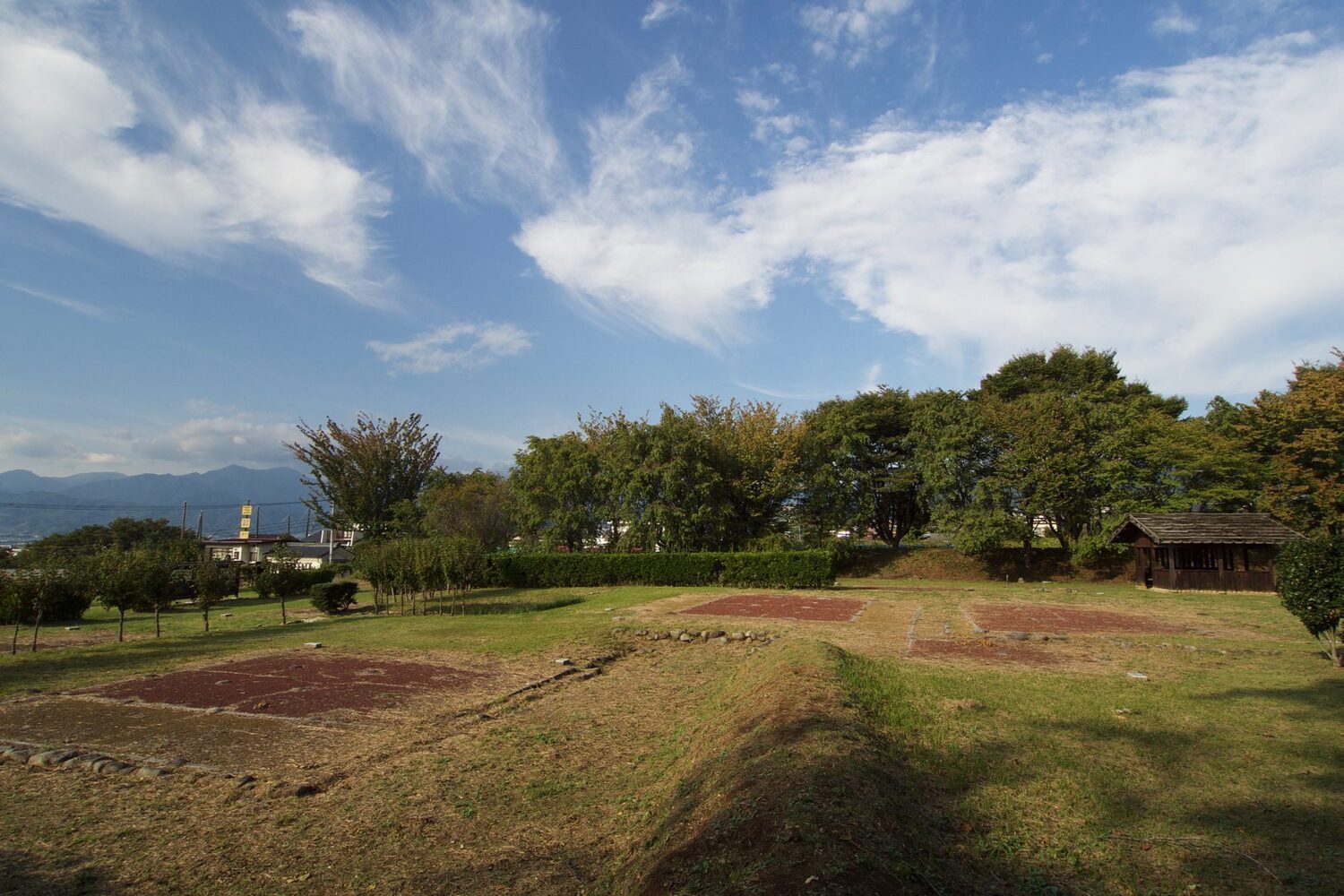
Gallery
| Castle Profile | |
|---|---|
| English Name | Katsunumashi Yakata |
| Japanese Name | 勝沼氏館 |
| Founder | Katsunuma |
| Year Founded | |
| Castle Type | Hilltop |
| Castle Condition | Ruins only |
| Designations | National Historic Site |
| Historical Period | Edo Period |
| Features | trenches, stone walls |
| Visitor Information | |
| Access | Katsunuma Budokyo (Chuo Line), 30 min walk |
| Hours | |
| Time Required | |
| Location | Koshu, Yamanashi Prefecture |
| Coordinates | 35.65989, 138.73174 |
|
Loading map... {"minzoom":false,"maxzoom":false,"mappingservice":"leaflet","width":"auto","height":"200px","centre":false,"title":"","label":"","icon":"Castlemarker.png","lines":[],"polygons":[],"circles":[],"rectangles":[],"copycoords":false,"static":false,"zoom":6,"defzoom":14,"layers":["CartoDB.Positron"],"image layers":[],"overlays":[],"resizable":false,"fullscreen":false,"scrollwheelzoom":true,"cluster":false,"clustermaxzoom":20,"clusterzoomonclick":true,"clustermaxradius":80,"clusterspiderfy":true,"geojson":"","clicktarget":"","imageLayers":[],"locations":[{"text":"","title":"","link":"","lat":35.65989,"lon":138.73174,"icon":"../images/1/1e/Castlemarker.png"}],"imageoverlays":null} |
|
| Admin | |
| Added to Jcastle | 2017 |
| Admin Year Visited | 2017 |
| Admin Visits | October 9, 2017 |
2.50


 (2 votes)
Loading comments...


