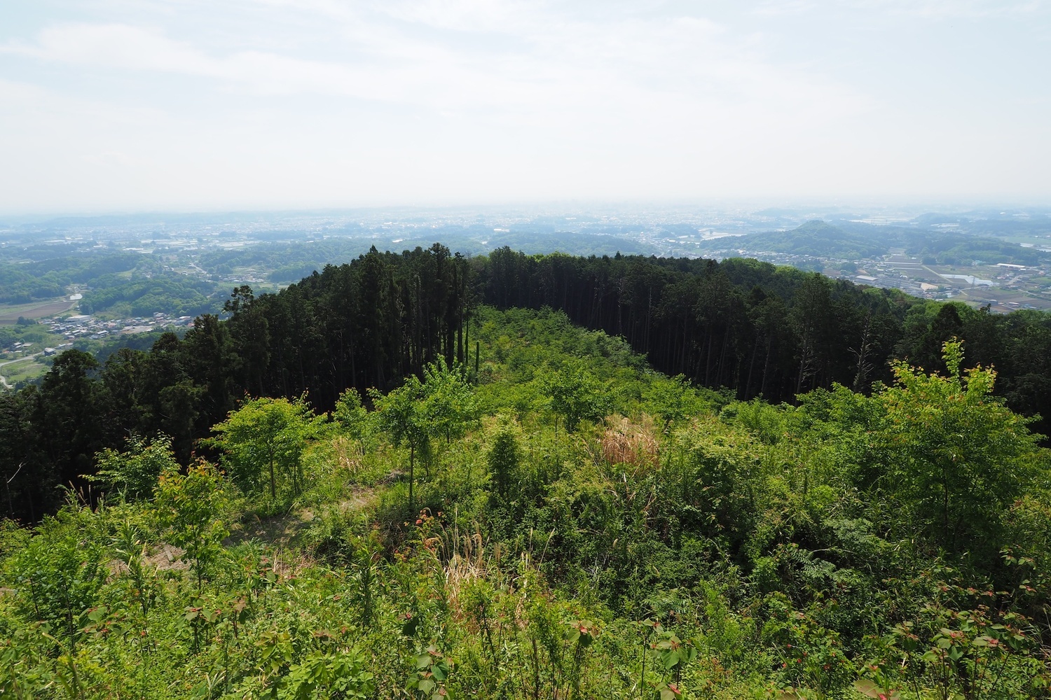
Tage Castle
From Jcastle.info
Jump to:navigation, search
Loading map...
{"format":"leaflet","minzoom":false,"maxzoom":false,"limit":500,"offset":0,"link":"all","sort":["order"],"order":[],"headers":"show","mainlabel":"","intro":"","outro":"","searchlabel":"... further results","default":"","import-annotation":false,"width":"auto","height":"350px","centre":false,"title":"","label":"","icon":"Darkred18.png","lines":[],"polygons":[],"circles":[],"rectangles":[],"copycoords":false,"static":false,"zoom":false,"defzoom":14,"layers":["Esri.WorldTopoMap"],"image layers":[],"overlays":[],"resizable":false,"fullscreen":false,"scrollwheelzoom":true,"cluster":false,"clustermaxzoom":20,"clusterzoomonclick":true,"clustermaxradius":80,"clusterspiderfy":true,"geojson":"","clicktarget":"","showtitle":false,"hidenamespace":true,"template":"InfoWindowProfile","userparam":"","activeicon":"","pagelabel":false,"ajaxcoordproperty":"","ajaxquery":"","locations":[{"text":"\u003Cdiv style=\"width:150px\"\u003E\n\u003Cp\u003E\u003Ca href=\"/view/File:Tage24.jpg\" class=\"image\"\u003E\u003Cimg alt=\"Tage24.jpg\" src=\"../images/thumb/1/19/Tage24.jpg/125px-Tage24.jpg\" decoding=\"async\" width=\"125\" height=\"83\" srcset=\"../images/thumb/1/19/Tage24.jpg/188px-Tage24.jpg 1.5x, ../images/thumb/1/19/Tage24.jpg/250px-Tage24.jpg 2x\" data-file-width=\"1500\" data-file-height=\"1000\" /\u003E\u003C/a\u003E\u003C!--MW-PAGEIMAGES-CANDIDATE-0--\u003E\n\u003C/p\u003E\n\u003C/div\u003E","title":"","link":"","lat":36.60435,"lon":139.80501,"icon":"../images/0/06/Darkred18.png"},{"text":"\u003Cdiv style=\"width:150px\"\u003E\n\u003Cp\u003E\u003Ca href=\"/view/File:Tage2.jpg\" class=\"image\"\u003E\u003Cimg alt=\"Tage2.jpg\" src=\"../images/thumb/c/ce/Tage2.jpg/125px-Tage2.jpg\" decoding=\"async\" width=\"125\" height=\"83\" srcset=\"../images/thumb/c/ce/Tage2.jpg/188px-Tage2.jpg 1.5x, ../images/thumb/c/ce/Tage2.jpg/250px-Tage2.jpg 2x\" data-file-width=\"1500\" data-file-height=\"1000\" /\u003E\u003C/a\u003E\u003C!--MW-PAGEIMAGES-CANDIDATE-1--\u003E\n\u003C/p\u003E\n\u003C/div\u003E","title":"","link":"","lat":36.60539,"lon":139.80609,"icon":"../images/0/06/Darkred18.png"},{"text":"\u003Cdiv style=\"width:150px\"\u003E\n\u003Cp\u003E\u003Ca href=\"/view/File:Tage5.jpg\" class=\"image\"\u003E\u003Cimg alt=\"Tage5.jpg\" src=\"../images/thumb/d/df/Tage5.jpg/125px-Tage5.jpg\" decoding=\"async\" width=\"125\" height=\"83\" srcset=\"../images/thumb/d/df/Tage5.jpg/188px-Tage5.jpg 1.5x, ../images/thumb/d/df/Tage5.jpg/250px-Tage5.jpg 2x\" data-file-width=\"1500\" data-file-height=\"1000\" /\u003E\u003C/a\u003E\u003C!--MW-PAGEIMAGES-CANDIDATE-2--\u003E\n\u003C/p\u003E\n\u003C/div\u003E","title":"","link":"","lat":36.6046,"lon":139.80513,"icon":"../images/0/06/Darkred18.png"},{"text":"\u003Cdiv style=\"width:150px\"\u003E\n\u003Cp\u003E\u003Ca href=\"/view/File:Tage6.jpg\" class=\"image\"\u003E\u003Cimg alt=\"Tage6.jpg\" src=\"../images/thumb/d/d3/Tage6.jpg/125px-Tage6.jpg\" decoding=\"async\" width=\"125\" height=\"83\" srcset=\"../images/thumb/d/d3/Tage6.jpg/188px-Tage6.jpg 1.5x, ../images/thumb/d/d3/Tage6.jpg/250px-Tage6.jpg 2x\" data-file-width=\"1500\" data-file-height=\"1000\" /\u003E\u003C/a\u003E\u003C!--MW-PAGEIMAGES-CANDIDATE-3--\u003E\n\u003C/p\u003E\n\u003C/div\u003E","title":"","link":"","lat":36.60456,"lon":139.80504,"icon":"../images/0/06/Darkred18.png"},{"text":"\u003Cdiv style=\"width:150px\"\u003E\n\u003Cp\u003E\u003Ca href=\"/view/File:Tage4.jpg\" class=\"image\"\u003E\u003Cimg alt=\"Tage4.jpg\" src=\"../images/thumb/7/73/Tage4.jpg/125px-Tage4.jpg\" decoding=\"async\" width=\"125\" height=\"83\" srcset=\"../images/thumb/7/73/Tage4.jpg/188px-Tage4.jpg 1.5x, ../images/thumb/7/73/Tage4.jpg/250px-Tage4.jpg 2x\" data-file-width=\"1500\" data-file-height=\"1000\" /\u003E\u003C/a\u003E\u003C!--MW-PAGEIMAGES-CANDIDATE-4--\u003E\n\u003C/p\u003E\n\u003C/div\u003E","title":"","link":"","lat":36.60449,"lon":139.80506,"icon":"../images/0/06/Darkred18.png"},{"text":"\u003Cdiv style=\"width:150px\"\u003E\n\u003Cp\u003E\u003Ca href=\"/view/File:Tage_pano2.jpg\" class=\"image\"\u003E\u003Cimg alt=\"Tage pano2.jpg\" src=\"../images/thumb/1/16/Tage_pano2.jpg/125px-Tage_pano2.jpg\" decoding=\"async\" width=\"125\" height=\"46\" srcset=\"../images/thumb/1/16/Tage_pano2.jpg/188px-Tage_pano2.jpg 1.5x, ../images/thumb/1/16/Tage_pano2.jpg/250px-Tage_pano2.jpg 2x\" data-file-width=\"1500\" data-file-height=\"554\" /\u003E\u003C/a\u003E\u003C!--MW-PAGEIMAGES-CANDIDATE-5--\u003E\n\u003C/p\u003E\n\u003C/div\u003E","title":"","link":"","lat":36.60449,"lon":139.80506,"icon":"../images/0/06/Darkred18.png"},{"text":"\u003Cdiv style=\"width:150px\"\u003E\n\u003Cp\u003E\u003Ca href=\"/view/File:Tage3.jpg\" class=\"image\"\u003E\u003Cimg alt=\"Tage3.jpg\" src=\"../images/thumb/d/d4/Tage3.jpg/125px-Tage3.jpg\" decoding=\"async\" width=\"125\" height=\"83\" srcset=\"../images/thumb/d/d4/Tage3.jpg/188px-Tage3.jpg 1.5x, ../images/thumb/d/d4/Tage3.jpg/250px-Tage3.jpg 2x\" data-file-width=\"1500\" data-file-height=\"1000\" /\u003E\u003C/a\u003E\u003C!--MW-PAGEIMAGES-CANDIDATE-6--\u003E\n\u003C/p\u003E\n\u003C/div\u003E","title":"","link":"","lat":36.60445,"lon":139.80507,"icon":"../images/0/06/Darkred18.png"},{"text":"\u003Cdiv style=\"width:150px\"\u003E\n\u003Cp\u003E\u003Ca href=\"/view/File:Tage_pano1.jpg\" class=\"image\"\u003E\u003Cimg alt=\"Tage pano1.jpg\" src=\"../images/thumb/c/cc/Tage_pano1.jpg/125px-Tage_pano1.jpg\" decoding=\"async\" width=\"125\" height=\"46\" srcset=\"../images/thumb/c/cc/Tage_pano1.jpg/188px-Tage_pano1.jpg 1.5x, ../images/thumb/c/cc/Tage_pano1.jpg/250px-Tage_pano1.jpg 2x\" data-file-width=\"1500\" data-file-height=\"557\" /\u003E\u003C/a\u003E\u003C!--MW-PAGEIMAGES-CANDIDATE-7--\u003E\n\u003C/p\u003E\n\u003C/div\u003E","title":"","link":"","lat":36.60445,"lon":139.80507,"icon":"../images/0/06/Darkred18.png"},{"text":"\u003Cdiv style=\"width:150px\"\u003E\n\u003Cp\u003E\u003Ca href=\"/view/File:Tage_pano3.jpg\" class=\"image\"\u003E\u003Cimg alt=\"Tage pano3.jpg\" src=\"../images/thumb/f/fa/Tage_pano3.jpg/125px-Tage_pano3.jpg\" decoding=\"async\" width=\"125\" height=\"43\" srcset=\"../images/thumb/f/fa/Tage_pano3.jpg/188px-Tage_pano3.jpg 1.5x, ../images/thumb/f/fa/Tage_pano3.jpg/250px-Tage_pano3.jpg 2x\" data-file-width=\"1500\" data-file-height=\"513\" /\u003E\u003C/a\u003E\u003C!--MW-PAGEIMAGES-CANDIDATE-8--\u003E\n\u003C/p\u003E\n\u003C/div\u003E","title":"","link":"","lat":36.60438,"lon":139.8051,"icon":"../images/0/06/Darkred18.png"},{"text":"\u003Cdiv style=\"width:150px\"\u003E\n\u003Cp\u003E\u003Ca href=\"/view/File:Tage7.jpg\" class=\"image\"\u003E\u003Cimg alt=\"Tage7.jpg\" src=\"../images/thumb/4/4b/Tage7.jpg/125px-Tage7.jpg\" decoding=\"async\" width=\"125\" height=\"83\" srcset=\"../images/thumb/4/4b/Tage7.jpg/188px-Tage7.jpg 1.5x, ../images/thumb/4/4b/Tage7.jpg/250px-Tage7.jpg 2x\" data-file-width=\"1500\" data-file-height=\"1000\" /\u003E\u003C/a\u003E\u003C!--MW-PAGEIMAGES-CANDIDATE-9--\u003E\n\u003C/p\u003E\n\u003C/div\u003E","title":"","link":"","lat":36.60456,"lon":139.8046,"icon":"../images/0/06/Darkred18.png"},{"text":"\u003Cdiv style=\"width:150px\"\u003E\n\u003Cp\u003E\u003Ca href=\"/view/File:Tage8.jpg\" class=\"image\"\u003E\u003Cimg alt=\"Tage8.jpg\" src=\"../images/thumb/5/5d/Tage8.jpg/125px-Tage8.jpg\" decoding=\"async\" width=\"125\" height=\"83\" srcset=\"../images/thumb/5/5d/Tage8.jpg/188px-Tage8.jpg 1.5x, ../images/thumb/5/5d/Tage8.jpg/250px-Tage8.jpg 2x\" data-file-width=\"1500\" data-file-height=\"1000\" /\u003E\u003C/a\u003E\u003C!--MW-PAGEIMAGES-CANDIDATE-10--\u003E\n\u003C/p\u003E\n\u003C/div\u003E","title":"","link":"","lat":36.60465,"lon":139.80459,"icon":"../images/0/06/Darkred18.png"},{"text":"\u003Cdiv style=\"width:150px\"\u003E\n\u003Cp\u003E\u003Ca href=\"/view/File:Tage9.jpg\" class=\"image\"\u003E\u003Cimg alt=\"Tage9.jpg\" src=\"../images/thumb/e/e9/Tage9.jpg/125px-Tage9.jpg\" decoding=\"async\" width=\"125\" height=\"83\" srcset=\"../images/thumb/e/e9/Tage9.jpg/188px-Tage9.jpg 1.5x, ../images/thumb/e/e9/Tage9.jpg/250px-Tage9.jpg 2x\" data-file-width=\"1500\" data-file-height=\"1000\" /\u003E\u003C/a\u003E\u003C!--MW-PAGEIMAGES-CANDIDATE-11--\u003E\n\u003C/p\u003E\n\u003C/div\u003E","title":"","link":"","lat":36.60483,"lon":139.80451,"icon":"../images/0/06/Darkred18.png"},{"text":"\u003Cdiv style=\"width:150px\"\u003E\n\u003Cp\u003E\u003Ca href=\"/view/File:Tage10.jpg\" class=\"image\"\u003E\u003Cimg alt=\"Tage10.jpg\" src=\"../images/thumb/0/07/Tage10.jpg/125px-Tage10.jpg\" decoding=\"async\" width=\"125\" height=\"83\" srcset=\"../images/thumb/0/07/Tage10.jpg/188px-Tage10.jpg 1.5x, ../images/thumb/0/07/Tage10.jpg/250px-Tage10.jpg 2x\" data-file-width=\"1500\" data-file-height=\"1000\" /\u003E\u003C/a\u003E\u003C!--MW-PAGEIMAGES-CANDIDATE-12--\u003E\n\u003C/p\u003E\n\u003C/div\u003E","title":"","link":"","lat":36.60489,"lon":139.80443,"icon":"../images/0/06/Darkred18.png"},{"text":"\u003Cdiv style=\"width:150px\"\u003E\n\u003Cp\u003E\u003Ca href=\"/view/File:Tage11.jpg\" class=\"image\"\u003E\u003Cimg alt=\"Tage11.jpg\" src=\"../images/thumb/1/1e/Tage11.jpg/125px-Tage11.jpg\" decoding=\"async\" width=\"125\" height=\"83\" srcset=\"../images/thumb/1/1e/Tage11.jpg/188px-Tage11.jpg 1.5x, ../images/thumb/1/1e/Tage11.jpg/250px-Tage11.jpg 2x\" data-file-width=\"1500\" data-file-height=\"1000\" /\u003E\u003C/a\u003E\u003C!--MW-PAGEIMAGES-CANDIDATE-13--\u003E\n\u003C/p\u003E\n\u003C/div\u003E","title":"","link":"","lat":36.60491,"lon":139.80441,"icon":"../images/0/06/Darkred18.png"},{"text":"\u003Cdiv style=\"width:150px\"\u003E\n\u003Cp\u003E\u003Ca href=\"/view/File:Tage12.jpg\" class=\"image\"\u003E\u003Cimg alt=\"Tage12.jpg\" src=\"../images/thumb/8/84/Tage12.jpg/125px-Tage12.jpg\" decoding=\"async\" width=\"125\" height=\"83\" srcset=\"../images/thumb/8/84/Tage12.jpg/188px-Tage12.jpg 1.5x, ../images/thumb/8/84/Tage12.jpg/250px-Tage12.jpg 2x\" data-file-width=\"1500\" data-file-height=\"1000\" /\u003E\u003C/a\u003E\u003C!--MW-PAGEIMAGES-CANDIDATE-14--\u003E\n\u003C/p\u003E\n\u003C/div\u003E","title":"","link":"","lat":36.60506,"lon":139.80422,"icon":"../images/0/06/Darkred18.png"},{"text":"\u003Cdiv style=\"width:150px\"\u003E\n\u003Cp\u003E\u003Ca href=\"/view/File:Tage13.jpg\" class=\"image\"\u003E\u003Cimg alt=\"Tage13.jpg\" src=\"../images/thumb/1/1d/Tage13.jpg/125px-Tage13.jpg\" decoding=\"async\" width=\"125\" height=\"83\" srcset=\"../images/thumb/1/1d/Tage13.jpg/188px-Tage13.jpg 1.5x, ../images/thumb/1/1d/Tage13.jpg/250px-Tage13.jpg 2x\" data-file-width=\"1500\" data-file-height=\"1000\" /\u003E\u003C/a\u003E\u003C!--MW-PAGEIMAGES-CANDIDATE-15--\u003E\n\u003C/p\u003E\n\u003C/div\u003E","title":"","link":"","lat":36.60513,"lon":139.80393,"icon":"../images/0/06/Darkred18.png"},{"text":"\u003Cdiv style=\"width:150px\"\u003E\n\u003Cp\u003E\u003Ca href=\"/view/File:Tage14.jpg\" class=\"image\"\u003E\u003Cimg alt=\"Tage14.jpg\" src=\"../images/thumb/0/0a/Tage14.jpg/125px-Tage14.jpg\" decoding=\"async\" width=\"125\" height=\"83\" srcset=\"../images/thumb/0/0a/Tage14.jpg/188px-Tage14.jpg 1.5x, ../images/thumb/0/0a/Tage14.jpg/250px-Tage14.jpg 2x\" data-file-width=\"1500\" data-file-height=\"1000\" /\u003E\u003C/a\u003E\u003C!--MW-PAGEIMAGES-CANDIDATE-16--\u003E\n\u003C/p\u003E\n\u003C/div\u003E","title":"","link":"","lat":36.60511,"lon":139.80388,"icon":"../images/0/06/Darkred18.png"},{"text":"\u003Cdiv style=\"width:150px\"\u003E\n\u003Cp\u003E\u003Ca href=\"/view/File:Tage15.jpg\" class=\"image\"\u003E\u003Cimg alt=\"Tage15.jpg\" src=\"../images/thumb/0/0c/Tage15.jpg/125px-Tage15.jpg\" decoding=\"async\" width=\"125\" height=\"83\" srcset=\"../images/thumb/0/0c/Tage15.jpg/188px-Tage15.jpg 1.5x, ../images/thumb/0/0c/Tage15.jpg/250px-Tage15.jpg 2x\" data-file-width=\"1500\" data-file-height=\"1000\" /\u003E\u003C/a\u003E\u003C!--MW-PAGEIMAGES-CANDIDATE-17--\u003E\n\u003C/p\u003E\n\u003C/div\u003E","title":"","link":"","lat":36.60505,"lon":139.80384,"icon":"../images/0/06/Darkred18.png"},{"text":"\u003Cdiv style=\"width:150px\"\u003E\n\u003Cp\u003E\u003Ca href=\"/view/File:Tage16.jpg\" class=\"image\"\u003E\u003Cimg alt=\"Tage16.jpg\" src=\"../images/thumb/9/98/Tage16.jpg/125px-Tage16.jpg\" decoding=\"async\" width=\"125\" height=\"83\" srcset=\"../images/thumb/9/98/Tage16.jpg/188px-Tage16.jpg 1.5x, ../images/thumb/9/98/Tage16.jpg/250px-Tage16.jpg 2x\" data-file-width=\"1500\" data-file-height=\"1000\" /\u003E\u003C/a\u003E\u003C!--MW-PAGEIMAGES-CANDIDATE-18--\u003E\n\u003C/p\u003E\n\u003C/div\u003E","title":"","link":"","lat":36.60479,"lon":139.80384,"icon":"../images/0/06/Darkred18.png"},{"text":"\u003Cdiv style=\"width:150px\"\u003E\n\u003Cp\u003E\u003Ca href=\"/view/File:Tage17.jpg\" class=\"image\"\u003E\u003Cimg alt=\"Tage17.jpg\" src=\"../images/thumb/a/ad/Tage17.jpg/125px-Tage17.jpg\" decoding=\"async\" width=\"125\" height=\"83\" srcset=\"../images/thumb/a/ad/Tage17.jpg/188px-Tage17.jpg 1.5x, ../images/thumb/a/ad/Tage17.jpg/250px-Tage17.jpg 2x\" data-file-width=\"1500\" data-file-height=\"1000\" /\u003E\u003C/a\u003E\u003C!--MW-PAGEIMAGES-CANDIDATE-19--\u003E\n\u003C/p\u003E\n\u003C/div\u003E","title":"","link":"","lat":36.60441,"lon":139.80389,"icon":"../images/0/06/Darkred18.png"},{"text":"\u003Cdiv style=\"width:150px\"\u003E\n\u003Cp\u003E\u003Ca href=\"/view/File:Tage18.jpg\" class=\"image\"\u003E\u003Cimg alt=\"Tage18.jpg\" src=\"../images/thumb/5/50/Tage18.jpg/125px-Tage18.jpg\" decoding=\"async\" width=\"125\" height=\"83\" srcset=\"../images/thumb/5/50/Tage18.jpg/188px-Tage18.jpg 1.5x, ../images/thumb/5/50/Tage18.jpg/250px-Tage18.jpg 2x\" data-file-width=\"1500\" data-file-height=\"1000\" /\u003E\u003C/a\u003E\u003C!--MW-PAGEIMAGES-CANDIDATE-20--\u003E\n\u003C/p\u003E\n\u003C/div\u003E","title":"","link":"","lat":36.60436,"lon":139.80393,"icon":"../images/0/06/Darkred18.png"},{"text":"\u003Cdiv style=\"width:150px\"\u003E\n\u003Cp\u003E\u003Ca href=\"/view/File:Tage19.jpg\" class=\"image\"\u003E\u003Cimg alt=\"Tage19.jpg\" src=\"../images/thumb/3/36/Tage19.jpg/125px-Tage19.jpg\" decoding=\"async\" width=\"125\" height=\"83\" srcset=\"../images/thumb/3/36/Tage19.jpg/188px-Tage19.jpg 1.5x, ../images/thumb/3/36/Tage19.jpg/250px-Tage19.jpg 2x\" data-file-width=\"1500\" data-file-height=\"1000\" /\u003E\u003C/a\u003E\u003C!--MW-PAGEIMAGES-CANDIDATE-21--\u003E\n\u003C/p\u003E\n\u003C/div\u003E","title":"","link":"","lat":36.60404,"lon":139.80384,"icon":"../images/0/06/Darkred18.png"},{"text":"\u003Cdiv style=\"width:150px\"\u003E\n\u003Cp\u003E\u003Ca href=\"/view/File:Tage20.jpg\" class=\"image\"\u003E\u003Cimg alt=\"Tage20.jpg\" src=\"../images/thumb/f/f7/Tage20.jpg/125px-Tage20.jpg\" decoding=\"async\" width=\"125\" height=\"83\" srcset=\"../images/thumb/f/f7/Tage20.jpg/188px-Tage20.jpg 1.5x, ../images/thumb/f/f7/Tage20.jpg/250px-Tage20.jpg 2x\" data-file-width=\"1500\" data-file-height=\"1000\" /\u003E\u003C/a\u003E\u003C!--MW-PAGEIMAGES-CANDIDATE-22--\u003E\n\u003C/p\u003E\n\u003C/div\u003E","title":"","link":"","lat":36.60437,"lon":139.8049,"icon":"../images/0/06/Darkred18.png"},{"text":"\u003Cdiv style=\"width:150px\"\u003E\n\u003Cp\u003E\u003Ca href=\"/view/File:Tage21.jpg\" class=\"image\"\u003E\u003Cimg alt=\"Tage21.jpg\" src=\"../images/thumb/5/5e/Tage21.jpg/125px-Tage21.jpg\" decoding=\"async\" width=\"125\" height=\"83\" srcset=\"../images/thumb/5/5e/Tage21.jpg/188px-Tage21.jpg 1.5x, ../images/thumb/5/5e/Tage21.jpg/250px-Tage21.jpg 2x\" data-file-width=\"1500\" data-file-height=\"1000\" /\u003E\u003C/a\u003E\u003C!--MW-PAGEIMAGES-CANDIDATE-23--\u003E\n\u003C/p\u003E\n\u003C/div\u003E","title":"","link":"","lat":36.60485,"lon":139.8047,"icon":"../images/0/06/Darkred18.png"},{"text":"\u003Cdiv style=\"width:150px\"\u003E\n\u003Cp\u003E\u003Ca href=\"/view/File:Tage22.jpg\" class=\"image\"\u003E\u003Cimg alt=\"Tage22.jpg\" src=\"../images/thumb/5/50/Tage22.jpg/125px-Tage22.jpg\" decoding=\"async\" width=\"125\" height=\"83\" srcset=\"../images/thumb/5/50/Tage22.jpg/188px-Tage22.jpg 1.5x, ../images/thumb/5/50/Tage22.jpg/250px-Tage22.jpg 2x\" data-file-width=\"1500\" data-file-height=\"1000\" /\u003E\u003C/a\u003E\u003C!--MW-PAGEIMAGES-CANDIDATE-24--\u003E\n\u003C/p\u003E\n\u003C/div\u003E","title":"","link":"","lat":36.60498,"lon":139.80451,"icon":"../images/0/06/Darkred18.png"},{"text":"\u003Cdiv style=\"width:150px\"\u003E\n\u003Cp\u003E\u003Ca href=\"/view/File:Tage23.jpg\" class=\"image\"\u003E\u003Cimg alt=\"Tage23.jpg\" src=\"../images/thumb/8/8a/Tage23.jpg/125px-Tage23.jpg\" decoding=\"async\" width=\"125\" height=\"83\" srcset=\"../images/thumb/8/8a/Tage23.jpg/188px-Tage23.jpg 1.5x, ../images/thumb/8/8a/Tage23.jpg/250px-Tage23.jpg 2x\" data-file-width=\"1500\" data-file-height=\"1000\" /\u003E\u003C/a\u003E\u003C!--MW-PAGEIMAGES-CANDIDATE-25--\u003E\n\u003C/p\u003E\n\u003C/div\u003E","title":"","link":"","lat":36.60449,"lon":139.80465,"icon":"../images/0/06/Darkred18.png"},{"text":"\u003Cdiv style=\"width:150px\"\u003E\n\u003Cp\u003E\u003Ca href=\"/view/File:Tage25.jpg\" class=\"image\"\u003E\u003Cimg alt=\"Tage25.jpg\" src=\"../images/thumb/f/f3/Tage25.jpg/125px-Tage25.jpg\" decoding=\"async\" width=\"125\" height=\"83\" srcset=\"../images/thumb/f/f3/Tage25.jpg/188px-Tage25.jpg 1.5x, ../images/thumb/f/f3/Tage25.jpg/250px-Tage25.jpg 2x\" data-file-width=\"1500\" data-file-height=\"1000\" /\u003E\u003C/a\u003E\u003C!--MW-PAGEIMAGES-CANDIDATE-26--\u003E\n\u003C/p\u003E\n\u003C/div\u003E","title":"","link":"","lat":36.60358,"lon":139.80661,"icon":"../images/0/06/Darkred18.png"},{"text":"\u003Cdiv style=\"width:150px\"\u003E\n\u003Cp\u003E\u003Ca href=\"/view/File:Tage26.jpg\" class=\"image\"\u003E\u003Cimg alt=\"Tage26.jpg\" src=\"../images/thumb/9/9f/Tage26.jpg/125px-Tage26.jpg\" decoding=\"async\" width=\"125\" height=\"83\" srcset=\"../images/thumb/9/9f/Tage26.jpg/188px-Tage26.jpg 1.5x, ../images/thumb/9/9f/Tage26.jpg/250px-Tage26.jpg 2x\" data-file-width=\"1500\" data-file-height=\"1000\" /\u003E\u003C/a\u003E\u003C!--MW-PAGEIMAGES-CANDIDATE-27--\u003E\n\u003C/p\u003E\n\u003C/div\u003E","title":"","link":"","lat":36.60353,"lon":139.80666,"icon":"../images/0/06/Darkred18.png"},{"text":"\u003Cdiv style=\"width:150px\"\u003E\n\u003Cp\u003E\u003Ca href=\"/view/File:Tage27.jpg\" class=\"image\"\u003E\u003Cimg alt=\"Tage27.jpg\" src=\"../images/thumb/3/3a/Tage27.jpg/125px-Tage27.jpg\" decoding=\"async\" width=\"125\" height=\"83\" srcset=\"../images/thumb/3/3a/Tage27.jpg/188px-Tage27.jpg 1.5x, ../images/thumb/3/3a/Tage27.jpg/250px-Tage27.jpg 2x\" data-file-width=\"1500\" data-file-height=\"1000\" /\u003E\u003C/a\u003E\u003C!--MW-PAGEIMAGES-CANDIDATE-28--\u003E\n\u003C/p\u003E\n\u003C/div\u003E","title":"","link":"","lat":36.60349,"lon":139.8068,"icon":"../images/0/06/Darkred18.png"},{"text":"\u003Cdiv style=\"width:150px\"\u003E\n\u003Cp\u003E\u003Ca href=\"/view/File:Tage28.jpg\" class=\"image\"\u003E\u003Cimg alt=\"Tage28.jpg\" src=\"../images/thumb/5/51/Tage28.jpg/125px-Tage28.jpg\" decoding=\"async\" width=\"125\" height=\"83\" srcset=\"../images/thumb/5/51/Tage28.jpg/188px-Tage28.jpg 1.5x, ../images/thumb/5/51/Tage28.jpg/250px-Tage28.jpg 2x\" data-file-width=\"1500\" data-file-height=\"1000\" /\u003E\u003C/a\u003E\u003C!--MW-PAGEIMAGES-CANDIDATE-29--\u003E\n\u003C/p\u003E\n\u003C/div\u003E","title":"","link":"","lat":36.60328,"lon":139.80711,"icon":"../images/0/06/Darkred18.png"},{"text":"\u003Cdiv style=\"width:150px\"\u003E\n\u003Cp\u003E\u003Ca href=\"/view/File:Tage29.jpg\" class=\"image\"\u003E\u003Cimg alt=\"Tage29.jpg\" src=\"../images/thumb/8/83/Tage29.jpg/125px-Tage29.jpg\" decoding=\"async\" width=\"125\" height=\"83\" srcset=\"../images/thumb/8/83/Tage29.jpg/188px-Tage29.jpg 1.5x, ../images/thumb/8/83/Tage29.jpg/250px-Tage29.jpg 2x\" data-file-width=\"1500\" data-file-height=\"1000\" /\u003E\u003C/a\u003E\u003C!--MW-PAGEIMAGES-CANDIDATE-30--\u003E\n\u003C/p\u003E\n\u003C/div\u003E","title":"","link":"","lat":36.60024,"lon":139.80904,"icon":"../images/0/06/Darkred18.png"},{"text":"\u003Cdiv style=\"width:150px\"\u003E\n\u003Cp\u003E\u003Ca href=\"/view/File:Tage30.jpg\" class=\"image\"\u003E\u003Cimg alt=\"Tage30.jpg\" src=\"../images/thumb/0/0f/Tage30.jpg/125px-Tage30.jpg\" decoding=\"async\" width=\"125\" height=\"83\" srcset=\"../images/thumb/0/0f/Tage30.jpg/188px-Tage30.jpg 1.5x, ../images/thumb/0/0f/Tage30.jpg/250px-Tage30.jpg 2x\" data-file-width=\"1500\" data-file-height=\"1000\" /\u003E\u003C/a\u003E\u003C!--MW-PAGEIMAGES-CANDIDATE-31--\u003E\n\u003C/p\u003E\n\u003C/div\u003E","title":"","link":"","lat":36.60021,"lon":139.80905,"icon":"../images/0/06/Darkred18.png"},{"text":"\u003Cdiv style=\"width:150px\"\u003E\n\u003Cp\u003E\u003Ca href=\"/view/File:Tage31.jpg\" class=\"image\"\u003E\u003Cimg alt=\"Tage31.jpg\" src=\"../images/thumb/d/d4/Tage31.jpg/125px-Tage31.jpg\" decoding=\"async\" width=\"125\" height=\"83\" srcset=\"../images/thumb/d/d4/Tage31.jpg/188px-Tage31.jpg 1.5x, ../images/thumb/d/d4/Tage31.jpg/250px-Tage31.jpg 2x\" data-file-width=\"1500\" data-file-height=\"1000\" /\u003E\u003C/a\u003E\u003C!--MW-PAGEIMAGES-CANDIDATE-32--\u003E\n\u003C/p\u003E\n\u003C/div\u003E","title":"","link":"","lat":36.6002,"lon":139.80912,"icon":"../images/0/06/Darkred18.png"},{"text":"\u003Cdiv style=\"width:150px\"\u003E\n\u003Cp\u003E\u003Ca href=\"/view/File:Tage32.jpg\" class=\"image\"\u003E\u003Cimg alt=\"Tage32.jpg\" src=\"../images/thumb/f/f3/Tage32.jpg/125px-Tage32.jpg\" decoding=\"async\" width=\"125\" height=\"83\" srcset=\"../images/thumb/f/f3/Tage32.jpg/188px-Tage32.jpg 1.5x, ../images/thumb/f/f3/Tage32.jpg/250px-Tage32.jpg 2x\" data-file-width=\"1500\" data-file-height=\"1000\" /\u003E\u003C/a\u003E\u003C!--MW-PAGEIMAGES-CANDIDATE-33--\u003E\n\u003C/p\u003E\n\u003C/div\u003E","title":"","link":"","lat":36.6002,"lon":139.80921,"icon":"../images/0/06/Darkred18.png"},{"text":"\u003Cdiv style=\"width:150px\"\u003E\n\u003Cp\u003E\u003Ca href=\"/view/File:Tage33.jpg\" class=\"image\"\u003E\u003Cimg alt=\"Tage33.jpg\" src=\"../images/thumb/6/62/Tage33.jpg/125px-Tage33.jpg\" decoding=\"async\" width=\"125\" height=\"83\" srcset=\"../images/thumb/6/62/Tage33.jpg/188px-Tage33.jpg 1.5x, ../images/thumb/6/62/Tage33.jpg/250px-Tage33.jpg 2x\" data-file-width=\"1500\" data-file-height=\"1000\" /\u003E\u003C/a\u003E\u003C!--MW-PAGEIMAGES-CANDIDATE-34--\u003E\n\u003C/p\u003E\n\u003C/div\u003E","title":"","link":"","lat":36.60023,"lon":139.80938,"icon":"../images/0/06/Darkred18.png"},{"text":"\u003Cdiv style=\"width:150px\"\u003E\n\u003Cp\u003E\u003Ca href=\"/view/File:Tage34.jpg\" class=\"image\"\u003E\u003Cimg alt=\"Tage34.jpg\" src=\"../images/thumb/7/7e/Tage34.jpg/125px-Tage34.jpg\" decoding=\"async\" width=\"125\" height=\"83\" srcset=\"../images/thumb/7/7e/Tage34.jpg/188px-Tage34.jpg 1.5x, ../images/thumb/7/7e/Tage34.jpg/250px-Tage34.jpg 2x\" data-file-width=\"1500\" data-file-height=\"1000\" /\u003E\u003C/a\u003E\u003C!--MW-PAGEIMAGES-CANDIDATE-35--\u003E\n\u003C/p\u003E\n\u003C/div\u003E","title":"","link":"","lat":36.59997,"lon":139.80915,"icon":"../images/0/06/Darkred18.png"},{"text":"\u003Cdiv style=\"width:150px\"\u003E\n\u003Cp\u003E\u003Ca href=\"/view/File:Tage35.jpg\" class=\"image\"\u003E\u003Cimg alt=\"Tage35.jpg\" src=\"../images/thumb/7/72/Tage35.jpg/125px-Tage35.jpg\" decoding=\"async\" width=\"125\" height=\"83\" srcset=\"../images/thumb/7/72/Tage35.jpg/188px-Tage35.jpg 1.5x, ../images/thumb/7/72/Tage35.jpg/250px-Tage35.jpg 2x\" data-file-width=\"1500\" data-file-height=\"1000\" /\u003E\u003C/a\u003E\u003C!--MW-PAGEIMAGES-CANDIDATE-36--\u003E\n\u003C/p\u003E\n\u003C/div\u003E","title":"","link":"","lat":36.59986,"lon":139.80927,"icon":"../images/0/06/Darkred18.png"},{"text":"\u003Cdiv style=\"width:150px\"\u003E\n\u003Cp\u003E\u003Ca href=\"/view/File:Tage1.jpg\" class=\"image\"\u003E\u003Cimg alt=\"Tage1.jpg\" src=\"../images/thumb/4/43/Tage1.jpg/125px-Tage1.jpg\" decoding=\"async\" width=\"125\" height=\"83\" srcset=\"../images/thumb/4/43/Tage1.jpg/188px-Tage1.jpg 1.5x, ../images/thumb/4/43/Tage1.jpg/250px-Tage1.jpg 2x\" data-file-width=\"1500\" data-file-height=\"1000\" /\u003E\u003C/a\u003E\u003C!--MW-PAGEIMAGES-CANDIDATE-37--\u003E\n\u003C/p\u003E\n\u003C/div\u003E","title":"","link":"","lat":36.60397,"lon":139.81075,"icon":"../images/0/06/Darkred18.png"}],"imageLayers":[]}
Gallery
| Castle Profile | |
|---|---|
| English Name | Tage Castle |
| Japanese Name | 多気城 |
| Alternate Names | Tagesan-jo |
| Founder | |
| Year Founded | |
| Castle Type | Mountaintop |
| Castle Condition | Ruins only |
| Historical Period | Pre Edo Period |
| Features | trenches |
| Visitor Information | |
| Access | Utsunomiya Sta. (20 min bus) |
| Hours | mountain, open any time |
| Time Required | 120 mins |
| Location | Utsunomiya, Tochigi Prefecture |
| Coordinates | 36.6048, 139.80427 |
|
Loading map... {"minzoom":false,"maxzoom":false,"mappingservice":"leaflet","width":"auto","height":"200px","centre":false,"title":"","label":"","icon":"Castlemarker.png","lines":[],"polygons":[],"circles":[],"rectangles":[],"copycoords":false,"static":false,"zoom":6,"defzoom":14,"layers":["CartoDB.Positron"],"image layers":[],"overlays":[],"resizable":false,"fullscreen":false,"scrollwheelzoom":true,"cluster":false,"clustermaxzoom":20,"clusterzoomonclick":true,"clustermaxradius":80,"clusterspiderfy":true,"geojson":"","clicktarget":"","imageLayers":[],"locations":[{"text":"","title":"","link":"","lat":36.6048,"lon":139.80427,"icon":"../images/1/1e/Castlemarker.png"}],"imageoverlays":null} |
|
| Admin | |
| Added to Jcastle | 2018 |
| Admin Year Visited | 2018 |
| Admin Visits | April 30, 2018 |
2.00


 (one vote)
Loading comments...
Retrieved from "http://jcastle.info/smw139/index.php?title=Tage_Castle&oldid=23342"


