Goudo Castle
Gōdojō is a hirajiro (flatland castle) ruin located in Gōdo village of Mitake Township, Kani County. I was quite impressed with this site. A mostly intact moat and berm system survives to the north, west and east, and partially to the south, surrounding a spacious bailey, with the area to the southw
History
Saitō Myōchin, originally an abbot, came out of the priesthood to take over as the governor of Mino province when his older brother, Saitō Toshinaga, died in 1460. He built Gōdojō as his residence in 1468 due to the onset of the Ōnin Wars.
Field Notes
Gōdojō is a hirajiro (flatland castle) ruin located in Gōdo village of Mitake Township, Kani County. I was quite impressed with this site. A mostly intact moat and berm system survives to the north, west and east, and partially to the south, surrounding a spacious bailey, with the area to the southwest and south-south sloping off (I assumed it had been effaced by housing construction, but apparently lignite was mined here at some point).
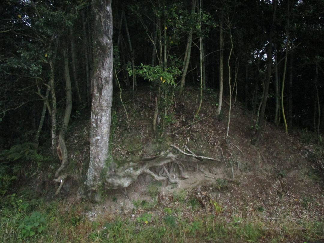
Although the site is a hirajiro in its layout and design, it does sit on a sort of plateau, and this difference in elevation to the south has determined the composition of its defences. The lower side of the fort, particularly the surviving portion of the southern perimeter to the southeast which has an outer array of dorui (earthen ramparts), has only very shallow dorui on the inside of the moat atop of the bailey parapet. In contrast, in the north of the ruin there is no outside dorui, but a mizubori (water moat) or numabori (swamp moat) with very tall and thick dorui on the inside. The inner dorui continues in the east and west, but it's very overgrown so I didn't walk the whole length.
I started my exploration by jumping into the southeastern portion of the karabori (dry moat), and climbing, because the moat slopes with the terrain, up to the northeast. Beyond that the moat becomes water-filled. I got out and followed the numabori along to where there were gaps in the northern embankments. I think one of these was probably a modern road built by removing the dorui, but there is a narrower one, too narrow for a car, which may have been a dobashi (earthen bridge) and castle's main entrance in the past. I got as close as I dared to the moat here, and my shiny new hiking boots got a baptism of fire - or mud, as it were. The northwestern portion of moat was so overgrown and coagulated that I couldn't even see inside it and daylight didn't penetrate. The interior of the bailey is now farmsteads, houses and fields.
| Castle Profile | |
|---|---|
| English Name | Goudo Castle |
| Japanese Name | 顔戸城 |
| Founder | Saitō Myōchin |
| Year Founded | 1468 |
| Castle Type | Flatland |
| Castle Condition | Ruins only |
| Historical Period | Pre Edo Period |
| Artifacts | Dorui, Dobashi, Karabori, &c. |
| Features | water moats, trenches |
| Visitor Information | |
| Access | Gōdo Station on the Meitetsu-Hiromi Line; 6 min walk |
| Hours | 24/7 free; fields |
| Time Required | 50 minutes |
| Location | Mitake, Gifu Prefecture |
| Coordinates | 35.43875, 137.10738 |
|
|
|
| Admin | |
| Added to Jcastle | 2025 |
| Contributor | ART |
| Admin Year Visited | Viewer Contributed |
| Friends of JCastle | |
| Jōkaku Hōrōki | |
| Kojōdan | |
| Yogo | |


