Magone Castle (Mikawa)
Magonejō is a yamajiro (mountaintop castle) ruin located in Hirase Township, Toyota Municipality. Ruins are earthworks, including horikiri (trenches), dobashi (earthen bridges), dorui (earthen ramparts) and kuruwa (baileys). The castle's layout is long and narrow, following the ridgeline. To reach t
History
Magonejō was originally built by Kaji Nobukatsu, the first patriarch of the Kaji Clan, probably in the early 15th century. The castle was attacked in 1536, during the reign of Kaji Nobuie, the 7th patriarch of the Kaji Clan, and conquered. Some time after which, in 1566, the Kaji Clan under Kaji Katsutada became subservient to Honda Tadakatsu. Honda Tadatomo was installed as castellan of Magonejō by the Matsudaira. Magonejō fell to Takeda forces in 1571. Honda Tadatomo fled and became a monk, and it seems that Magonejō was thereafter abandoned with the retreat of the Takeda back to Kai. The ruins of the fort appear to date to the latter half of the 16th century.
Field Notes
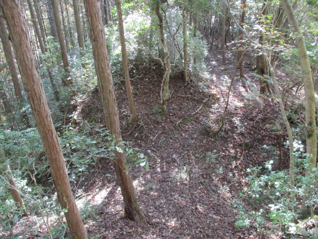
Magonejō is a yamajiro (mountaintop castle) ruin located in Hirase Township, Toyota Municipality. Ruins are earthworks, including horikiri (trenches), dobashi (earthen bridges), dorui (earthen ramparts) and kuruwa (baileys). The castle's layout is long and narrow, following the ridgeline. To reach the ruins one has to walk the narrow ridge from the Kasuga shrine for several hundred metres. This narrow ridge path with steep sides would oblige an attacking army to come almost single-file, and it is likely this causeway was used as the fort's most forward defensive line.
The forward baileys are separated by trenches and linked by dobashi running between the trenches. For me these trench systems were the most interesting feature of this site. Forward facing berms provide an earthen bulwark overlooking the trenches.
There are a series of terraced baileys leading up to the main bailey. It seems that all of the baileys of this fort have at least one shallow pit where a well was situated. A large ramp of earth grants access to the main bailey on the peak. This main bailey is spacious and round. To the northeast and northwest there are trenches and berms. However, the bailey naturally towers over its rear approach, and so the horikiri here are not so deep.
Note: this is Magonejō in Mikawa Province (now Aichi Pref.), not to be confused with Magonejō in Hitachi Province (now Ibaraki Pref.).
Gallery
| Castle Profile | |
|---|---|
| English Name | Magone Castle (Mikawa) |
| Japanese Name | 三河孫根城 |
| Founder | Kaji Nobukatsu |
| Year Founded | Early 15th Century |
| Castle Type | Mountaintop |
| Castle Condition | Ruins only |
| Historical Period | Pre Edo Period |
| Artifacts | Horikiri, Dorui, Dobashi, &c. |
| Features | trenches |
| Visitor Information | |
| Access | Accessed via the Kasuga Shrine |
| Hours | 24/7 free; mountain |
| Time Required | 40 mins |
| Location | Toyota, Aichi Prefecture |
| Coordinates | 35.05396, 137.33887 |
|
|
|
| Admin | |
| Added to Jcastle | 2025 |
| Contributor | ART |
| Admin Year Visited | Viewer Contributed |
| Friends of JCastle | |
| Jōkaku Hōrōki | |
| Umoreta Kojō | |
| Jōkaku Shashin Kiroku | |
| Aichi Rekishi Meguri | |
| Yogo | |


