Binmanji Castle
Binmanjijō is a hirayamajiro (hilltop and plains castle) ruin on a small hill overlooking Binmanji village, Taga Township, Inukami County. Ruins are in the form of earthworks, including dorui (earthen ramparts), hori (trenches) and a bailey space. I started climbing the hill from near the bottom w
History
Binmanji was a large Tendai sect temple which militarised in the Sengoku period in opposition to local warlords. The fortified temple, which contained more than 120 buildings and 40 monasteries, was gutted by Nagamasa Asai in 1562. The fort may have seen more action during Oda Nobunaga's invasion a decade later, as what was left of Binmanji resisted him, whereupon it was destroyed almost completely in 1572, leaving a single sub-hall called Fukujuin which became part of Konomiya-jinja. Binmanji's foundation stones were recycled into the ramparts of Hikone Castle.
Field Notes
Binmanjijō is a hirayamajiro (hilltop and plains castle) ruin on a small hill overlooking Binmanji village, Taga Township, Inukami County. Ruins are in the form of earthworks, including dorui (earthen ramparts), hori (trenches) and a bailey space.
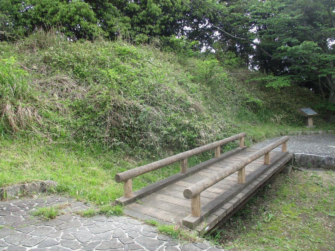
I started climbing the hill from near the bottom when I thought I recognised a residual trench in the bushes. The main bailey is now a small park neighbouring the Taga Service Area. There is a small bridge over a depression which may have been a moat, and beside this a large mound which served as a bulwark.
The castle is named for the once large Tendai temple called Binmanji; it seems the hilltop was used as a fortified redoubt for when the temple came under attack. As for the rest of the temple, it is long since gone. The Meishin Expressway runs to the rear of the castle-mount.
| Castle Profile | |
|---|---|
| English Name | Binmanji Castle |
| Japanese Name | 敏満寺城 |
| Founder | Tendai Sect |
| Year Founded | Medieval Era |
| Castle Type | Hilltop |
| Castle Condition | Ruins only |
| Historical Period | Pre Edo Period |
| Artifacts | Hori, Dorui |
| Features | trenches |
| Visitor Information | |
| Access | Taga-taisha-mae Station on the Taga Line; 10 minute walk |
| Hours | 24/7 free; mountain |
| Time Required | 30 minutes |
| Location | Taga, Shiga Prefecture |
| Coordinates | 35.21938, 136.28291 |
|
|
|
| Admin | |
| Added to Jcastle | 2024 |
| Contributor | ART |
| Admin Year Visited | Viewer Contributed |
| Friends of JCastle | |
| Jōkaku Hōrōki | |
| Oshiro Tabi Nikki | |
| Kojōdan | |
| Shiseki Yawa | |


