Kabuto Castle
Kabutojō is a yamajiro (mountaintop castle) ruin in Kabuto Township, Kameyama Municipality. Kabutojō is a twin bailey complex featuring dorui (earthen ramparts) and a segment of ishigaki (stone-piled retaining wall). The west bailey is situated above the eastern bailey, and both are surrounded by
History
Kabutojō is said to have been constructed in 1367 by Kabuto Morimune, although it's not clear if the fort on the mountainside was built at that time, or just a manor hall. The Kabuto Clan were descendent of the Seki Clan. It is further said that, in the Sengoku period, the seventh Kabuto patriarch renamed the fort from Ushidanijō to Kabutojō, and so perhaps this is an indication that the castle was expanded with solid fortifications at that time.
Takigawa Kazumasu, a general of Oda Nobunaga, invaded Ise Province from 1568, and the Kabuto Clan pledged loyalty to Oda Nobutaka, Nobunaga's son who became the ruler of Ise, in the Aźuchi period. However, in 1583, following the death of Oda Nobunaga, Nobutaka vied for control of the Oda franchise with his brother, Nobukatsu. Initially Nobutaka was allied with Toyotomi Hideyoshi, but after the latter elected Oda Hidenobu as the toddler heir to the helm of Japan, Nobutaka alligned with Shibata Katsuie and Takigawa Kazumasu to oppose this clear power-play by Hideyoshi. However, Katsuie was defeated at Shizuǵatake, and Kazumasu was defeated at Ise-Kameyamajō in the summer of 1583. At this time or soon after, Kabutojō was also attacked and destroyed.
Field Notes
Kabutojō is a yamajiro (mountaintop castle) ruin in Kabuto Township, Kameyama Municipality. Kabutojō is a twin bailey complex featuring dorui (earthen ramparts) and a segment of ishigaki (stone-piled retaining wall).
The west bailey is situated above the eastern bailey, and both are surrounded by dorui. The north-facing dorui appears to have been piled up, whilst the south-facing dorui, which is larger, appears to have been carved from the ridge. The bulbous portion of dorui on the south side between the two baileys is thought to be a yaguradai, a platform for a keep. The bulwark along the ridge to the east is also thought to have been the site of a tower, and was labelled 'higashi-yaguradai' on my map.
The main compounds are entered via the west bailey through a masugata (crank-shape) gate complex. The parapet line continues on beyond the turn for the gate, and this area is said to be a look-out (maybe a 'nishi-yaguradai'). I was sure I would find a trench beneath this dorui because it is set above the ridge, but there was nothing, which surprised me. Indeed, curiously, Kabutojō appears to lack trenches completely, which is quite unusual for a yamajiro.
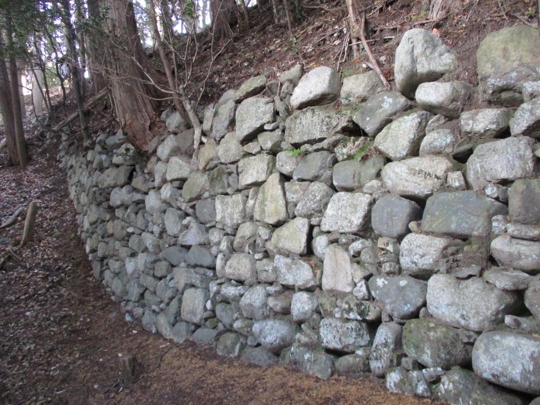
The ishigaki segment can be found beside the masugata on the outside of the west bailey. It was no doubt a substantial undertaking to build such a handsome wall atop of this mount. Another point of interest is the shallow, stone-lined well in the fort's east bailey.
I wondered if Kabutojō, with its positions for towers and stone-lined ramparts, was renovated in the Aźuchi period. The valley below held an important trade route and a fort here would've been necessary for securing supply lines.
Kabutojō is accessed from the hiking trail that starts in the necropolis of Shinpukuji, a temple at the foot of the castle-mount. The cenotaphs for the Kabuto Clan are also found here, and I wondered if this is where the castle's kyokan (residential annex) was. Shinpukuji is right by the railway tracks and accessed via a dedicated crossing; it is a handsome temple with its ishigaki and belfry. The trail to the castle ruins bring one first to a terraced sub-bailey and then to the higashi-yaguradai. Following the southern ramparts along from here brings one to the masugata, and from there the ishigaki segment is below and to the left.
Gallery
| Castle Profile | |
|---|---|
| English Name | Kabuto Castle |
| Japanese Name | 鹿伏兎城 |
| Alternate Names | Ushidanijō (牛谷城) |
| Founder | Kabuto Morimune |
| Year Founded | 1367 |
| Castle Type | Mountaintop |
| Castle Condition | Ruins only |
| Designations | Prefectural Historic Site |
| Historical Period | Pre Edo Period |
| Artifacts | Kuruwa, Dorui, Ishigaki, &c. |
| Features | stone walls |
| Visitor Information | |
| Access | Kabuto Station on the Kansai Main Line; 2 min walk to trailhead |
| Hours | 24/7 free; mountain |
| Time Required | 50 mins |
| Location | Kameyama, Mie Prefecture |
| Coordinates | 34.8441, 136.33734 |
|
|
|
| Admin | |
| Added to Jcastle | 2025 |
| Contributor | ART |
| Admin Year Visited | Viewer Contributed |
| Friends of JCastle | |
| Jōkaku Hōrōki | |
| Umoreta Kojō | |
| Kojōshi Tanbō | |


