Kagohana Fort
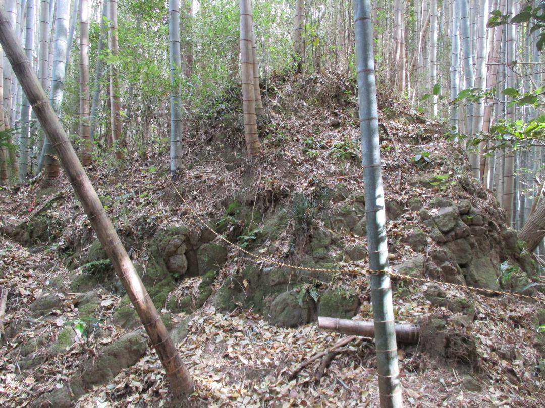
Kagohana-toride is a yamajiro (mountaintop castle) ruin in Aoi Ward, Shizuoka Municipality. The fort is a satellite fortification of Shizuhatayamajō on the mountain above. Ruins include kuruwa (baileys), dorui (earthen ramparts) and a single, large horikiri (trench) bisecting the ridge. Since I desc
History
Kagohana-toride was a satellite fortification of Shizuhatayamajō on one of its lower ridges. It is said that Takeda Shingen encamped here during his invasion of Suruga and attack on Sunpu in 1569. However, he is also said to have encamped at Inomiya, a shrine at lower elevation and further to the south. It seems that Kagohana-toride is confused with this jinsho (fortified encampment site). There would not be room for such an encampment at Kagohana-toride itself, or, for that matter, at Shizuhatayamajō.
Field Notes
Kagohana-toride is a yamajiro (mountaintop castle) ruin in Aoi Ward, Shizuoka Municipality. The fort is a satellite fortification of Shizuhatayamajō on the mountain above. Ruins include kuruwa (baileys), dorui (earthen ramparts) and a single, large horikiri (trench) bisecting the ridge. Since I descended from Shizuhatayama to reach this site, I came first across the upper bailey with its dorui; this area is terribly overgrown with bamboo grass. Next I managed to break through to the horikiri. Above is the main bailey, which one climbs to using a rope, the terrain being very fearsome. This ridge is isolated; once a path ran through here but it is now overgrown, and I think I disturbed an oinker when crashing into the main bailey.
| Castle Profile | |
|---|---|
| English Name | Kagohana Fort |
| Japanese Name | 籠鼻砦 |
| Founder | Imagawa Clan |
| Year Founded | 15th Century |
| Castle Type | Mountaintop |
| Castle Condition | Ruins only |
| Historical Period | Pre Edo Period |
| Artifacts | Horikiri, Kuruwa, &c. |
| Features | trenches |
| Visitor Information | |
| Access | Descend from Shizuhatayamajō; the southwestern ridge from the third bailey. |
| Hours | 24/7 free; mountain |
| Time Required | 20 mins |
| Location | Shizuoka, Shizuoka Prefecture |
| Coordinates | 34.99425, 138.37215 |
|
|
|
| Admin | |
| Added to Jcastle | 2025 |
| Contributor | ART |
| Admin Year Visited | Viewer Contributed |
| Friends of JCastle | |
| Yogo | |


