Katsumata Castle
Katsumatajō is a yamajiro (mountaintop castle) ruin in Katsuta township, Makinohara Municipality. If only every yamajiro was as well-groomed as Katsumatajō then life could be a dream! So, Katsumatajō is my dream yamajiro because with all of the trees cut down we can see clearly the structure of the
History
Katsumatajō was originally built by the Katsumata Clan, an off-short of the neighbouring Yokochi Clan, in the middle 15th century. The concentration of the fort's defences toward the north and east strongly suggest that it was intended to repel the Imagawa Clan. The Katsumata served both the Kamakura (as gokenin) and Muromachi (as hōkōshū, retainers of gokenin) shogunates, but Katsumatajō was destroyed by Imagawa Yoshitada in 1476.
Field Notes
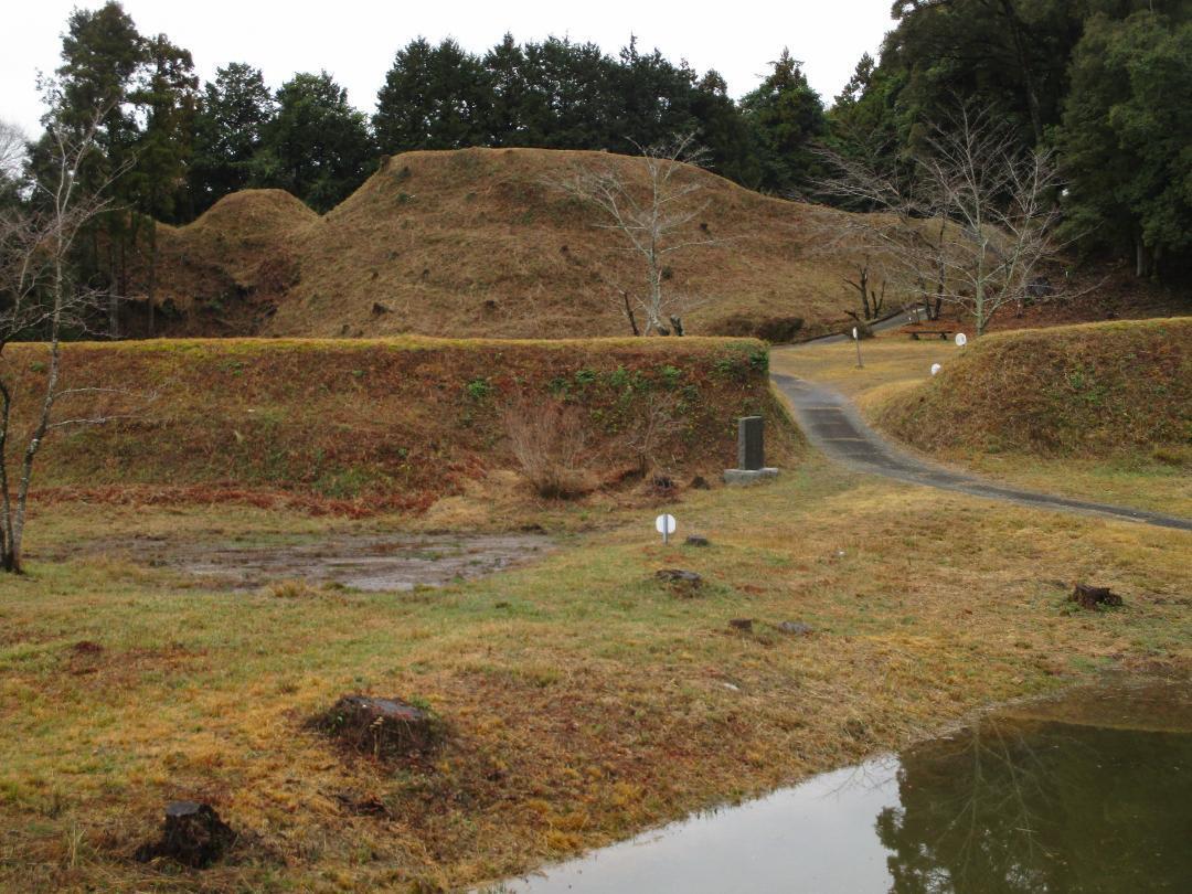
Katsumatajō is a yamajiro (mountaintop castle) ruin in Katsuta township, Makinohara Municipality. If only every yamajiro was as well-groomed as Katsumatajō then life could be a dream! So, Katsumatajō is my dream yamajiro because with all of the trees cut down we can see clearly the structure of the castle, near to how it looked when first constructed, albeit without things like buildings, stockades and watchtowers. Most yamajiro ruins aren't maintained, and it's even rarer to have one preserved without trees (usually cedar plantations) obstructing the view between baileys and features. Katsumatajō also has good signage and engaging features, including horikiri (trenches), dorui (earthen ramparts) and kuruwa (baileys).
Katsumatajō has a ladder-like layout with an additional southerly spur connected to the main bailey. There is a deguruwa (detached bailey), now a field with tea bushes, on the approach to the castle proper. The forest road runs through an umadashi (barbican bailey), but looking to the side remains of trenches can be seen. Thereupon the ruins of the castle loom above, and the layered ramparts can be starkly seen.
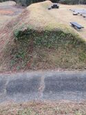
The third bailey sits beneath the second. It is surrounded by dorui along its forward-facing northern side. Below there is a yokobori (lateral moat) with more dorui. A large creek separates it from the outer baileys. To the east there is a ridge protected with dual horikiri. To have not only the bailey space cleared but also the dorui and horikiri is a rare treat. Due to rainfall a pond had formed in this bailey.
The second bailey's stolid ramparts are directly adjacent and above the third bailey. The second bailey is also protected by dorui in the north, east and northwest. The foundations of buildings unearthed during archaeological excavations are delineated in the second bailey. The castle's eastern bailey structure can be clearly seen from the second bailey below it. Between the main bailey and second bailey is a horikiri and dorui. The main bailey complex is terraced with dorui at the top, rear bailey. Here there is also a small shrine and a stele to mark the castle site. To the rear of the main bailey is the south bailey, which has dorui and horikiri to its rear. The mountainside ridge at the back of the castle is forested, and there is a roped off, dubious walkway leading away from the ruins. Along the ridge here is evidence of tatebori (climbing moats).
Finally, perhaps the most attractive area of Katsumatajō is the east bailey complex (it is southeast in relation to the main bailey). The ridge to the east of the east bailey is divided by embankments and five horikiri in a row; these looked to me like the humps of a great convoy of dromedaries. The southeastern ridge eventually leads to the shaded monomi-kuruwa (watchtower bailey) which is a hidden corner of the castle ruins. There are great views from the east bailey, and I saw Mount Fuji appear between bands of clouds.
| Castle Profile | |
|---|---|
| English Name | Katsumata Castle |
| Japanese Name | 勝間田城 |
| Founder | Katsumatajō |
| Year Founded | Mid' 15th Century |
| Castle Type | Mountaintop |
| Castle Condition | Ruins only |
| Designations | Prefectural Historic Site |
| Historical Period | Pre Edo Period |
| Artifacts | Dorui, Kuruwa, Horikiri, &c. |
| Features | trenches |
| Visitor Information | |
| Access | Nearest stations are Kanaya Station on the Tōkaidō Main Line, and Shin-Kanaya on the Ôigawa Main Line |
| Hours | 24/7 free; mountain |
| Time Required | 120 minutes |
| URL | Castle Website |
| Location | Makinohara, Shizuoka Prefecture |
| Coordinates | 34.7784, 138.15759 |
|
|
|
| Admin | |
| Added to Jcastle | 2024 |
| Contributor | ART |
| Admin Year Visited | Viewer Contributed |
| Friends of JCastle | |
| Jōkaku Hōrōki | |
| Kojōdan | |
| Yogo | |


