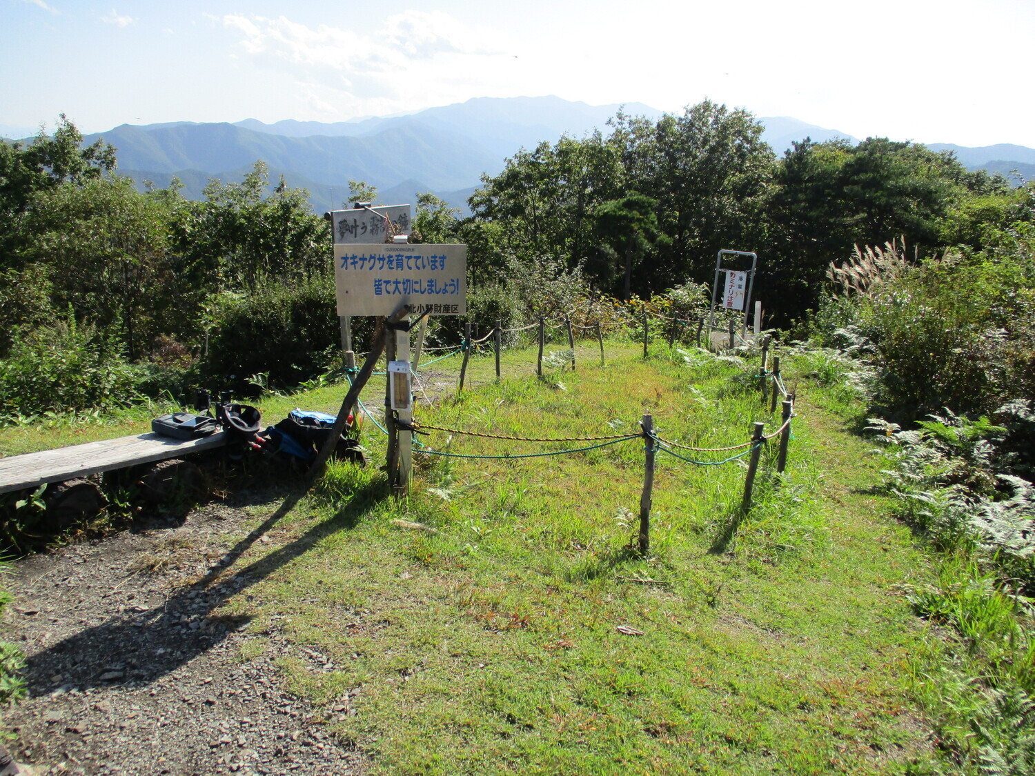
Kiridouzan Noroshidai
From the Yamanokami Nature Park the peak of Kiridōzan takes about an hour and a half to climb to. I ascended after having already come back down from the site of Himejō. The trail is easy to follow. It has many switchbacks. Near the top of the trail is a very steep section where the path splits into
History
According to the "Report on the Distribution of Medieval Castle Ruins in Nagano Prefecture" edited by the Nagano Prefectural Board of Education, there was a beacon tower on this mountain during the Warring States period.
Field Notes
From the Yamanokami Nature Park the peak of Kiridōzan takes about an hour and a half to climb to. I ascended after having already come back down from the site of Himejō. The trail is easy to follow. It has many switchbacks. Near the top of the trail is a very steep section where the path splits into two. The steeper slope is called "man's slope" and the gentler, weaving path is called "woman's slope". Well, I may be comfortably masculine enough to order a barcadi mohito from a pretty barmaid, but I wasn't going to let the mountain emasculate me, and so I took the man's slope at a gambol.
The view from the top is stunning. There used to be a fortified signal tower on this peak. There was a fellow up there doing something with radios; he seemed like an amateur enthusiast. I suppose there are lots of reasons to climb mountains. Here I made a start on my provisions, which consisted of bacon-flavoured poppiri.
| Castle Profile | |
|---|---|
| English Name | Kiridouzan Noroshidai |
| Japanese Name | 霧訪山狼煙台 |
| Alternate Names | 霧訪山烽火台 |
| Founder | |
| Year Founded | |
| Castle Type | Mountaintop |
| Castle Condition | Ruins only |
| Historical Period | Pre Edo Period |
| Features | |
| Visitor Information | |
| Access | The trail from Yamanokami Nature Park takes 90 to 120 mins; the trail from Kita-Ono takes about 80 mins up. Ono Station on the Chūō East Line is the nearest station to a trail head.. |
| Hours | 24/7 free; mountain |
| Time Required | 10 minutes |
| Location | Shiojiri, Nagano Prefecture |
| Coordinates | 36.06395, 137.95107 |
|
|
|
| Admin | |
| Added to Jcastle | 2021 |
| Contributor | ART |
| Admin Year Visited | Viewer Contributed |


