Kurumayama Castle (Hanishina)
Kurumayamajō, a small mysterious yamajiro (mountaintop castle) ruin, is a fort without a name. Consequentially, it could have many names. Located in the mountains above Ômuro village in Matsushiro Township, Nagano Municipality, the site is sometimes conflated with - and probably related to - nearby
History
My assumption was that the yamajiro site was a satellite fortification of Kurumajō (itself also a yamajiro, though an unorthodox one). However, it's also possible the sites were constructed and maintained at different times. It's just my conjecture, but since Kurumajō is in a realtive blindspot below the peak, I believe the yamajiro above was used as a look-out or 'bansho (guardpost)' for the fort below. See Kurumajō for more information.
Field Notes
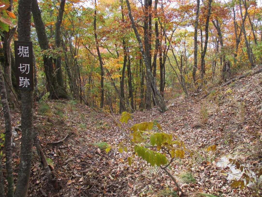
Kurumayamajō, a small mysterious yamajiro (mountaintop castle) ruin, is a fort without a name. Consequentially, it could have many names. Located in the mountains above Ômuro village in Matsushiro Township, Nagano Municipality, the site is sometimes conflated with - and probably related to - nearby Kurumajō. Kurumayamajō is located on the peak above Kurumajō, which is a fort site hollowed out between ridges, and the layout consists of a single bailey complex with a solid rear trench. There may be some terracing along the steep ridge which swings down to Kurumajō. The sign in the bailey simply reads 'the Ruins of a Mountaintop Castle'.
'Yamajiro':
Starting near the agricultural university, to reach Kurumayamajō was steep and effortous but maybe quicker than ascending from the Ômuro kofun complex. My goal was to reach Kurumajō, and I came upon this (presumed) satellite fortification without knowing priorly about its existence! Simply sign-posted as 'Yamajiro Ruins', it's a bit of a mystery. Now, in contrast, Kurumajō is not itself sign-posted. There appears to be some conflation between the 'Yamajiro' site and Kurumajō which sits lower down the mountain between converging ridges.
Around 2020, 'Yamajiro' was labelled as 'Kurumajō' on the trekking course map, but the map I saw, which seemed like it could've been recently printed, did not call the peak 'Kurumajō', but simply 'Yamajiro' instead. There seems to be confusion or contention about the location of Kurumajō. I took to calling the peak site 'Kurumayamajō' on the assumption it was a sort of redoubt for the larger fort below. Or should we tautologically call it 'Yamajirojō'? Or simply 'Yamajō'? I think it would be logical to refer to it as the 'bansho (guardpost)' of Kurumajō, keeping watch from the peak. Has nobody else considered this? Going about naming castle sites, I have become impertinent.
Note: I can find no official name for this site. Since we need to call this site something, I've impertinently decided to give primacy to 'Kurumayamajō ('Kuruma' + 'Yamajiro')', so as to show its presumed relation to and conflation with Kurumajō.
| Castle Profile | |
|---|---|
| English Name | Kurumayama Castle (Hanishina) |
| Japanese Name | 埴科車山城 |
| Alternate Names | 車出城・山城城・山城・車城番所 |
| Founder | Tōjō Clan |
| Year Founded | Sengoku Period |
| Castle Type | Mountaintop |
| Castle Condition | Ruins only |
| Historical Period | Pre Edo Period |
| Artifacts | Horikiri, Kuruwa, &c. |
| Features | trenches |
| Visitor Information | |
| Access | Hike from Ômuro Tumuli Complex, Kasumijō, or any point on the Kimyōsan Trekking Course |
| Hours | 24/7 free; mountain |
| Time Required | 30 minutes |
| Location | Nagano, Nagano Prefecture |
| Coordinates | 36.58752, 138.22898 |
|
|
|
| Admin | |
| Added to Jcastle | 2023 |
| Contributor | ART |
| Admin Year Visited | Viewer Contributed |


