Majino Castle (Kai)
Majinojō, also referred to as Majino-toride, is a yamajiro (mountaintop castle) ruin in Nanbu Township, historical Koma County. The fort ruins sit above the hamlet of Majino in the township's Fukushi area. This local site admirably has a dedicated parking spot or two at the start of the short trail
History
Majinojō was constructed in the mid' 16th century. The South Koma County Journal states that Majinojō was used as a noroshidai (beacon fort) by the Takeda; the garrison commander was Hara Torakichi, an ashigaru commander in the Takeda army, and the castellan was Majino Yūdayū, but this personage is generally unknown. Per local folkore, the castle was occupied by Mochiźuki Yasubē; this would've been after 1543 which is when the Mochiźuki submitted to and became vassals of Takeda Shingen.
The fort is clearly of a larger scale than a simple noroshidai, and the physical remains suggest a construction - or reconstruction - date in the late Sengoku period. The fort's ruins may date to 1582 and the invasion by Tokugawa forces of Kai Province. Tokugawa Ieyasu ordered Okabe Masatsuna to construct Suganumajō to the north, and so it is thought that Tokugawa forces may have also rebuilt Majinojō at that time. Typically unejōtatebori is not a feature associated with Takeda-built fortresses.
Field Notes
Majinojō, also referred to as Majino-toride, is a yamajiro (mountaintop castle) ruin in Nanbu Township, historical Koma County. The fort ruins sit above the hamlet of Majino in the township's Fukushi area. This local site admirably has a dedicated parking spot or two at the start of the short trail which winds up to the castle ruins.
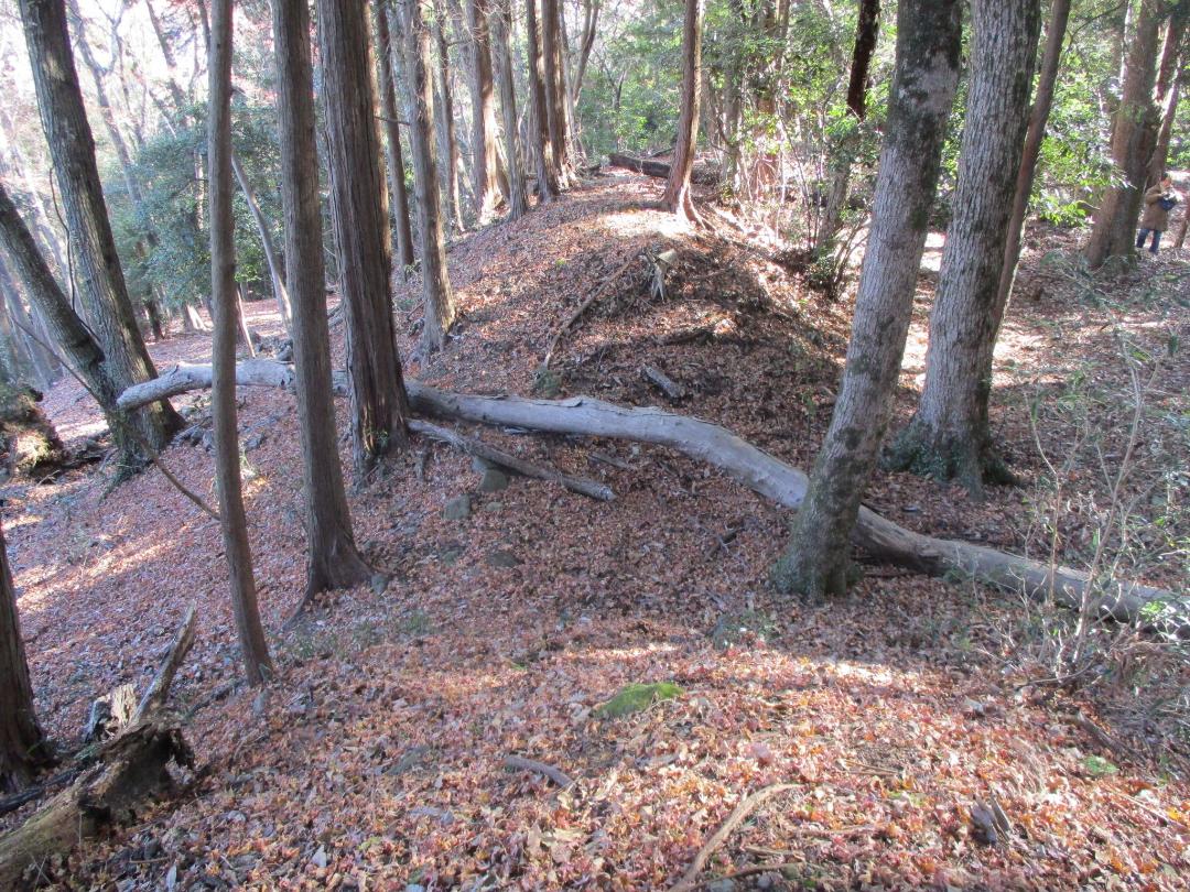
Majinojō is a principally earthworks fort with features typical of yamajiro such as kuruwa (baileys), dorui (earthen ramparts) and trenches. It is built to a sizable scale, with tall and thick ramparts, multiple baileys, and several gate complexes.
The layout of the fort is concentric with a dominant main bailey on the hilltop, surrounded by impressive dorui. The hillside is terraced below into sub-baileys. To the east is a projecting bailey with a dobashi (earthen bridge) and karabori (dry moat) complex. To the north is a tatebori (climbing moat) and nobori-dorui (climbing earthen ramparts) carved from a ridge spur. The approach to the fort is alongside a little southward, and it seems this is where the fort's kyokan (residential annex) used to be, and this area is terraced today but it's since been cultivated and is now a cedar plantation.
To the south the fort has three layers of terraced baileys, with some castle-bloggers indicating masonry remains in the corner of the second bailey - facing the third. However, I think this may be natural rock. But I made my own discovery: just below here is what appears to be a tatebori, and this wasn't shown on the map I was using (by Yogo-sensei).
Majinojō has a prominent southern spur, and this is where can be found it's most unique feature. A ten-deep row of undulating berms and trenches. Usually unejōtatebori (climbing trench array) complexes cover the mountainside, but at Majinojō one rises onto the ridge and creates a formidable array of lateral trenches. These ten rows of lateral trenches gradually rise, so defenders could presumably fire over their companions from them. This innovative configuration of trenches and ramparts is not seen anywhere else quite like this, and is very special, which may be in part why Majinojō is a prefectural-level designated historical site.
| Castle Profile | |
|---|---|
| English Name | Majino Castle (Kai) |
| Japanese Name | 甲斐真篠城 |
| Alternate Names | Majino-toride (真篠砦) |
| Founder | Majino Yūdayū; Tokugawa Ieyasu |
| Year Founded | Mid' 16th Century; 1582 |
| Castle Type | Mountaintop |
| Castle Condition | Ruins only |
| Designations | Prefectural Historic Site |
| Historical Period | Pre Edo Period |
| Artifacts | Dorui, Dobashi, Karabori, &c. |
| Features | trenches, stone walls |
| Visitor Information | |
| Access | Ide Station on the Minobu Line; 40 minute walk; or, 5 min by car from Tomizawa IC. |
| Hours | 24/7 free; mountain |
| Time Required | 60 minutes |
| Location | Nanbu, Yamanashi Prefecture |
| Coordinates | 35.25696, 138.47196 |
|
|
|
| Admin | |
| Added to Jcastle | 2025 |
| Contributor | ART |
| Admin Year Visited | Viewer Contributed |
| Friends of JCastle | |
| Jōkaku Hōrōki | |
| Umoreta Kojō | |
| Yogo | |


