Noji Castle
Nojijō is a hirajiro (flatland castle) - sub-type mizujiro (water castle) - ruin in Mikkabi Township of Hamana Ward, Hamamatsu Municipality. Ruins include moats and berms, but there is little left, and the site is now a shrine and orchards. The main bailey area is now a local park, and there is a
History
Nojijō was built in 1583 by Honda Nobutoshi on the orders of Tokugawa Ieyasu. The reason is unclear why, since Honda Nobutoshi was already stationed not far to the south at Sakujō, and so a new castle just to the north seems redundant. Likely, Sakujō, a hilltop fort, had little room for expansion, and a larger base was desired, closer to trade routes and with more level areas for the fort or a surrounding town to expand into. The fort was quite large, measuring about 400m east-west and 200m north-south. Nojijō was used to station Tokugawa Ieyasu's forces en route across Tôtōmi Province. Uemura Shōwemon served as garrison commander.
Nojijō was occupied up until 1680. The reason for this is that it was used by the shogun's retinue for use en route between Kyōto and Edo / Sunpu. Castellans were hatamoto (bannerman), including the Ichino, Hikosaka and Yonekura clansmen. In 1626 it was converted into an ochaya, a sort of fortified lodging house, where Tokugawa Iemitsu stayed. In 1680 the shogunate decommissioned its network of ochaya and goten, and Nojijō was abandoned. Some buildings were relocated for use in the Arai-seki, a checkpoint along Lake Hamana to the south, and the site was put to plough thereafter.
Field Notes
Nojijō is a hirajiro (flatland castle) - sub-type mizujiro (water castle) - ruin in Mikkabi Township of Hamana Ward, Hamamatsu Municipality. Ruins include moats and berms, but there is little left, and the site is now a shrine and orchards.
The main bailey area is now a local park, and there is a raised plot overlooking the lakeshore where a shrine used to stand. There is a large mound with an altar on which could've served as some sort of platform. To the rear of this mound is what looks like a moat site, or pass, from which the piled earth was excavated, or so I fancied.
Most of the moats at this site, of which several segments remain, are horrendously overgrown, but a relatively clear stretch of karabori (dry moat) can be seen in a field just to the east of the park. The remnants of other dry moats cut into the fields here and there, but are mostly choked with vegetation. Particularly in the south there appears to be the remains of a ringing moat system. The second bailey moat is partially visible, having been cleared of overgrowth.
The Hamana Lake Cycle Road wraps around the western half of the site. In the eastern half of the site there is a large berm with a long pond bent at a clean angle beneath it. I estimate the length of the long portion of this pond to be about 40-50m. It really looks like a mizubori (water moat), perhaps some remnant of a larger moat system which cut the small peninsula on which the castle sits off from the mainland. It wasn't depicted on the map I was using, but would correspond to the outermost moat around the third bailey, the southern portion of which remains as a karabori.
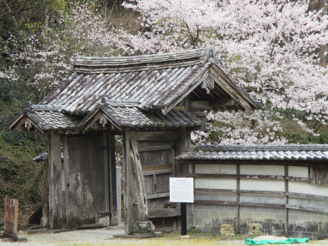
At a nearby temple, Makayaji, my castle senses tingled when I saw the temple's sanmon (main gate), which looked like a castle gate. I checked and it turned out to be a relocated gate from Nojijō. Of course, I should've researched that beforehand instead of relying on any sixth sense, but it was a happy discovery.
Gallery
| Castle Profile | |
|---|---|
| English Name | Noji Castle |
| Japanese Name | 野地城 |
| Alternate Names | Noji-ochaya |
| Founder | 1583 |
| Year Founded | Nobutoshi |
| Castle Type | Flatland |
| Castle Condition | No main keep but other buildings |
| Historical Period | Edo Period |
| Artifacts | Karabori, Mizubori, &c. |
| Features | water moats, trenches |
| Visitor Information | |
| Access | Tsuźuki Station on the Tenryū-Hamanako Line; 10 min walk. |
| Hours | 24/7 free; park |
| Time Required | 20 minutes |
| Location | Hamamatsu, Shizuoka Prefecture |
| Coordinates | 34.79234, 137.56942 |
|
|
|
| Admin | |
| Added to Jcastle | 2025 |
| Contributor | ART |
| Admin Year Visited | Viewer Contributed |
| Friends of JCastle | |
| Jōkaku Hōrōki | |
| Shiseki no Yawa | |
| Umoreta Kojō | |
| Jōseki Meguri Bibōroku | |
| Jōkaku Shashin Kiroku | |
| Yogo | |


