Tashiro Castle (Nukata)
Tashirojō is a low-lying yamajiro (mountaintop castle) ruin in Shimoyama-Tashiro Township, Toyota Municipality. There are several sites called 'Tashirojō' in Mikawa Province; this one is in the historical Nukata County (this part of Nukata County was transferred to Kamo County / Toyota Municipality
History
Tashirojō was built before the mid' 16th century, though it is not known when exactly. In 1551, this Matsudaira Clan stronghold under Matsudaira Michihisa was attacked by 3,000 knights under Imagawa Yoshimoto, but held. However, the following year, faced with a fresh assault by another 2,500 mounted warriors and other forces, the Matsudaira surrendered Tashirojō. Following the weakening of the Imagawa due to their loss at Okehazama, 2,000 knights under Matsudaira Motoyasu (Tokugawa Ieyasu) re-took Tashirojō in 1560. In the early 1570s the fort was attacked and destroyed by Kai-Takeda forces under Takeda Katsuyori.
Field Notes
Tashirojō is a low-lying yamajiro (mountaintop castle) ruin in Shimoyama-Tashiro Township, Toyota Municipality. There are several sites called 'Tashirojō' in Mikawa Province; this one is in the historical Nukata County (this part of Nukata County was transferred to Kamo County / Toyota Municipality in 1878), therefore it is also distinguished as Nukata-Tashirojō after the county, or Shimoyama-Tashirojō after the old township / area.
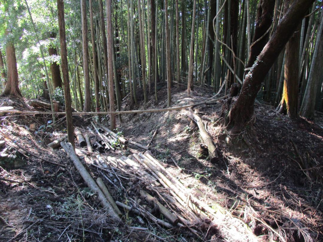
The fortification ruins here consist of karabori / horikiri (dry moats / trenches), dorui (earthen ramparts) and baileys. There are two impressive trenches to the rear of a main bailey. A tall, thick segment of dorui rises to the rear of the main bailey, and there is dorui heaped in the middle of the double trench system too. The main bailey appears divided by a slight terrace; old masonry is apparent in some places. Toward the tip of the hill the ridge suddenly drops down cliff-like, which probably indicates some form of forward bulwark.
This small site has quite impressive earthworks. The tall embankments and deep trenches I was particularly happy with because this site is not easy to get to. The ruins can be found on a low mountain tip overlooking the valley, but there is no obvious path, and I was forced to stand on and flatten tall grasses, and alternatively crawl on my knees under said long grass, to progress. There used to be a well maintained path up to the castle ruins, signposts and even an explanatory board with a map! That was, judging by pictures on old castle blogs, over twenty years ago. Now this site is completely overgrown, and the old concrete path is fractured and subsiding, so beware.
| Castle Profile | |
|---|---|
| English Name | Tashiro Castle (Nukata) |
| Japanese Name | 額田田代城 |
| Alternate Names | 下山田代城 (Shimoyama-Tashirojō) |
| Founder | Matsudaira Michihisa |
| Year Founded | 16th Century |
| Castle Type | Mountaintop |
| Castle Condition | Ruins only |
| Historical Period | Pre Edo Period |
| Artifacts | Dorui, Horikiri, Kuruwa |
| Features | trenches |
| Visitor Information | |
| Access | National Route 301; old trail from south of mount |
| Hours | 24/7 free; mountain |
| Time Required | 20 mins |
| Location | Toyota, Aichi Prefecture |
| Coordinates | 35.03341, 137.31246 |
|
|
|
| Admin | |
| Added to Jcastle | 2025 |
| Contributor | ART |
| Admin Year Visited | Viewer Contributed |
| Friends of JCastle | |
| Jōkaku Hōrōki | |
| Kojōdan | |
| Jōshi Meguri Bibōroku | |
| Jōkaku Shashin Kiroku | |
| Oshiro Tabi Nikki | |


