ART Autumn Update Part 2
This is the second of a multi part series updating ART's recent contributions to Jcastle.info If you haven't seen ART's Facebook Japanese Castle Group yet I highly encourage you to do so. There are contributions from a variety of members, discussio
ART Autumn Update Part 2
2023/10/22
This is the second of a multi part series updating ART's recent contributions to Jcastle.info
If you haven't seen ART's Facebook Japanese Castle Group yet I highly encourage you to do so. There are contributions from a variety of members, discussion and news about castle developments and discoveries.
I'm still working on lots more updates myself. As always, follow me on Instagram or Facebook (links in the footer) for the latest updates.
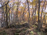
Nakajou Yakata (Chikuma) / 筑摩中城館
Nakajouikenotaira Fort / 中城池之平砦
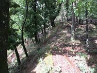
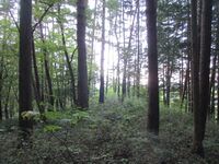
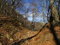
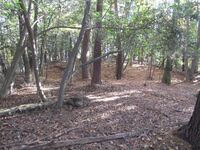
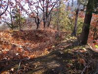
I believe I may have been the first person to present an introduction to this site on all the internet (including Japanese sources) since I could find no information besides the site’s name and location being listed (this was in 2022 but I don't think anything's come out since). It seems few have actually been here. If there is no information about a site and no ruins at it, then generally it’s not worth introducing, but I believe Nakajōikenodaira-toride has earthworks in evidence which indicate some medieval fortification. I confirmed the location on a map of historical sites put out by the municipality.
Sometimes one doesn’t know what is at a site unless one goes oneself. There is indication that the ridgetop site of Nakajōikenodaira-toride has been levelled in places with enclosures both on the ridge and terraced beneath in the southeast. In the northwest the slopes of the mountain appear to have been carved to make them steeper and more formidable (a feature called kirigishi). An old trail winds its way up the mountain in parts and the earth is banked up on either side, creating an undulating terrain just below the fort site. It’s not clear to me when this mountain pathway was dug out, but it may have been used as the main approach to the fort (a feature called ôte). There was some slight semblance of dorui (earthen ramparts) above the kirigishi in what I took for the fort’s main bailey space.
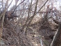
The history of this site is unknown. I felt sure that ‘something’ had been here, even if its exact nature was unclear. After the main fort site, the ridge climbed gradually and there was some terracing, so that the upper ridge may have been fortified, to my mind, as well. Eventually the ridge bulges toward a portion where it shoots up steeply, and so this is likely the end of any possible site of fortifications. Notably at this final juncture where a modern trail runs, I noted what looked like a trench cutting and embankment beneath a projecting part of the ridge which looked like it could’ve formed a small bulwark. And so I have presented my impressions of the site.Nakamura Castle (Azumi) / 安曇中村城
Nakanojin Castle / 中ノ陣城
Nakanojinjō, meaning ‘Middle Camp Castle’, itself consists of earthworks and masonry. The layout is of a central bailey complex with some sub-baileys below. There is a large horikiri (trench) sunk into the ridge at the rear of the main bailey with tall dorui (earthen ramparts). To the prow and aft of the main bailey ishigaki (stone-piled ramparts) remains can be seen. A spur of terraced mini-baileys goes down the ridge south, but another spur goes to another fort site in the southwest.
See also Akiyoshi Fort and Utsutsu Castle. For the southwest ridge site see Kokuzousannanseioneno Castle (Aida).Nakayama Castle (Suwa) / 諏訪中山城
Nishinahon Castle / 仁科本城
Ogawara Yakata / 小河原館

Oh'iwa Castle / 大岩城
The layout of Ôiwajō is like some kind of centipede with long antennae. It is anti-symmetrical. To see most of the castle without going back and forth (which is up and down), attack from the northeast, as I did. Coming from this direction one comes to a lower detached bailey. Then there is a climb up a fierce, rocky ridge. One will see a mound along the ridge after the pinnacle rocks. This mound is a bōrui, a defensive bulwark of mounded earth. A tree grows on it now. The castle ruins begin in earnest from here. There is a trench ruin and, after another steep segment, terraced baileys. Here the castle splits in two as the northwestern spur was also fortified, though there is much less to see there so I didn’t go because I didn’t want to re-climb half the mountain again.
Going south from the fork one comes to the integral baileys of Ôiwajō. Three large baileys are divided by horikiri (trenches). The middle bailey has a sub-bailey running beneath to the west. To the rear many stones are laying about, and it seems clear that they were originally piled to clad ramparts; these blocks have helped the rear of the middle bailey retain a sharp shape like, but have mostly collapsed now and are scattered about.
After the rear bailey is a huge trench as deep as a house is tall. There are some more trench complexes along the ridge thereafter and then the mountain rises sharply (and cruelly) on its way to the ruins of Amabikijō. There are some ruins on the western slope of the castle mount too but I didn’t check them out because ‘Iki wa yoi-yoi; Kaeri wa kowai’ – that’s why (but I ended up being very short on time so it’s well that I skipped them anyway).
By the way, this site’s narrow ridges were also in part sculpted, in places exposing bedrock. This feature is called ‘ikkigake (一騎駈け)’, or ‘the single knight canter’, because the narrow paths with steep drops on each side force attackers to proceed single file. A defending force can then deal with enemies a man at a time, neutralising any advantage that a larger force may’ve enjoyed.Ohsaki Castle / 大崎城
Ohsakide Castle / 大崎出城
Okkoto Jinjou / 乙事陣場
- The boar god Okkotonushi in Miyazaki Hayao’s Mononoke-hime appears to be named for this locale; Miyazaki drew a bird’s eye style map of the area, which has many ancient Jōmon sites, and so it seems he was familiar with it.
Reishouzan Castle / 齢松山城
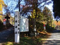
Rokugawa Jin'ya / 六川陣屋
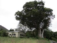
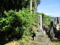
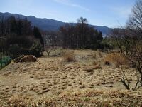
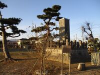
There is a shrine on the site and an information board about the jin’ya. The signs says that ruins include the shrine, water channels and stone walls. I looked about but it seems by ‘stone walls’ what was meant were the old stone blocks lining some of the irrigation ditches in the neighbourhood. The shrine sits on a stone base but this is modern. The shrine is probably the most interesting feature then. I had some time before my train back to Nagano came so I went about the neighbourhood which covers the former footprint of the jin’ya. It is mostly homes and orchards now.
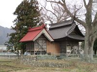
The lead picture shows a satsuban, or a board for displaying rules of the domain. This one may have been restored.Sano Castle (Azumi) / 安曇佐野城
In order to reach Sanojō I cycled up a forest road with many hairpins near the Sanozaka Ski Slope. Before that road turns across a gorge there is an even more dubious track going off to the north. I followed this path, now overgrown and unusable due to trees, and met at a bend with the ridge which would take me to the yamajiro site.
There was no trail and the going was steep. It had rained that morning too, and so there were slippy sections. I crawled up that mountain and later I slid back down! Skinny trees with flexible branches were a pain, as they tried to gouge my eyes when I approached, and whip me viciously as I went by, lashing at my lips and flicking my earlobes. I kept close to the earth to avoid falling down or over the ridge. Coming down I just slid, getting very dirty, and karate blocked the whipping trees.
Visiting Sanojō itself was very rewarding and interesting. The climb had made me work for it, but the nawabari (layout) also proved very fascinating, and there were some impressive ruins in the form of earthworks. The castle precincts span a section of the ridge which climbs for about 200m. There is a lower section which is very small but contains terraces on either side of a moat trace, though these earthworks are by now very deformed and only a maniac would suspect them. Climbing from the abandoned forestry road to these outer ruins was not easy and was at least a half hour slog.
A determined soul is rewarded when the castle ruins proper come into view. The ridge is carved with earthworks to create fortifiable spaces. There is a double trench complex at the start of the castle proper. Embankments and trenches create a wavy, undulating terrain. The double lower trench is followed by a middle trench and upper trench which protect terraced baileys. Between the lower trenches and middle trench is a confusing array of small terraced mini-baileys.
The fort's main bailey area is found between the middle and upper trench. This area is very interesting and I don't recall seeing its like before. The largest bailey, which I took for the main bailey, is to the right (going up), and there is a second bailey cluster (terraced), running parallel to it with a terraced depressed area in between. This twin bailey running parallel to the main bailey is novel. What was the sunken area used for? Indeed, the purpose of the fort in its entirety may only be speculated at.
I clambered up the second twin bailey and then up along the upper trench. The upper trench is the deepest, most impressive trench at this site. It turns out, however, that there are several upper trenches. Since Sanojō is built along the ridge rather than at a mountain peak, its defenders were concerned with rear defence especially, but it's amazing to imagine any signifcant force coming from the top of the mountain when the fort itself was already so high up. And the ridge which continues ever higher is even steeper and more unforgiving than that which drops below. But, of course, there being yet more fortification remains up here, I just had to keep on climbing.
I made it to the middle of the upper trenches, indicated by blogger and Shinshū yamajiro legend Ranmaru. I had come via the side a little and so I could already see, however, that there was yet another trench above this. So I climbed even more. Finally I made it to the upper of the upper trenches. This trench is the highest up but also the shallowest. Nonetheless, I was very happy to have made it to this highest goal. Sometimes one does not appreciate, however, how steep and dangerous a section of ridge is until one must go back down...
To make it to this furthest part of Sanojō is challenging and not without risk. I slid back down a game trail through a beast-sized tunnel hollowed out between the small trees. Only then did I enter the main bailey from behind via the (lowest) upper trench. The earth used to dig the horikiri is heaped up into a solid dorui (earthen rampart) segment at the rear of the main bailey. The views from here would've been amazing if not for all the trees!Sendatsu Castle / 先達城
Shinano Kawada Yakata / 信濃川田館
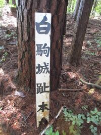
Shirokoma Castle / 白駒城
Shironomine Castle (Azumi) / 安曇城の峰城
Shironominejō seems to have been a single bailey complex but with the distinction of the spacious main bailey being split by a yokobori (lateral trench). Beneath the main bailey where I ascended there was a horikiri (trench), though it wasn’t very deep. The part of the main bailey which overlooks the plain is quite well formed, and one can see where dorui (earthen ramparts) were banked up and the slope was carved. This dying ghost of dorui is the clearest impression besides the trenches of a castle site, but admittedly it’s little to go off.
I proceeded down along another ridge spur but found no ruins. Eventually I dropped off the mountain to get back to the forestry road and my (rented) e-bike (that bicycle has a powerful battery and I realised it would get me into the mountainous interior of Ikusaka via Ômachi more handily than my own bicycle, so I might go on more rent-a-cycle adventures from Ômachi in the future). I’ll have to draw a map to show what I’ve found since I can’t find any existing one. My drawing skills are so poor but it’s least I can do...Soudai Castle / 霜台城
Soudaide Castle / 霜台出城
Suda Yakata / 須田館

Suwa Ohhouri Yakata / 諏訪大祝館
Suwa Yakata / 諏訪館
Suzumegamori Noroshidai / 雀ヶ森狼煙台
Takahara Castle (Shinano) / 信濃高原城
Takaino Jin'ya / 高井野陣屋
Takanashi Yakata (Suzaka) / 高梨館(須坂市)
Takeba Castle / 竹場城

Takebajō was not my original destination on the day I visited. I went to Nagano with the plan of renting a bicycle and cycling out to some yamajiro (mountaintop castles) which had caught my interest. It turns out that it's pretty difficult to rent a bicycle in Nagano; I knew I could rent a decent 'e-bike' in Suzaka, but I thought it'd save time to get one in Nagano and go from there directly. Two places are listed as offering rental bicycles in Nagano, but both of these places were closed when I visited. I checked two bicycle repair shops but they didn't rent. At 11am I called it quits and began making my way back to Matsumoto. I had already been to most major sites in Chikuhoku Municipality, but there was one site near Sakakita Station which I hadn't yet been to yet, Takebajō.
Despite it being quite close to the station as the crow flies, Takebajō is difficult to get to. Not being a crow, I had intended to simply go to the foot of the mountain closest to the station and climb the naked ridge from there. But I could see from topographic maps that this was very steep, almost 'mushroom-like', and there were no reports of trails there. Most castle explorers, it seemed, went from a temple to the west, but this was a bit far for me to walk to. Instead I came up with my own route by closely inspecting maps (on 'Yamap' app').
There is a housing estate called Mukōhara opposite the station. The relative height of Takebajō is about 150m, but by going via this housing area, which sits on flattened land overlooking the valley, I could half the relative height I had to climb on the mountain itself. Between the castle mount and the housing area there are deep ravines, so first I had to go south. It was a circuitous route but not too steep. I accessed a ridge near a cemetery, and, though there was no trail, it wasn't a steep climb. Having not anticipated coming here I had my bag with me and wanted to avoid steep climbs (the day before had also been intense). After some climbing from the south I came to a lovely trail along the top ridge. From there it was a pleasant saunter, practically, to reach Takebajō. The only steep section along that trail is the depression between Takebajō, sitting on its mushroom, and the rest of the mountain. Along the way one can see some nice rock formations; the rocks emerge from white, sandy soil with pine trees growing, and I had observed similar scenery at other mountains in the area.
As for Takebajō itself, it is small and not an overly developed fort, and so really only of interest to yamajiro fanatics. I entered the castle area from the south where there is a southern spur with a horikiri (trench) before the southern bailey. The main bailey, which is not large, rises from there. Another horikiri is found in the northwest beneath the main bailey. From the northeast there is a large spur of the castle. Along this ridge are two horikiri cradling a sunken bailey. Rising above this, though not as high as the main bailey, is an outer bailey. According to the blogs I was following (Ranmaru, Yogo), there used to be somekind of antenna here, but I just found a clear space. In fact, the earth was much flatter here than in other parts of the ruin, indicating its modern use. A spur of fortification ruins continue to the north from this outer bailey, including another horikiri.
I think there may be more detached baileys at this castle. Various bloggers and commentors mention possible earthworks in different parts of the mountain. I descended by the most northerly ridge, and along here was what looked like some terracing and a possible bailey circle divided by a trench mirroring a natural creek. It seems castle maniac Takeshita Hanbē, who leaves reviews of obscure sites on Google Maps, may have also come here as he references 'earthwork-like features' along the way, and it seems he came up via this northern ridge, mentioning a shrine he passed. When I got down I found this shrine. He was pretty crazy coming up that way, as it was very steep, as attested by my lightning descent; catching myself falling with various trees, I call that 'falling with style'. Naturally my thanks goes to the bloggers mentioned here that came before me. I will add to this legacy, I suppose, by recommending the southern route as the gentlest one for accessing the ruins of Takebajō.Takeno Castle / 竹の城
There is a trail up to Takenojō from the northwest, and I started claiming here and got about a quarter of the way up. I guess it would’ve been fine to continue, but, since I was on a rented e-bike I decided I may as well cycle instead up the forest road which goes to a pass between the mountains linking Takenojō and Inōejō. The climb doesn’t take as long and the relative elevation is only about 20m to the start of the castle ruins from forest road. But I wanted to mostly come this way because the castle is orientated that way - south, so climbing from the north goes to its rear; it’s always best to start at the bottom of a castle rather than the top, I believe. It’s fine to go either way but going from the south is the lazier way, and it’s easier to appreciate the scale of the castle.
Takenojō is like a giant staircase, and its layout is fairly unique. There are three large trenches in the lower part of the site. These are fairly deep and stretch across the wide ridge, retaining good form. Three well-built trenches one after the other like this leaves its impression. And then there is another triple set in the form of baileys, the lower two terraced, at the top of the castle mount. Some of the baileys use bare rock-face as walls. To the rear of the main bailey, trenches, albeit smaller than those below, are sunk into the bare rock of the ridge.Takinoiri Castle / 滝ノ入城
Takinoirijō consists of two baileys located quite distant from each other. The main bailey is pluck-shaped, and has three spurs. The northeastern spur is where I ascended from, and there’s not much in the way of ruins here. The northwestern spur has two horikiri (trenches), and fallen masonry along it. The masonry is clustered on the inner sides of the horikiri, a feature I had observed repeatedly in the Tsutsuhatajō fort group. In the final trench I came across a large hornet. It muttered something disrespectful with its buzzing and then left me alone though. I quickly retreated.
The southward spur of Takinoirijō leads to a detached bailey further along the ridge known as the Senzōbō-kuruwa (千僧坊曲輪). Sōbō means ‘priest’s quarters’, and by tradition it is believed that monks from Ganshōin temple below lived here, but I don’t know about that. I certainly don’t think a thousand could’ve lived here as the name suggests! From the Senzōbō-kuruwa there is a well developed trail with rope sections down to Ganshōin. I finally saw people here, having been on the mountain for about four hours by this point without seeing anyone. This trail is the safest way to go to Takinoirijō, but the climbing sections dominate the ridge, whereas at Tsutsuhatajō the ruins dominate, and so I went via the latter.
See also: Tsutsuhata Castle I, Tsutsuhata Castle II, Tsutsuhata Castle III, Tsutsuhata Castle IV, Tsutsuhata Castle V, Karidako Castle, Ganshouin YakataTsukioi Castle / 月生城
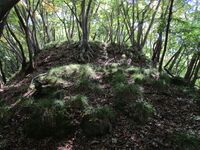
Tsukioijō was a beautifully constructed earthworks castle. Features include horikiri (trenches), tatebori (climbing trenches), unejōtatebori (falling trenches in rows), kuruwa (baileys), obikuruwa (ring bailey) and dorui (earthen ramparts), as well as extensive terracing of the many ridges surrounding the main bailey which is at the top of the site. The mountain can be seen from below to have three fronds, and these correspond to the spurs of the fortified space: north spur, west spur, and east spur. The rear of the castle to the south is also worked along the ridge which climbs up to Amabikijō, and is like a raised tail for the castle. The central area of Tsukioijō is bulbous and star-shaped. The central bailey is very well defended with an obi-kuruwa, a huge trench to the rear, terracing to the east, and unejō on the western slope.
See also Oh'iwa Castle, Suda Castle, Amabiki CastleTsutsugahana Castle / 十九塙城
Tsutsuhata Castle I / 二十端城一ノ城

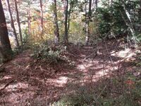
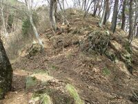
Tsutsuhatajō is a fortification complex consisting of five distinct fort sites. The castles are numbered one through five, with the first being Tsutsuhatajō-Ichinoshiro (Tsutsuhata Castle I). Ichinoshiro is made up of a series of terraces with a horikiri (trench) to the rear. Lower portions of the mountainside may have been terraced, but it’s hard to know if this was fortified space or just for hillside agriculture. The earth-piled ramparts which form the terraces of the larger baileys furthest up, however, are clearly part of the fort. The rear trench is quite impressive.
In terms of its place overall in Tsutsuhatajō, Ichinoshiro, the first castle, is the least engaging, but one can reach it very quickly by climbing from a trail which starts behind some old statuettes and stelae on the south of the ridge terminus. Although the main part of the fort is relatively clear, the lower, less developed parts of the ridge are overgrown and various plants, many of them thorny, obscure the path. This flora isn’t impassable, but it’s a bit annoying. One must persevere at first but not despair as the ridge clears up as it climbs.
See also: Tsutsuhata Castle II, Tsutsuhata Castle III, Tsutsuhata Castle IV, Tsutsuhata Castle V, Takinoiri Castle, Karidako Castle, Ganshouin YakataTsutsuhata Castle II / 二十端城二ノ城
Ninoshiro’s integral baileys start at the lower ridge fork and go a little way up along the ridge. Baileys are separated by horikiri, dorui and terracing. One trench is full of bamboo, but the others are mostly clear and easy to identify due to their depth and the dorui banked up behind them. There are traces of stone piling around the lower bailey of Ninoshiro, as well as in the trenches. The trenches were apparently stone-lined, but now most of the walls have collapsed, leaving the stone blocks to fill the trenches. Above Ninoshiro is Sannoshiro, but the ridge sweeps up quite drastically here and so one is forced into a climbing section to go between the two sites.
See also: Tsutsuhata Castle I, Tsutsuhata Castle III, Tsutsuhata Castle IV, Tsutsuhata Castle V, Takinoiri Castle, Karidako Castle, Ganshouin YakataTsutsuhata Castle III / 二十端城三ノ城
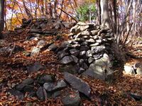
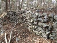
Sannoshiro also has the most masonry remaining of all the forts, and, whilst most of the ramparts have collapsed, remaining standing segments can be found throughout, though some are quite perilous to get a good look at. After seeing so much collapsed masonry, I was very pleased to find these surviving intact segments. Although the scale of the collapsed stone blocks would appear to indicate tall walls, we can see from what survives that the ishigaki (stone-piled ramparts) at Tsutsuhatajō were not so tall, but instead stacked in terraced bands.
See also: Tsutsuhata Castle I, Tsutsuhata Castle II, Tsutsuhata Castle IV, Tsutsuhata Castle V, Takinoiri Castle, Karidako Castle, Ganshouin YakataTsutsuhata Castle IV / 二十端城四ノ城
Tsutsuhata Castle V / 二十端城五ノ城
Sometimes I comment on nature. I was surrounded by thousands of small butterflies at Gonoshiro, and they appeared to be disguised as autumn leaves falling from the trees. That was incredible.
See also: Tsutsuhata Castle I, Tsutsuhata Castle II, Tsutsuhata Castle III, Tsutsuhata Castle IV, Takinoiri Castle, Karidako Castle, Karidaoh Castle, Ganshouin YakataUtsutsu Castle / 現城
Utsutsujō is a single bailey fort complex with the main and only bailey (arguably, but opinions differ on how much of the ridge was fortified) protect fore and aft with horikiri (trenches) and tatebori (climbing trenches). The main bailey is split into two parts by a small terrace. The rear to the main bailey was probably a horikiri which bisected the ridge, but looks like it has been partially filled in. The tatebori section remains and can be seen to the right when entering the bailey space. It’s possible there was also a dobashi (earthen bridge), however. The forward horikiri is well preserved, even though it is full of the clutter of fallen trees and hard to move in, and is actually one of the more impressive examples of horikiri found on Mount Kokuzō (the other large one at Nakanojinjō having been partially filled in).
See also Nakanojin Castle.Uyama Castle (Azumi) / 安曇鵜山城
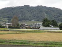
I was looking forward to the long weekend in October, starting for me Friday midday, and had a busy weekend planned. But the weather was miserable the whole time. The temperature had dropped, but that was a welcome sign of the onset of the mountain castling season. What was not welcome was the rain! I still managed to get out Saturday, despite the showers and the wet, and visit some very minor sites in Aźumi County. I had intended the sole yamajiro I visited to be a gentle warm-up for some bigger hikes, but it turned into quite the slog! This is my account of Uyamajō.
During a break in the clouds the weather was clement, so I decided to take the scenic route between Matsumoto and Ikeda via the Azumino Cycling Road, by-passing the more direct route in Akashina and instead going between Toyoshina and Hotaka. This initially pleasant cycle took longer than I had expected and I already endured some light showers by the end of it. The weather had really soured by the time I got to the foot of the mountain at midday. Though I had maps, the erection of electrified barriers to stop animals getting off the mountain and into tea plantations meant it took me a while to find a way to get onto the mountain (at one point I got shocked through my gloves moving along the fence!).
The way I came down has a well maintained trail, and I would recommend taking this main trail from the Aźumi side which goes to Mt Tengu. But there are two sites associated with Uyamajō, and Mt Tengu is just one of them. Another is located on the ridge between the peak and the Uyamashi-jinja; the site of the shrine is thought to have been that of the castle's kyokan (living area) (but in the same area there are also vicinities called 'tonoyashiki' and 'motoyashiki' which are suggestive). Since I wanted to see this site as well I forced my way up the ridge behind the shrine. The trail was overgrown and obstructed with tree trunks. It was quite the climb and I got wet and dirty. I also had to backtrack down a small outcropping of the ridge to get to my quarry.
The portion of Uyamajō indicated by Shinano castle expert Miyasaka Takeo is at odds with other sources which indicate the centre of Uyamajō to be the peak above called Mt Tengu. Since I visited both I can offer my thoughts on which is the site of the main fort, though there is no reason why both sites couldn't've hosted fortificatons. The ridge site, pointed out by Miyasaka-sensei, consists of a small earthen bulwark along a small ridge terminus which overlooks the plain. It seems that this space has been flattened, and the earth on the plainside is steep. Above, where this small ridge outcropping connects with the main ridge, I also noticed a ledge of flattened earth beneath a small peak, and behind it what could've been the remains of a trench, though this was merely suspicion on my part (everything was overgrown and difficult to photograph).
Next I climbed (with difficulty) to reach Mt Tengu. This peak is wide and flat, and could've easily accomodated a fort. There is a small mound in the centre of what overall seemed to me to be the shape of a triangle with curvy sides - or something like a guitar pick. One of the points particularly interested me because it looked like dorui (earthen ramparts) had been piled up at the edge. The sides of the peak seemed sculpted like kirigishi (terraforming to steepen banks) in places, particularly here, and within the bailey space was a depression I took for the remains of a well (though it could've just been an old tree bowl - left where a tree had collapsed).
Ridges joining with the peak on sides not in the direction of the kyokan were very narrow, and due to landslides one was barely walkable. Beneath the proposed dorui there is a narrow ridge which goes to a lower peak, and this is also included as part of the proposed area of the castle, a sort of detached bailey, though there isn't much to see here. On the side of the peak toward the kyokan the sloping is gradual, and, my imagination invigourated, I fancied some trench remains, but, on reflection, these were likely indentations in the ridgeline brought about by earth movements. Nevertheless it seems like there may have been terracing along this portion of the mount which has by now degraded.
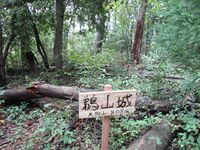
Visiting Uyamajō is a series of impressions and suspicions. But I was most engaged at the Tengu Peak. This to me is the most likely site of a fort. The earth in these mountains is slippery, and there are many scars from landslides, and these earth movements have eaten into any earthworks, making them harder to identify. I would say the peak of Mt Tengu is the main destination for anyone foolhardy enough to visit Uyamajō (Miyasaka preferences the ridge; could god be wrong?). I was delighted to find a spanking new sign there which read 'Uyama Castle (Mount Tengu)', and, on the reverse side, 'Commemorating the ascent of Kumagorō, September of 2022'. And so another castle explorer had come not long before me, and left this wonderful signpost for us all. After a hard climb this was inspiring to see.Uyama Yakata (Azumi) / 安曇鵜山館
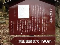
Wadahigashiyama Castle / 和田東山城
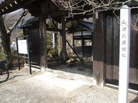
Watauchi Inoue Yakata / 綿内井上館

Yamada Takanashi Yakata / 山田高梨館

Yamada Yakata (Takai) / 高井山田館
Recent News
Sep 28, 2025
Yagyu Castles, Chihaya Akasaka Forts, and Kaibara Jin'ya
Sep 20, 2025
ART added 33 new castles across central Japan
Jul 29, 2025
31 new profiles from ART for Gifu Prefecture
Jul 19, 2025
Battle of Shizugatake Feature + 17 new castles
Jul 8, 2025
34 new profiles from ART for Shizuoka and Yamanashi
Jun 7, 2025
Comment System Upgrade
May 24, 2025
Four new castles around Sasayama Hyogo
May 16, 2025
10 Kyoto Castles Update May 2025
Mar 23, 2025
Hagi Castle & Hagi Castle Town Project
Jan 23, 2025
Bitchu Matsuyama Castle and Ohmatsuyama Castle Updates
Jan 3, 2025
2024 Jcastle cleanup and Happy New Year 2025
Dec 10, 2024
Sayonara Google Maps
Dec 2, 2024
Tsuyama Castle Update and 500th Castle Visited
Nov 11, 2024
Jcastle Rebuild 2024
Oct 3, 2024
11 New Castles around Kyoto
Sep 30, 2024
ART's New Profiles for Aichi Prefecture
Sep 22, 2024
5 new Okinawa Castle Profiles
Jul 27, 2024
Mikazuki Jinya, Kohyama Castle, and updated Hikone Castle
Jul 22, 2024
28 new profiles from ART
Jul 7, 2024
5 Castles from Ayabe City in Kyoto