ART added 33 new castles across central Japan
ART has added 33 more sites, spanning Awaji, Settsu, Omi, Kii, Ise (Mie), Owari and Musashi (Saitama)
ART added 33 new castles across central Japan and Saitama
2025-09-20
ART has added 33 more sites, spanning Awaji, Settsu, Omi, Kii, Ise (Mie), Owari and Musashi (Saitama)
Akahori Castle (Ise) / 伊勢赤堀城
Asano Castle / 浅野城
Banba Castle / 番場城
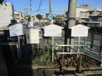
Doi Tono Yashiki / 土肥殿屋敷
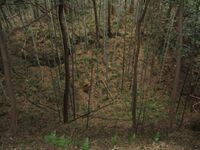
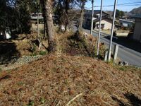
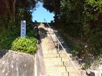
Anyway, my visit to this site was mostly incidental to me visiting the information centre for Kamaha Castle, as well as the scenic shukuba (inn-town) called Banba-juku. I was getting on well with the guide at the visitor centre, housed in a lovely old thatched-roof (covered up) dwelling, so I asked him about the yashiki site. He said that there was a small mound beneath a gingko tree in a field, and this was the most castle-like feature he could suggest. I was able to see the gingko tree rising from behind the cottage, but couldn't get close enough to confirm the mound. It seems that some excavations were done here at some point and a demarquette erected where a building had been found, but that maybe now the site has been reploughed for rice paddies. The site was further damaged by the construction of the Meishin Expressway in the satoyama area.
These pictures also show the visitor centre and Banba-juku. Banba-juku seems to be in a dead-end valley these days, but there is a cutting in the mountains in the west. This route was used because where Maibara downtown is today stretched an inlet of Lake Biwa, and the surrounding terrain was difficult and marshy, so Banba became an important checkpoint along the Tōkaidō route.Hamada Castle (Ise) / 伊勢浜田城
Hazu Castle (Ise) / 伊勢羽津城
Higashi Sakabe Castle / 東坂部城
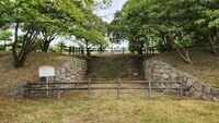
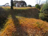
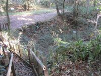
The main bailey is surrounded, at least in part, by a berm and moat complex. This can still be seen clearly in the east and north; the western side is presumed to have also had a moat but there is a road there now. The southern face of the fort is elevation without berms.
To the north is an outer bailey, which I was happy to have found since I didn't have a map and it would've been easy to miss; it is now vegetable patches and a bamboo grove surrounded by dorui, again to the north and east, with indications of trenches beneath the ramparts.
The fort sits atop a small cliff with a temple below. I wondered if the temple had eaten into the hillside as there is a spur of lumpy earth extending southward as if to embrace the temple. The ruins are easy to navigate because they appear to be maintained as part of the temple grounds, and used in part as a garden.Hirao Castle (Ise) / 伊勢平尾城
Hobonishi Castle / 保々西城
The main bailey is against the cliff's edge to the south and west, and on the plateau side it is protected in the north and east by tall, thick dorui (earthen ramparts), and deep, wide karabori (dry moats), which are themselves are most impressive. Dobashi (earthen bridges) span the 8m deep moats in the north and east. The northern gate complex has a flat profile, and eastern one is a masugata (crank-shaped) gate complex.
The approach to the castle goes by a secondary bailey, protected by karabori and dorui, though not of the same scale as the main bailey. A dobashi climbs into this bailey, but the main entrance appears to be where there is a small masugata gate complex of dorui.
In the northwest the tongue-shaped plateau is cut off from the surrounding land with a long stretch of karabori and dorui. Between this outer barrier and the inner citadel are the remains of more than half a dozen roughly square enclosures surrounded by dorui. The trace of medieval streets moves in orderly and angular fashion between the dorui. It is clear that these enclosures contained bukeyashiki, the homes of samurai, or retainers of the castellan.
The main road takes an 'L' shape through the settlement and leads to the outer moat. There is a right-angled bend here before the moat. It appears a wooden bridge was used here and was the town's main entry point. Another access point today is used to enter the ruins from the plateau side, but I wonder if this was constructed later by peasants who reclaimed the land for agriculture.
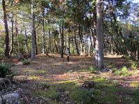
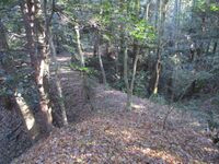
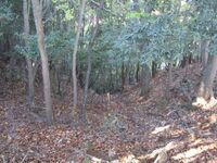
This vast, remarkably well preserved site, is now apparently a park, Hobo-no-Satoyama Park, but it is not maintained, and is almost entirely overgrown with skinny trees and other plants which make exploration tedious. There are a couple of marker posts and an old information board, but other than that nothing has been made of this site; the ruins are not "on the map", referred to only as a park, and no protections are in place for their preservation. It is hard to believe that such an intriguing site remains largely obscure and unremarked. This is a hidden treasure appreciated only by fans of medieval castles - or at least ones prepared to get into the thick of the brush.Hongou Castle (Owari) / 尾張本郷城
I passed by here on the way back from Iwasaki Castle after having seen some information about it there, but access is limited and there is little reason to come here. The former site of Hongōjō can also be seen from Iwasakijō's mogi tenshu (faux keep) as it's quite close by.
'Hongō' often refers to the principal settlement within a township or county, or the original town thereat, and, as such, there are many places with this name. Point in case, there is a Hongō Station to the north of this site on Nagoya's Higashiyama subway line, but this is not the same place, and the nearest station is Nisshin Station on the Meitetsu-Toyota Line.Horishi Yakata (Omi) / 近江堀氏館
Horiuchi Shingu Castle / 堀内新宮城
Ichiba Castle (Ise) / 伊勢市場城
The ruins can be divided into the castle proper and the surrounding medieval fortified townscape. On three sides Ichibajō's central bailey is surrounded by tall, thick dorui (earthen ramparts), with deep, wide karabori (dry moats) beneath the ramparts. The scale of these earthworks is mightily impressive. To the south the fort overlooks the cliffside, but here too are some smaller berms and terracing.
The main bailey has two gate complexes. One in the north, a pseudo-masugata (crank-shape) complex, and one in the southeastern corner, which, due to an intervening terrace, also functions as a masugata. Here, just beneath the southern point of the huge western berm, there is a well. It has a thin bit of rope strung across it, barely taught, to stop a man stumbling into the abyssal chute from which escape would be but a vain hope.
It would be death to fall in that well I thought, squinting to see the bottom of the cylindrical pit; the fall might be survivable, yet no one would come or hear you. Indeed, this fantastic ruin, a testament to the military engineering of medieval hands, is unloved, neglected, and terribly overgrown with bamboo and pest plants. No one comes here! It's a secret treasure of the dedicated castle maniac.
To underscore this bamboo-choked, rampant abandon, there was, in the castle's ruined umadash (barbican) no less, an abandoned car, ran through with bamboo like a corpse on a pike in a castle siege. In the blinding gloom of that foetid copse, I looked inside the old car. And the fabric of the driver's seat... moved. Something was trying to get out. I braced myself for rabid racoon-dog attack, but what emerged was a very flustered bird, and it soon flew off.
Yes, what adventures we get ourselves into. I mounted the ramparts, and followed them around. This part wasn't so difficult on the largest berms, and it gave me a good look over the moats from above, but descending into the main bailey meant swimming through colonies of dead bamboo. I thrashed and kicked my way out.
As mentioned, the remnants of outer baileys and enclosed residences of the castellan's retainers are found on the plateau around the castle, and significant remains of dorui can be found around and in the bamboo groves to the east of the castle proper. Old maps show many more segments than appear to survive today, including around a temple to the north. Over the centuries, however, particularly in recent decades, the remains of the castle-town have been chipped away at, regrettably obscurring its layout.
Ichibajō is twinned with another site of similar design and scale to the north about 2km away, Hobonishijō, and the two sites together are also referred to as Asakurajō after their overlords, the Ise-Asakura Clan.Iwakura Castle (Owari) / 尾張岩倉城
Owari-Iwakurajō is a hirajiro (flatland) castle ruin in Iwakura Municipality. It is designated by the municipality as a site of historical importance. Despite this, few to no ruins remain. As such, the most interesting thing about this site was reading the explanatory boards there. One featured a nice map of what the castle used to look like.
Additionally there is a encarved stone block to mark the castle on a mound with a Buddhist altar house. The other stele on the mound are religious monuments. However, at the back of the mound there is a row of houses with nothing but a long, narrow field behind them. Naturally I wondered if this is where the castle's moat once ran. Maybe this is where the city conducted archaelogical digs.
Owari-Iwakurajō is located in historic Owari Province, not to be confused with other castles with the same name in neighbouring provinces, such as Mikawa-Iwakurajō and Ōmi-Iwakurajō, which I've visited both.Kabuto Castle / 鹿伏兎城
The west bailey is situated above the eastern bailey, and both are surrounded by dorui. The north-facing dorui appears to have been piled up, whilst the south-facing dorui, which is larger, appears to have been carved from the ridge. The bulbous portion of dorui on the south side between the two baileys is thought to be a yaguradai, a platform for a keep. The bulwark along the ridge to the east is also thought to have been the site of a tower, and was labelled 'higashi-yaguradai' on my map.
The main compounds are entered via the west bailey through a masugata (crank-shape) gate complex. The parapet line continues on beyond the turn for the gate, and this area is said to be a look-out (maybe a 'nishi-yaguradai'). I was sure I would find a trench beneath this dorui because it is set above the ridge, but there was nothing, which surprised me. Indeed, curiously, Kabutojō appears to lack trenches completely, which is quite unusual for a yamajiro.
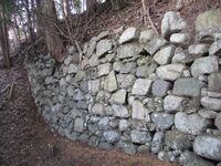
The ishigaki segment can be found beside the masugata on the outside of the west bailey. It was no doubt a substantial undertaking to build such a handsome wall atop of this mount. Another point of interest is the shallow, stone-lined well in the fort's east bailey.
I wondered if Kabutojō, with its positions for towers and stone-lined ramparts, was renovated in the Aźuchi period. The valley below held an important trade route and a fort here would've been necessary for securing supply lines.
Kabutojō is accessed from the hiking trail that starts in the necropolis of Shinpukuji, a temple at the foot of the castle-mount. The cenotaphs for the Kabuto Clan are also found here, and I wondered if this is where the castle's kyokan (residential annex) was. Shinpukuji is right by the railway tracks and accessed via a dedicated crossing; it is a handsome temple with its ishigaki and belfry. The trail to the castle ruins bring one first to a terraced sub-bailey and then to the higashi-yaguradai. Following the southern ramparts along from here brings one to the masugata, and from there the ishigaki segment is below and to the left.Kobayashi Castle (Owari) / 尾張小林城
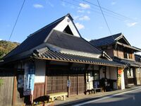
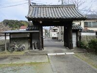
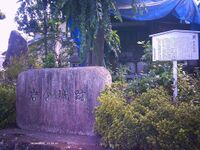
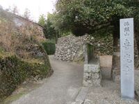
It was after the 2025 castle expo in Nagoya that, enjoying the mildly warm start-of-spring weather, I started rambling around the city, and, just by chance, came across this site unexpectantly. First I noticed the nice temple gate before noticing a stone marker with the name of a castle on. Lucky!
Even though someone has put a marker for this site on Google Maps, they have provided no information it, and I could find none on-site, but some castle-bloggers have covered it. It seems as if the castle-marker stele was moved from within the temple grounds to in front of the gate. That's just as well or I would not have found this place.
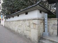
After finding the "castle" / temple, which has a nice garden gated behind the walls, and visiting the nearby Hisaya-ôdôri garden, I decided to follow the Shinhorigawa ('New Moat River') down to Kanayama Station. The river goes down past Atsuta-jingū before reconnecting to the Horigawa ('Moat River'). These rivers form(ed) a loop starting at Nagoya Castle and going down to Atsuta Shrine. Horigawa is a canal built in 1610 by Fukushima Masanori; it served as an outer moat for Nagoyajō, as well as the main artery for river transportation in the castle-town. However, the Shinhorigawa, also artificial, was not completed until the Meiji period.Makita Castle (Ise) / 伊勢蒔田城
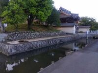
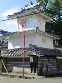
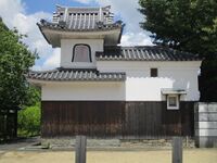
Matsuho Battery / 松帆台場
Matsumoto Castle (Ise) / 伊勢松本城
Minamoto Noriyori Yakata / 源範頼館
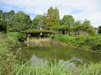
Moriguchi Castle / 守口城
I visited Moriguchijō - or the site of it (in Hama) - as part of a thematically driven tour of minor sites in the Ôsaka urban sprawl. The theme was temples with old drum towers built on the site of medieval forts. Nanshūji was the best example of these as its drum tower is built solidly like a yagura, or a keep at a castle. It's doubtful that anything as even as grand as this stood at the original fort, but the drum tower certainly imparts a certain castle-ish je nais sais quoi.
Even though its exact location has yet to be identified, Moriguchijō played an important role in medieval conflicts in the area, and so has an interesting history. Since the fort was built, destroyed and rebuilt over the centuries, it's perfectly possible that its exact location changed during that time.Nagi Castle / 葱生城
Nishi Sakabe Castle / 西坂部城
Noda Castle (Settsu) / 摂津野田城
Ohkura Yakata / 大蔵館
Ohkusa Castle (Aichi) / 愛知大草城
I entered the site via the causeway of the Kumano shrine, and along here there is a tall tatebori (climbing trench) with a dorui (earthen rampart) segment climbing parallel. This feature is quite clear on the ground, as it were, but overgrown in parts and difficult to photograph.
The east bailey is the topmost bailey, but the main bailey is in the western portion of the castle site, now separated by a road. There is a large dorui embankment on the western side of the main bailey. This is overgrown. Between the main bailey and the southwest bailey is a karabori (dry moat) and some dorui. To the east of the site a horikiri (trench) cuts the hilltop off from a connecting ridgeline.
Medieval fortification features are in evidence at this site, but most of the remains do not clearly come into focus, and it is hard to appreciate the overall structure. Some parts are off-limits, under plough, or very overgrown, so a full exploration is taxing. The hillside has many small terraced baileys, so that I'm sure I did not see them all. Overall I'd say this is a pro-level site for castle-explorers.
This site is Ôkusajō in Nagakute Municipality, Aichi Prefecture, formerly Aichi County of Owari Province. The county gives its name to the prefecture. There are several other sites called 'Ôkusajō' in Aichi Prefecture / Owari Province. This site is not to be confused with Chita-Ôkusajō (the one with the mogi tenshu (folly keep)), also in Owari Province, or Mikkawa-Ôkusajō, also in Aichi Prefecture. So far, out of the thousands of sites I've visited, I've been to three castle sites called 'Ôkusa' and all of them are in Aichi Prefecture!Orido Castle / 折戸城
Rokuta Yakata / 六田館
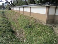
Rokuda-yakata's remains are fairly well preserved with dorui (earthen ramparts) and karabori (dry moat) surrounding a roughly square bailey. These fortifications almost surround the whole bailey except where a house now stands. The site is otherwise fields.
Even though the Rokuta-yakata, also referred to as the Higashi-gosho ('East Palace') was an annex of nearby Kitabatake-yakata, it actually has more to see of fortication ruins than that site, and so it shouldn't be missed when visiting the main Kitabatake Clan residence ruins with its garden and shrine. There are some old stone walls around the yakata's ramparts, but these may be from retaining walls piled after the fort and moats became rice paddies.Shoubudake Castle / 菖蒲嶽城
I found indications of what appeared to me to be a dobashi (earthen bridge) between trenches. The castle's footprint appears to have spread westward past where a pylon now stands. The construction of the pylon has probably effaced the fort's structure as ruins are hard to discern here; it is also quite overgrown. However, beneath this westerly part of the castle I did walk past a tatebori on my way up. There is a tight row of tatebori also beneath the main bailey facing north, but these earthworks are hard to make out.
Shōbudakejō also has a satellite fortification called 'North Castle' but it is apparently not well developed. I didn't know about it so I didn't check.Tsutsumihonji Castle / 堤本地城
Uneme Castle / 采女城
The layout of Unemejō is vaguely Italy-shaped, and it even has a detached bailey complex to serve as Sardinia; or, the shape of a boot kicking a ball, but who plays footy in heels? The trail to the castle goes up through a creek area directly to the main bailey. The main bailey is accessed via a masugata (crank-shaped) gate complex of dorui, and dorui rings basically the whole bailey. There is a deep well in the main bailey, and a signboard with information. To the north of the main bailey are the second and third baileys, each surrounded by dorui and separated by large horikiri (trenches); these earthworks may well be this site's highlight.
To the southeast of the main bailey there is a narrow trail that descends to what the map I was using, produced by the legendary castle-explorer of Jōkaku Hōrōki, designates the eighth bailey. In our Italy analogy, this bailey would be the peninsula of Salento. This bailey has dorui on the east-facing side, and has horikiri both fore and aft.
To the southwest is our Calabria and Sicily. I actually came that way after first visiting Sardinia, the detached bailey, which necessitated descending and climbing the steeply shorn hillside (not recommended), across the Tyrrhenian Sea. The Calabrian spur is made up of the three baileys (the lowermost of which in our belaboured analogy will have to be Sicily) with ramparts formed from the ridge, and is almost as large as the three integral baileys above. It connects eventually with the main bailey via a handsome dobashi (earthen bridge) which a wooden bridge has been built atop.Yagura Castle (Kii) / 紀伊矢倉城
This site sits between Zenryūji and Shingū Station, so I included it as part of my walk around Shingū, but I refrained from trespassing. The only path up appears to be from the south and there are signs prohibiting entry blocking the path. Most castle-bloggers have met with the same problem, but the blogger at Kojōshi got up. That blogger also took the southern path where the road cuts through the base of the hill, but makes no mention of having to get permission for entry, and so perhaps at the time of their visit the path was open. I will link that blog in the 'Friends of Jcastle' section.
Note: This is Yagurajō (alternatively Yakurajō) in Shingū Municipality, formerly part of Muro County, not to be confused with Yagurayamajō in Kinokawa Municipality, formerly part of Naka County, both in Wakayama Prefecture and the former Kii Province.Yokkaichi Jin'ya / 四日市陣屋
Recent News
Sep 28, 2025
Yagyu Castles, Chihaya Akasaka Forts, and Kaibara Jin'ya
Sep 20, 2025
ART added 33 new castles across central Japan
Jul 29, 2025
31 new profiles from ART for Gifu Prefecture
Jul 19, 2025
Battle of Shizugatake Feature + 17 new castles
Jul 8, 2025
34 new profiles from ART for Shizuoka and Yamanashi
Jun 7, 2025
Comment System Upgrade
May 24, 2025
Four new castles around Sasayama Hyogo
May 16, 2025
10 Kyoto Castles Update May 2025
Mar 23, 2025
Hagi Castle & Hagi Castle Town Project
Jan 23, 2025
Bitchu Matsuyama Castle and Ohmatsuyama Castle Updates
Jan 3, 2025
2024 Jcastle cleanup and Happy New Year 2025
Dec 10, 2024
Sayonara Google Maps
Dec 2, 2024
Tsuyama Castle Update and 500th Castle Visited
Nov 11, 2024
Jcastle Rebuild 2024
Oct 3, 2024
11 New Castles around Kyoto
Sep 30, 2024
ART's New Profiles for Aichi Prefecture
Sep 22, 2024
5 new Okinawa Castle Profiles
Jul 27, 2024
Mikazuki Jinya, Kohyama Castle, and updated Hikone Castle
Jul 22, 2024
28 new profiles from ART
Jul 7, 2024
5 Castles from Ayabe City in Kyoto