Nagano Castle Update Part I from ART
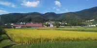
Just when you thought there couldn't possibly be any more castles for ART to visit in Nagano Prefecture along comes another update of over 100 new castle profiles. Here is the first installment.
Nagano Castle Update from ART Part I
2022/02/28
Just when you thought there couldn't possibly be any more castles for ART to visit in Nagano Prefecture along comes another update of over 100 new castle profiles. Here is the first installment.
Akagi Yakata / 赤木館

Ametoya Castle / 雨戸屋城
Anrakuji Yakata / 安楽寺館
Aoki Castle (Azumi) / 安曇青木城
Aoyagi Yakata / 青柳館

Aratoshou Castle / 荒砥小城
Asaka Castle (Chikuma) / Chikuma-Asakajō
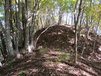
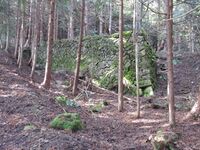
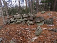
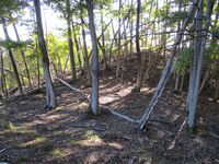
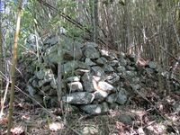
Asakajō may be said to have been built by grave robbers, since it was built over the site of an ancient necropolis. Materials from these tombs were dug up and re-used to construct the castle. There is a striking if unusual fortified space at the very start of the castle's precincts. It consists of a large 'L'-shaped dorui (earthen rampart) segment with stones lining the inside. This is thought to have been a space for mustering troops whilst screening them from the outside. It may have been constructed by hollowing out an ancient tomb.
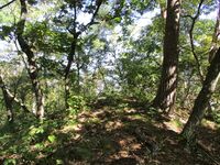
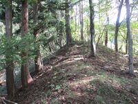
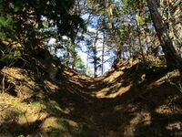
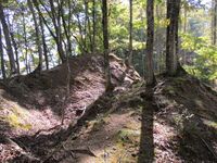
There are several small, narrow baileys along the ridge as it climbs. A large horikiri (trench) has been cut deep into the rocky ridge, in effect forming a large stone wall. Both sides of this huge trench have dark openings. These are the gaping mouths of dead tombs. Interred within were kings and wizards so ancient that none now know their names. The ultimate destiny of their sepulchral houses was to be recyclced as castle defences. Another tomb opening is found in the main bailey where a large stone slab now stands erected.
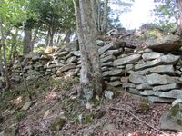
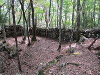
The principal baileys of this castle consist of two baileys on the peak, with one slightly lower situated than the other, forming a stone-lined wall between the first and second. A third bailey is terraced beneath the second. It has a spur, checked by a trench which eats into the hillside, which goes beneath both the first and second bailey. This is a "hip bailey". I came through here first so as to appreciate the first and second bailey from below. Both of these baileys have ishigaki lining them. To my suprise there was a lot of ishigaki also beneath this hip bailey toward the furthest corner. This is a most spectacular area of the castle ruins. To the rear of the principal baileys is a gigantic trench. Ishigaki can be seen on the "castle side". "Mountain side" there are many more trenches cutting into the ridge one after the other. Two large trenches sandwhich a smaller one which is spanned by a dobashi (earthen bridge), creating a sort of 'H'-shaped configuration.
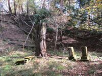
Asakajō is little known and difficult to find. Yet it has layers of ruins and mystery. The ishigaki and remains of kofun (ancient burial mounds) are a major attraction in visiting this site. In structure it is an examplar of the kind of Sengoku period forts found in central Shinano.Asama Palace / 浅間御殿

Chikatou Fort / 千鹿頭砦

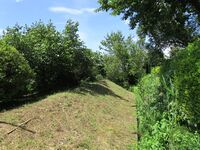
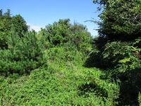
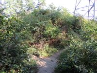
The preserved horikiri is at the very rear of the site, and I thought there may have been a shallower trace of a trench between the two baileys but it was too dense with vegetation on both sides to tell. In fact, the vegetation grew suspiciously thickest in these divots...
This adventure is a testament to a few things. Do not think that I am merely lucky; Shinano is dense with fortification sites no matter where one steps - at least near civilisation. And though I'm happy that I am experienced enough that I can immediately spot an obvious yamajiro (mountaintop castle) feature when I come across it, it appears that there are many hidden sites I haven't uncovered yet.Chikuma Goten'yama Castle / 筑摩御殿山城
Fumimichi Castle / 文道城

The castle site is genuinely a historical ruin, but there's not too much to see. Castle features can be delineated, though, which is great. The castle essentially is narrow in profile following a ridge. There are two small principal baileys between the remains of trenches. In the lower of the two is a pit which I took for the remains of a well. There is a gazebo here. The site was developed as a park but it is no longer maintained. Even as one ascends to the main bailey there are many trees and it is not immediately clear to see beyond... what is that phantom flitting through the trees? The main bailey has a terraced sub-bailey beneath. Below this is a large, flattened area. Comparing it with the baileys above, there can be no doubt that this wide area is modern in origin, developed as part of the park. Coming clear of the trees we finally get a full view of the mogi.
The mogi is tripple tiered and slender, but is built to full scale. This essentially creates a very confined space within that functions as a glorified look-out tower. There is about a tatami mat's worth of space to stand at the top. But I'm getting ahead of myself. The park is no longer groomed, and the whole space surrounding the mogi is overgrown with tall grasses. Eventually I found the old stair way and made it down to the mogi's entrance. There is a sign here. It seems that following an earthquake in 2014 the building was condemned. It is unsafe to enter, but there is no lock, nor was there ever, with the public being free to enter at their will. Now the only difference is the sign saying the structure is unsafe and there is risk of collapse. I bore this in mind, but I had to look inside. Taking responsibility for my own decisions then, I found a structure covered in dirt and web, but not so long abandoned, with a rack of slippers for guests by the small entrance space. The wood neither seemed particularly old. But the structure did creak when disturbed. It was quite something to experience the very narrow structure. No historical structure that I can think of was built like this at a castle. A pagoda, perhaps, would be similar, but they were often not built to be ascended, and most don't have stairs.
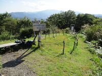
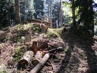
Beneath the "park" is a wide tarmacked area with a building at the end, the Furusato Hall. It's convenient to park here. The hall is abandoned and swarming with hornets. This area was once, it is thought, a hall attached to the castle, and so the lord would've lived here, and not where the faux keep is. Realistically this small fort never would've been able to stand up to the armies of Takeda Shingen, which makes its fate the more tragic. An abandoned tower in an overgrown park overlooking a disappearing village? Who will keep its stories alive?Furujou Yakata / 古城館
Futatsu Bungonokami Yakata / 二木豊後守館
Futatsugi Castle (Azumi) / 安曇二木城
Gongen Yakata / 権現館
Hieinoyama Fort / 比叡ノ山砦

Higashijou Castle (Chikuma) / 筑摩東条城
The ruins of Higashijōjō can be reached via a trail either from Hakusan-jinja, which is to the south and closer to the station, or via a route on the northern ridge. It's easier to take the northern ridge up and the shrine's causeway down, the latter being much steeper. Ruins related to the castle begin at the very start of the trail to the north.
Down a country lane is an old sign board about the castle and a direction post. There is also a marker for the Karō-yashiki (Chief Vassal's Residence). To the right, passing by a small valley, there is a path which climbs onto the ridge. Here there is a series of earthworks, such as terraces and embankments, which represent the former kyokan area of the castle, or the place that the castellan would actually reside when not under siege.
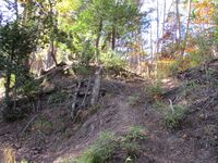
After a brief climb up the ridge we reach the ruins of the castle proper. There are six baileys in an "L" formartion which follow the natural contours of the terrain. The lowest, perhaps the sixth bailey, has some terracing along the approach and a modern gazebo structure. Higher up is the next bailey which is treated as the main bailey by the local education board since this is where we find marker posts, explanation boards and a general sense of maintenance (the tattered board at the bottom of the ridge has been amended but not repaired to include the new village authority of "Chikuhoku" but the sign board at the castle itself still reads "Honjō Village"). Yet this bailey is the lower than the subsequent baileys; counting backwards from the topmost it would be the fifth. It has forward facing terraces and what I think may have been a koshikuruwa ("hip baileys") on the south side. Beneath the bailey rocky outcroppings produce a sort of natural wall to the bailey's south side.
Between the fifth and fourth bailey I noticed what looked like the remains of a trench and earthen bridge (but it was not shown on the map I was referencing). The ridgeline sweeps up again and we come to the fourth bailey with the third immediately above it. These baileys are barely worked, having been only somewhat flattened if at all (it's hard to tell what work the mountain has done in five centuries) without terraces or trenches, and may be described as "natural baileys". Indeed, Higashijōjō makes splendid use of augmented natural terrain. There are a tremendous amount of rocks and boulders here. Beneath the third bailey there is a collection of rocks which form a path in the vague shape of a castle's koguchi ("tiger's maw gate"). The bailey itself is full of small but sturdy pine trees growing out of white sand like a bonsai arrangement. It seemed to me like a natural garden, and the rocky landscape offered thrills which reminded me of the pleasure gardens of Sūzhōu.
Between the third and second bailey several large boulders stand, and between three of them are sudden drops or chutes along the ridge which look like they could've been used as climbing trenches. There is an unworked peak at the top of the castle mount, a place where several large pines stand called Pine Path, and to the south at a right angle are the first and second baileys. These have a well preserved (albeit difficult to photograph because of the trees) horikiri (trench) with a dorui (earthen embankment) protecting the first bailey. The first bailey has some terraces beneath it. Though slightly narrower than the fifth bailey, it seems this may have been the main bailey, or at least the last line of defence. The trail leading down from here takes one to Hakusan-jinja, a shrine built beneath a series of gigantic boulders forming a cliff. I saw a cave in one of the rocks, and when I bent down to peer inside a snake slithered out. Higashijōjō is a blend of nature and castle ruins!Hime Castle (Chikuma) / 筑摩姫城
Himuro Yakata / 氷室館
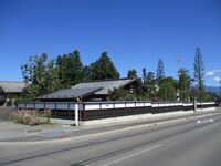
Hiraide Moated Settlement / 平出環濠集落
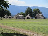
There is an information centre in the park, which is like an outdoor museum. Ruins of ancient burial mounds are also dotted around. The castle enthusiast will note the unmistakable remains of dorui (earthen ramparts) and moats surrounding the site. The remains around the reconstructed Kofun Period village are least obvious, forming a sort of raised platform above surrounding vineyards, though likely there were originally moats dug here. The most significant remains zigzag in angled fashion around a portion of the restored Jōmon Period village. Another stretch of ramparts and moat trace around the reconstructed Heain Period village, taking an obtuse angle. These fortifications likely date to the same period and were maintained throughout.
The modern village of Hiraide is built up to the south of the site, and itself contains many beautiful traditional homes. Where the foothills start beyond here is nestled the Hiraide Museum. This area features a climbing kiln and a reconstruction of a Nara Period pit home. The museum exhibits many artifacts. The highlight is a Nara Period ceramic pagoda.Hirakura Castle / 平倉城
Hora Yakata / 洞館
Horinouchi Yashiki / 堀内屋敷
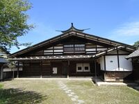
Jikouin Yakata / 慈光院館
Update (2022):
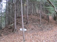
I felt like I didn’t do a thorough enough job of exploring this site during my first visit. Most of the ruins are in a forest to the east of the temple Jikōin, for which the site is named. There is also a fort site to the west of the temple which I wanted to check out called Jikouin Fort. I took the opportunity to revisit here, and this time checked further up the slope, finding several bands of terracing and a long karabori (dry moat) beneath what I took to be the yakata’s main enclosure.Jinguuji Yakata / 神宮寺館
Joukouin Yakata / 城光院館

Kakiage Castle (Chikuma) / 筑摩掻揚城
Kattori Castle (Chikuma) / 筑摩川鳥城
Kemi Castle (Chikuma) / 筑摩花見城
Kibune Castle / 木舟城
I mounted the ridge behind a temple called Jōfukuji and very quickly came upon evidence of terracing along it. I knew for sure I was on the right track when I encountered a small horikiri. Thereafter the ridge swept up quite drastically and with it came a marvellous climbing set of stair-like pocket baileys terracing the ridge with steep banks. At the top of these stairs is a complex of baileys. Three baileys are set in a row, one above the other, and the lowest of these is quite wide. To the south there is dorui with the remains of stone pilings scattered about, suggesting the use of some stonework. Beneath here is a spur along a lower ridge, which I did not look all of the way down (this castle ruin was too vast for me to cover every inch in just a few hours), though Yogo's map indicates there should be more baileys down here and a trench. The upper and middle bailey in this bailey group are impressive, and on the mountainside west of the upper terrace there is a large embankment or levelled peak which it is easy to imagine hosted a rudimentary tower or turret of some sort.
Already we can say that this would be about the size of a modest yamajiro by itself, but this is just the very doorstep of Kibunejō! Another bailey grouping, but taller and wider, with another large rear embankment is found following a deep moat, in turn another large trench beyond. I was staggered by this duplication of fortifications, but thereafter the castle widens out dramatically into a series of wide and long terraced baileys in between climbing ramparts. If barracks were built here they could've easily accomodated hundreds of men. This fascinating area, which Master Yogo describes like a "hinadan (doll stand)", unusual in its configuration for a mountaintop castle, is known as the otenjō (written as 御天上・御殿上), invoking the idea of a place of paramount importance. Actually I wondered how these terms might be related to tenshu (天守), getting me onto an etymological side quest...
The formation of this staggering array of earth is like the throne of a titan carved into the mountain. The amount of earth dug, moved, piled and flattened is mind-blowing. The surrounding countryside must've been denuded of able-bodied men to sculpt this abode of the gods.
A series of karabori (dry moats) and dorui interspersing yet more wide baileys gives way to what is considered the northern castle. The scenery is changed completely and we come into an area with ongoing forestry projects. A pylon sits on the hillside. The terracing here was either degraded, obscurred with recent activities, or never completed. Or some combination of those things. But above this terracing is a solid bailey complex. This area is sometimes considered the main bailey of the castle, surmounting the ultimate peak. The earthworks here are impressive. The bailey has dorui and is protected on three sides by deep horikiri. The easterly horikiri could swallow a house, and several trenches go off along a spur there; these were on my way to Aokijō and so I could check them all out.
To the north and northwest the extent of the site then doubles. After all that, there's so much more! How much of the mountain could possibly have been fortified? There is a bailey cluster to the north with some nice trenches along the site's most northerly spur. In general though the earthworks are less capably finished in these outer zones of the castle. It seems that the northern castle represents a later expansion which may not have been wholly finished. Indeed this site has many mysteries. Curiously this fascinating castle is little regarded, and until recently seems to have been completely forgotten, and has no designations or protections, which is very concerning. However, I am happy to report that newly minted signs indicating castle features have appeared throughout the site, and there is a sign pointing would-be adventurers in the direction of the castle from below near Jōfukuji. This is good news and tides that the ruins of Kibunejō may get more care and attention in the future.Kiridouzan Noroshidai / 霧訪山狼煙台
Kirihara Yakata / 桐原館
Koshikou Castle (Chikuma) / 筑摩古司口城
Motai Castle (Hanishina) / 埴科母袋城
Moto Castle (Chikuma) / 筑摩本城
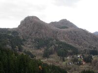
Narukami Castle (Chikuma) / 筑摩鳴雷城
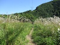
From Tokô village there is a well developed hiking trail which leads to the peak of Narukami. It's not possible to get lost. I saw many harvestmen during the hike up. Where I'm from we call these arachnids 'daddy long legs' but some people use that term to refer to craneflies or certain types of spiders. These creatures are not well loved, but the Japanese kind is particularly creepy because two of its forward legs are extra long, terminating in hair-like extremities which it apparently uses to feel its way about. I saw one bobbing up and down in an evil dance which appeared to aid in devouring something it had caught in its chelates.
There are two signs which may cause confusion. The first is at the base of the mountain. One sign points up to the mountain on the left, and the other to some place else: Ôte-something. Ôte refers to the main gate of a castle, but I took the left route and I don't recommend going right as it will go some place else before going to the castle ruin. The second confusing sign is not far below the castle. It says 'Ôyokote (大横手)', which maybe refers to "the side entrance" to the castle ruins, but it isn't a proper castle term I think. I chose to ignore it and took a smaller trail which went directly to the castle ruins via the ridgeline and comes out at the main bailey. One can follow the sign for an easier trail; it comes out at the castle's horikiri, and from there the rest of the ruins are to the right.Nishijou Castle (Chikuma) / 筑摩西條城
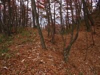
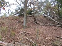
The first ruins one sees of Nishijōjō coming from the rear are a series of tripple trenches at a right angle to the castle proper which protect a westerly ridge. Nishijōjō ("West District Castle") is twinned with Higashijōjō ("East District Castle") on the other side of the valley and so the defence is orientated facing away from the valley. The castle proper is made up of six integral baileys which line the ridge running north-south. There is terracing beneath the topmost shukuruwa (main bailey), also west-facing, but it was too overgrown for me to explore down there. Much of the castle is covered in young bamboo, but the path winds its way through. The baileys basically work their way down from the shukuruwa in stair-like fashion, with the exception that the third bailey, having its own small peak, is wholly surrounded by the fourth bar on the east-facing cliff face. At the bottom of this fortified stairway a respectably deep trench was dug. The trail out of the castle ruin can be found here. The trench itself is probably the most significant feature of the castle, along with the tripple trench system mentioned above.
This site is not to be confused with Nishijou Castle. Both sites are in historical Chikuma County, though the other Nishijōjō is now part of Shiojiri Municipality.Saburouhora Castle (Chikuma) / 筑摩三郎洞城
Samine Castle (Chikuma) / 筑摩三峯城
Saruga Castle (Chikuma) / 筑摩猿ヶ城
Why was a castle called for a monkey? The answer is in the castle's remote and inaccessible location; that is, you'd need to be a monkey to get to it, or climb into it. There is no need for elaborate stone walls at this altitude; the mountain provides the sheerest rocks and boulders as an instantaneously defensible position. These natural ramparts are augmented with horikiri (trenches) and a series of flattened areas for baileys. The main bailey is set just above Sarutobi-iwa, and there is a long bailey complex that follows the ridge beyond, with a terraced sub-bailey below. Some earth is piled up here too, which looks like dorui (earthen ramparts), but it may be yet another gift from the mountain which the intrepid castle builders incorporated into their base.
This site is not to be confused with Saruga Castle (Azumi), also in Nagano / Shinano.Sasaga Castle (Chikuma) / 筑摩笹城
Sasano Castle (Chikuma) / 筑摩佐々野城
Sasazawa Castle (Chikuma) / 筑摩笹沢城

Takeyama Castle (Hanishina) / 埴科竹山城
Uchi Castle (Chikuma) / 筑摩内城
Uzuhashi Castle (Azumi) / 安曇埋橋城
Wada Castle (Chikuma) / 筑摩和田城
Yagura Castle (Chikuma) / 筑摩矢倉城

Yamazaki Fort (Chikuma) / 筑摩山崎砦
Recent News
Sep 28, 2025
Yagyu Castles, Chihaya Akasaka Forts, and Kaibara Jin'ya
Sep 20, 2025
ART added 33 new castles across central Japan
Jul 29, 2025
31 new profiles from ART for Gifu Prefecture
Jul 19, 2025
Battle of Shizugatake Feature + 17 new castles
Jul 8, 2025
34 new profiles from ART for Shizuoka and Yamanashi
Jun 7, 2025
Comment System Upgrade
May 24, 2025
Four new castles around Sasayama Hyogo
May 16, 2025
10 Kyoto Castles Update May 2025
Mar 23, 2025
Hagi Castle & Hagi Castle Town Project
Jan 23, 2025
Bitchu Matsuyama Castle and Ohmatsuyama Castle Updates
Jan 3, 2025
2024 Jcastle cleanup and Happy New Year 2025
Dec 10, 2024
Sayonara Google Maps
Dec 2, 2024
Tsuyama Castle Update and 500th Castle Visited
Nov 11, 2024
Jcastle Rebuild 2024
Oct 3, 2024
11 New Castles around Kyoto
Sep 30, 2024
ART's New Profiles for Aichi Prefecture
Sep 22, 2024
5 new Okinawa Castle Profiles
Jul 27, 2024
Mikazuki Jinya, Kohyama Castle, and updated Hikone Castle
Jul 22, 2024
28 new profiles from ART
Jul 7, 2024
5 Castles from Ayabe City in Kyoto